Dungannon in County Armagh, Northern Ireland, United Kingdom — Northwestern Europe (the British Isles)
Trackways
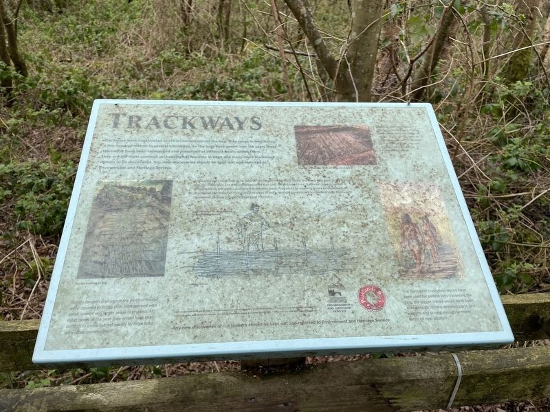
Trackways were constructed to aid movement across the bog. They range in length from a few hundred meters to several kilometers. As the bogs have grown over the years these trackways have been submerged and preserved at different levels within them. They are the most common archaeological feature in bogs and many more trackways remain to be discovered. Any new discoveries should be kept wet and reported to Environment and Heritage Service.
Photo/illustration captions
Before modern drainage many parts pf Ireland were covered in a soggy peat interspersed with small islands and larger areas of dryland. At most times of the year they would have been difficult to cross but necessary to forge links with other communities.
Some trackways were built as far back as the Neolithic (BC 4000-2000) and many date back to the Bronze (BC 2000-500) and they continued to be built until the fairly recent times. Trackways have a number of different forms and were constructed in different ways. They could be anything from a loose deposit of brushwood and branches from coppiced trees to more carefully constructed hurdles and large tracts with brushwood packing and split logs pegged into place.
The narrowest trackways would have been used for pedestrians traversing the bog, the bigger tracks would have been wide enough to take wheeled carts and wagons and strong enough to move cattle to new pasture.
Topics. This historical marker is listed in these topic lists: Natural Features • Parks & Recreational Areas.
Location. 54° 29.211′ N, 6° 35.566′ W. Marker is in Dungannon, Northern Ireland, in County Armagh. Marker can be reached from Derryhubbert Road, half a kilometer west of Derrylileagh Road, on the right when traveling west. Touch for map. Marker is in this post office area: Dungannon, Northern Ireland BT71 6NW, United Kingdom. Touch for directions.
Other nearby markers. At least 8 other markers are within 16 kilometers of this marker, measured as the crow flies. Logboats (about 180 meters away, measured in a direct line); Derryadd Lake (approx. 0.4 kilometers away); World Wars Memorial (approx. 7.8 kilometers away); R.J. Patterson (approx. 15.8 kilometers away); South African Campaign Memorial (approx. 15.8 kilometers away); John Nichol (approx. 15.8 kilometers away); Brian Boroimhe (Brian Boru) (approx. 16 kilometers away); St. Patrick's Cathedral Crypt (approx. 16 kilometers away). Touch for a list and map of all markers in Dungannon.
More about this marker. Marker can be accessed from the Derryladd Lough entrance to Peatlands Park.
Located about 1.5 mile along the Peatlands walk trail.
Credits. This page was last revised on May 1, 2022. It was originally submitted on May 1, 2022, by Cajun Scrambler of Assumption, Louisiana. This page has been viewed 80 times since then and 13 times this year. Photos: 1, 2. submitted on May 1, 2022, by Cajun Scrambler of Assumption, Louisiana.
Editor’s want-list for this marker. Wide shot of marker and surrounding area in context. • Can you help?

