Near Clifton in Fairfax County, Virginia — The American South (Mid-Atlantic)
Enslaved Burial Ground at Bull Run Marina

Photographed By Devry Becker Jones (CC0), May 6, 2022
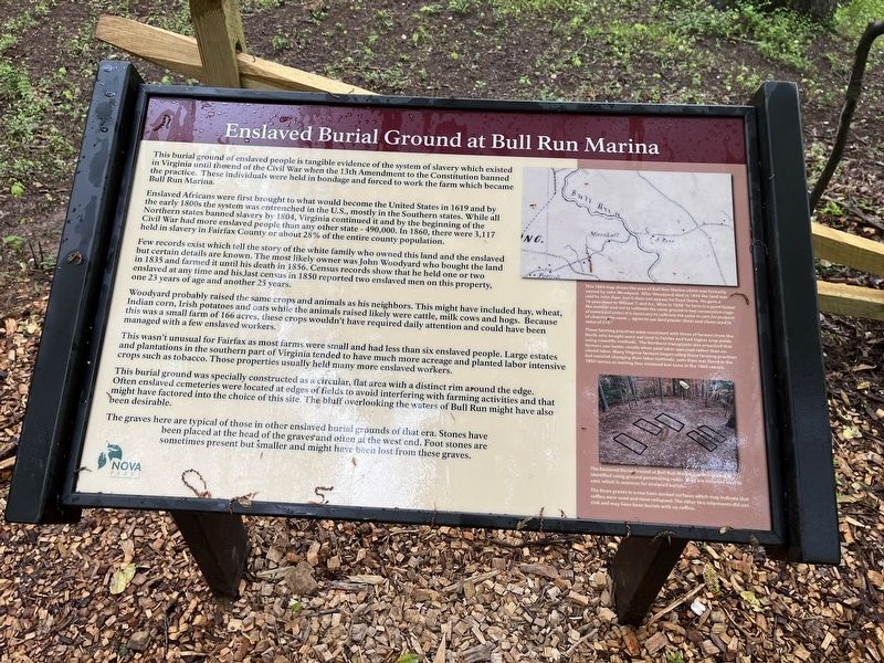
1. Enslaved Burial Ground at Bull Run Marina Marker
This burial ground of enslaved people is tangible evidence of the system of slavery which existed in Virginia until the end of the Civil War when the 13th Amendment to the Constitution banned the practice. These individuals were held in bondage and forced to work the farm which became Bull Run Marina.
Enslaved Africans were first brought to what would become the United States in 1619 and by the early 1800s the system was entrenched in the U.S., mostly in the Southern states. While all Northern states banned slavery by 1804, Virginia continued it and by the beginning of the Civil War had more enslaved people than any other state — 490,000. In 1860, there were 3,117 held in slavery in Fairfax County or about 28% of the entire county population.
Few records exist which tell the story of the white family who owned this land and the enslaved but certain details are known. The most likely owner was John Woodyard who bought the land in 1835 and farmed it until his death in 1856. Census records show that he held one or two enslaved at any time and his last census in 1850 reported two enslaved men on this property, one 23 years of age and another 25 years.
Woodyard probably raised the same crops and animals as his neighbors. This might have included hay, wheat, Indian corn, Irish potatoes and oats while the animals raised likely were cattle, milk cows and hogs. Because this was a small farm of 166 acres, these crops wouldn't have required daily attention and could have been managed with a few enslaved workers.
This wasn't unusual for Fairfax as most farms were small and had less than six enslaved people. Large estates and plantations in the southern part of Virginia tended to have much more acreage and planted labor intensive crops such as tobacco. Those properties usually held many more enslaved workers.
This burial round was specially constructed as a circular, flat area with a distinct rim around the edge. Often enslaved cemeteries were located at ages of fields to avoid interfering with farming activities and that might have factored into the choice of this site. The bluff overlooking the waters of Bull Run might have also been desirable.
The graves here are typical of those in other enslaved burial grounds of that era. Stones have been placed at the head of graves and often at the west end. Foot stones are sometimes present but smaller and might have been lost from these graves.
[Sidebar:]
This 1864 map shows the area of Bull Run Marina which was formerly owned by John Woodyard. After Woodyard died in 1856 the land was sold to John Dyer, but it does not appear he lived there. He gave a 16-year lease to William T.

Photographed By Devry Becker Jones (CC0), May 6, 2022
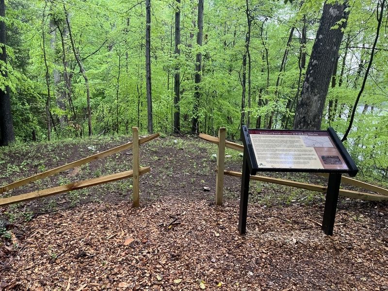
2. The burial ground is visible in the background. The marker shows in the foreground.
These farming practices were consistent with those of farmers from the North who bought worn out land in Fairfax and had higher crop yields using scientific methods. The Northern transplants also preached that farmers saw better results when paid labor was used rather than enslaved labor. Many Virginia farmers began using these farming practices but resisted changing their labor methods. John Dyer was listed in the 1850 census as owning four enslaved but none in the 1860 census.
The Enslaved Burial Ground at Bull Run Marina has five graves as identified using ground penetrating radar. They are oriented west to east, which is common for enslaved burials.
The three graves in a row have sunken surfaces which may indicate that coffins were used and have collapsed. The other two interments did not sink and may have been burials with no coffins.
Erected by NOVA Parks.
Topics and series. This historical marker is listed in these topic lists: African Americans • Agriculture • Animals • Cemeteries & Burial Sites • Settlements & Settlers. In addition, it is included in the NOVA Parks series list. A significant historical year for this entry is 1619.
Location. 38° 44.558′ N, 77° 23.087′ W. Marker is near Clifton, Virginia, in Fairfax County. Marker can be reached from the intersection of Old Yates Ford Road (Route 612) and Kincheloe Road, on the left when traveling west. Touch for map. Marker is at or near this postal address: 12619 Old Yates Ford Rd, Clifton VA 20124, United States of America. Touch for directions.
Other nearby markers. At least 8 other markers are within 3 miles of this marker, measured as the crow flies. Wolf Run Shoals (approx. 1.7 miles away); Washington-Rochambeau Wagon Route (approx. 2.3 miles away); Nature is Close at Hand at the Webb Sanctuary (approx. 2.4 miles away); Southard (approx. 2.4 miles away); The Fairfax Herald (approx. 2˝ miles away); Red Gables (approx. 2˝ miles away); Fulmer Brill House (approx. 2˝ miles away); Ferndale (approx. 2˝ miles away). Touch for a list and map of all markers in Clifton.
Credits. This page was last revised on May 7, 2022. It was originally submitted on May 7, 2022, by Devry Becker Jones of Washington, District of Columbia. This page has been viewed 320 times since then and 24 times this year. Photos: 1, 2. submitted on May 7, 2022, by Devry Becker Jones of Washington, District of Columbia.