Livermore in Alameda County, California — The American West (Pacific Coastal)
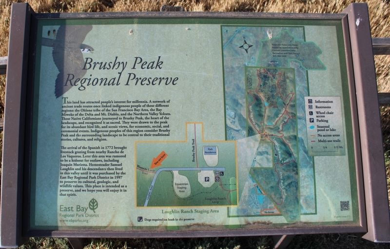
Brushy Peak Regional Preserve
This land has attracted people's interest for millennia. A network of ancient trade routes once linked indigenous people of these different regions: the Ohlone tribe of the San Francisco Bay Area, the Bay Miwoks of the Delta and Mt. Diablo, and the Northern Valley Yokuts. These native Californians journeyed to Brushy Peak, the heart of the landscape and recognized it as sacred. They were drawn to the peak for its abundant bird life, and scenic views, for economic, social, and ceremonial events. Indigenous people of this region consider Brushy Peak and the surrounding landscape to be central to their traditional stories, culture, and religion.
The arrival of the Spanish in 1772 brought livestock grazing from nearby Rancho de Los Vaqueros. Later this area was rumored to be a hideout for outlaws, including Joaquin Murietta. Homesteader Samuel Laughlin and his descendants then lived in this valley until it was purchased by the East Bay Regional Park District in 1997 to preserve its cultural, geologic, and wildlife values. This place is intended as a preserve, and we hope you will enjoy it in that spirit.
Erected by East Bay Regional Park District.
Topics. This historical marker is listed in these topic lists: Animals • Anthropology & Archaeology • Churches & Religion • Hispanic Americans • Native Americans • Settlements & Settlers. A significant historical year for this entry is 1772.
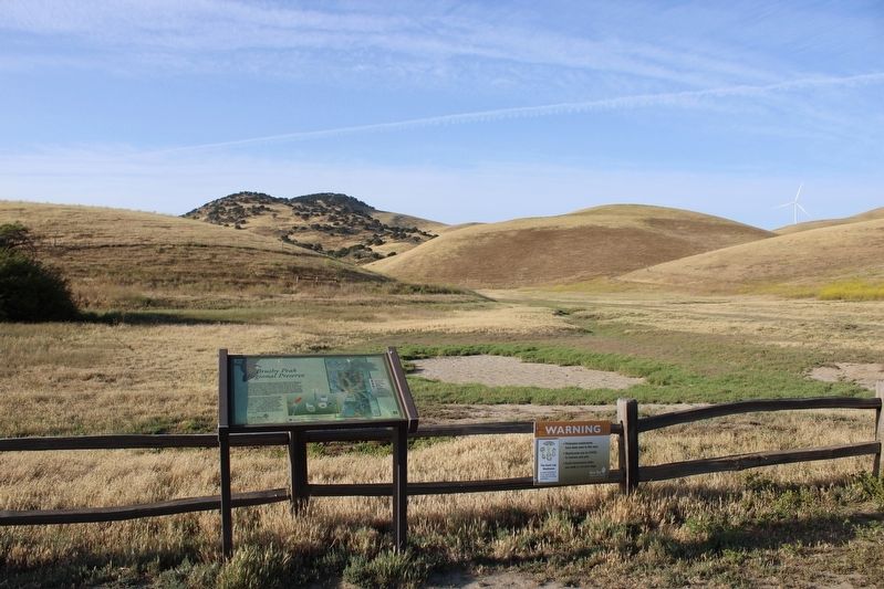
Location. 37° 44.829′ N, 121° 42.601′ W. Marker is in Livermore, California, in Alameda County. Marker is on West Side Loop Trail west of Laughlin Road, on the right when traveling west. The marker is mounted to a metal stand just east of the West Side Loop Trailhead at Laughlin Road. Touch for map. Marker is at or near this postal address: 3837 Laughlin Rd, Livermore CA 94551, United States of America. Touch for directions.
Other nearby markers. At least 8 other markers are within 6 miles of this marker, measured as the crow flies. A different marker also named Brushy Peak Regional Preserve (about 500 feet away, measured in a direct line); a different marker also named Brushy Peak Regional Preserve (about 500 feet away); Lawrence Livermore National Laboratory (approx. 4.3 miles away); Trevarno Road (approx. 4.4 miles away); From China to America (approx. 4˝ miles away); Robert Livermore (approx. 5.3 miles away); Duarte Garage (approx. 5.3 miles away); a different marker also named Duarte Garage (approx. 5.3 miles away). Touch for a list and map of all markers in Livermore.
Credits. This page was last revised on May 10, 2022. It was originally submitted on May 10, 2022, by Joseph Alvarado of Livermore, California. This page has been viewed 222 times since then and 28 times this year. Photos: 1, 2. submitted on May 10, 2022, by Joseph Alvarado of Livermore, California. • Devry Becker Jones was the editor who published this page.

