
Mountain Rest in Oconee County, South Carolina — The American South (South Atlantic)
Chauga Town
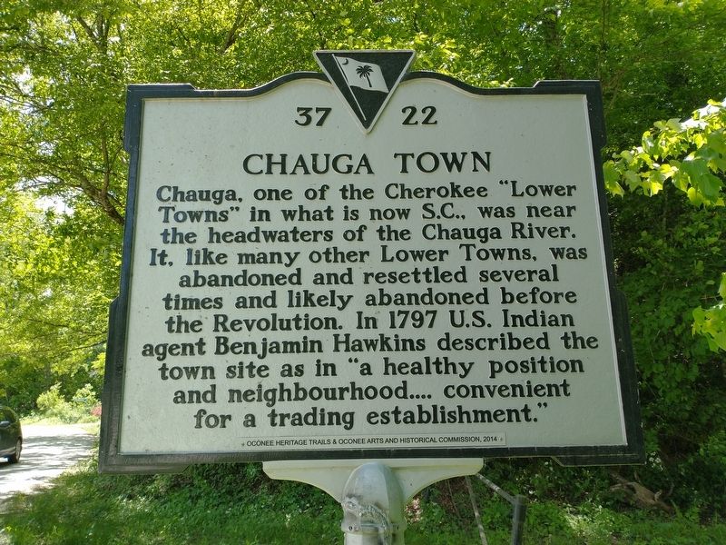
Photographed by Tom Bosse, May 13, 2022
1. Chauga Town Marker
Erected 2014 by Oconee Heritage Trails & Oconee Arts and Historical Commission. (Marker Number 37 22.)
Topics. This historical marker is listed in these topic lists: Colonial Era • Indigenous Peoples and Communities • Settlements & Settlers. A significant historical year for this entry is 1797.
Location. 34° 51.055′ N, 83° 9.422′ W. Marker is in Mountain Rest, South Carolina, in Oconee County. It is at the intersection of Morehead Place Road and Meadowview Drive, on the left when traveling north on Morehead Place Road. Touch for map. Marker is in this post office area: Mountain Rest SC 29664, United States of America. Touch for directions.

Regionally, this marker is in South Carolina’s and pstate, in the Foothills, in the
this page online
Other nearby markers. At least 8 other markers are within 4 miles of this marker, measured as the crow flies: Mountain Rest School / Hillbilly Day (approx. 1.4 miles away); The Civilian Conservation Corps (approx. 3.1 miles away); Civilian Conservation Corps Monument (approx. 3.1 miles away); A Building with a Past (approx. 3.1 miles away); Oconee State Park (approx. 3.1 miles away); Cherokee Boundary (1777) (approx. 3.1 miles away); The Oconee Waterwheel (approx. 3.1 miles away); Building a Tradition (approx. 3.1 miles away). Touch for a list and map of all markers in Mountain Rest.
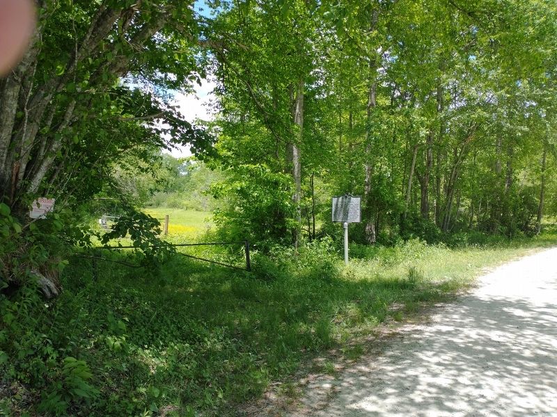
Photographed by Tom Bosse, May 13, 2022
2. Chauga Town Marker
Credits. This page was last revised on May 19, 2022. It was originally submitted on May 19, 2022, by Tom Bosse of Jefferson City, Tennessee. This page has been viewed 1,198 times since then and 92 times this year. Photos: 1, 2. submitted on May 19, 2022, by Tom Bosse of Jefferson City, Tennessee. • Bernard Fisher was the editor who published this page.
