Lowell in Middlesex County, Massachusetts — The American Northeast (New England)
Working the Water
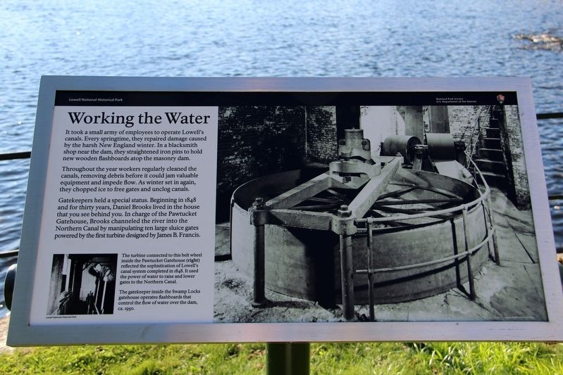
Throughout the year workers regularly cleaned the canals, removing debris before it could jam valuable equipment and impede flow. As winter set in again, they chopped ice to free gates and unclog canals.
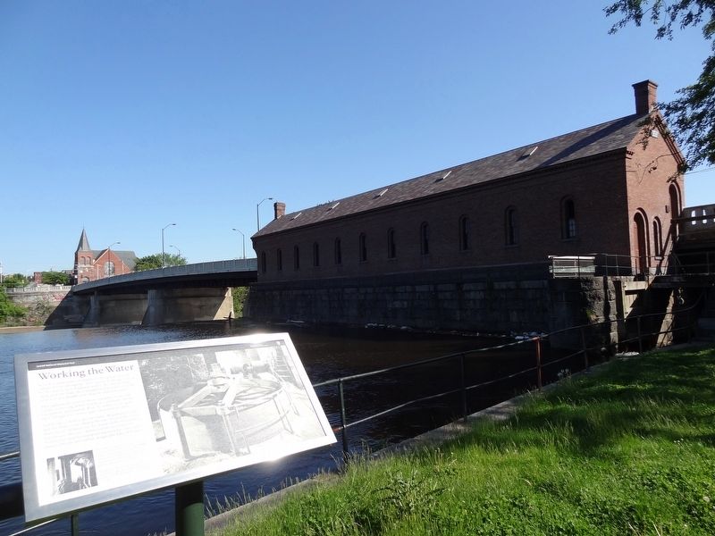
Gatekeepers held a special status. Beginning in 1848 and for thirty years, Daniel Brooks lived in the house that you see behind you. In charge of the Pawtucket Gatehouse, Brooks channeled the river into the Northern Canal by manipulating ten large sluice gates powered by the first turbine designed by James B. Francis.
[Captions]
• (Left) The gatekeeper inside the Swamp Locks gatehouse operates flashboards that control the flow of water over the dam, ca. 1950. Lowell National Historical Park
• (Right) The turbine connected to this belt wheel inside the Pawtucket Gatehouse (right) reflected the sophistication of Lowell's canal system completed in 1848. It used the
this page online
Erected by National Park Service.
Topics. This historical marker is listed in this topic list: Waterways & Vessels. A significant historical year for this entry is 1848.
Location. 42° 38.935′ N, 71° 19.806′ W. Marker is in Lowell, Massachusetts, in Middlesex County. It can be reached from School Street north of Pawtucket Street, on the right when traveling south. Marker is along the Northern Canal by the Pawtucket Gatehouse. Touch for map. Marker is at or near this postal address: 17 School St, Lowell MA 01854, United States of America. Touch for directions.

Regionally, this marker is in Greater Boston and in the Merrimack Valley. It is also in the American Northeast, in New England, and on the Eastern Seaboard. Globally, it is in the North Atlantic Region, North America, the Western Hemisphere, the Western World, and the Anglosphere. Historically, it finds itself in what was once one of the original Thirteen Colonies.
Other nearby markers. At least 8 other markers are within walking distance of this marker: Around the Falls
Credits. This page was last revised on May 19, 2022. It was originally submitted on May 19, 2022, by Duane and Tracy Marsteller of Murfreesboro, Tennessee. This page has been viewed 271 times since then and 29 times this year. Photos: 1, 2. submitted on May 19, 2022, by Duane and Tracy Marsteller of Murfreesboro, Tennessee.
