Chemung in Chemung County, New York — The American Northeast (Mid-Atlantic)
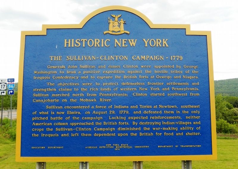
The Sullivan-Clinton Campaign — 1779
Historic New York
Generals John Sullivan and James Clinton were appointed by George Washington to lead a punitive expedition against the hostile tribes of the Iroquois Confederacy and to capture the British forts at Oswego and Niagara.
The objectives were to protect defenseless frontier settlements and strengthen claims to the rich lands of western New York and Pennsylvania. Sullivan marched north from Pennsylvania; Clinton started southwest from Canajoharie on the Mohawk River.
Sullivan encountered a force of Indians and Tories at Newtown, southeast of what is now Elmira, on August 29, 1779, and defeated them in the only pitched battle of the campaign. Lacking expected reinforcements, neither American column approached the British forts. By destroying Indian villages and crops the Sullivan-Clinton Campaign diminished the war-making ability of the Iroquois and left them dependent upon the British for food and shelter.
Erected 1974 by New York State American Revolution Bicentennial Commission; Education Department; and Department of Transportation.
Topics and series. This historical marker is listed in these topic lists: Native Americans • Settlements & Settlers • War, US Revolutionary • Wars, US Indian. In addition, it is included in the Historic New York State, and the The Spirit of ’76, America’s Bicentennial Celebration series lists. A significant historical date for this entry is August 29, 1779.
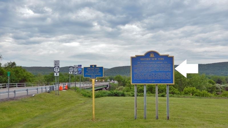
Location. 42° 0.549′ N, 76° 37.581′ W. Marker is in Chemung, New York, in Chemung County. Marker is on Wyncoop Creek Road (County Road 3) just south of Main Street (County Road 60), on the right when traveling south. Touch for map. Marker is at or near this postal address: 773 County Road 60, Chemung NY 14825, United States of America. Touch for directions.
Other nearby markers. At least 8 other markers are within 3 miles of this marker, measured as the crow flies. Junction Canal (here, next to this marker); Old Chemung (about 300 feet away, measured in a direct line); Sullivan Road (approx. ¼ mile away); Military Route (approx. 0.9 miles away); Chemung (approx. 2.3 miles away); Chemung Village (approx. 2.3 miles away); Soldiers of the American Revolution (approx. 2.9 miles away); Riverside Cemetery (approx. 2.9 miles away). Touch for a list and map of all markers in Chemung.
Also see . . .
1. What is the Sullivan/Clinton Campaign?.
The Sullivan-Clinton Campaign was the largest expedition ever before mounted against native North Americans. It targeted the Iroquois Six Nations Confederacy: specifically, the Seneca, Cayuga and Onondaga nations. In the middle of the American Revolution, George Washington ordered two Generals, John Sullivan and James Clinton, and more than 6,200 men — roughly 25% of the entire rebel army — to clear-cut and burn these resisting or then neutral Iroquois nations from one of Earth’s most fertile regions. They should "not merely be overrun," Washington insisted, "but destroyed." After five days in April and four weeks in September, almost all of Iroquoia was reduced to shattered hearths and fields of fire.(Submitted on May 20, 2022, by Cosmos Mariner of Cape Canaveral, Florida.)
2. Sullivan Expedition.
The campaign was ordered by George Washington, in response to the 1778 Iroquois–British attacks on Wyoming, German Flats and Cherry Valley, with the aim of "taking the war home to the enemy to break their morale". The Continental Army carried out a scorched-earth campaign, chiefly in the lands of the Iroquois Confederacy in what is now Pennsylvania and western New York State. The expedition was largely successful, with more than 40 Iroquois villages and their stores of winter crops destroyed, breaking the power of the Iroquois in New York all the way to the Great Lakes.(Submitted on May 20, 2022, by Cosmos Mariner of Cape Canaveral, Florida.)
Credits. This page was last revised on May 20, 2022. It was originally submitted on May 20, 2022, by Cosmos Mariner of Cape Canaveral, Florida. This page has been viewed 246 times since then and 39 times this year. Photos: 1, 2. submitted on May 20, 2022, by Cosmos Mariner of Cape Canaveral, Florida.

