Chantilly in Fairfax County, Virginia — The American South (Mid-Atlantic)
Hiding in the Icehouse
Sully Historic Site
— Cain's Branch Archaeological Trail —
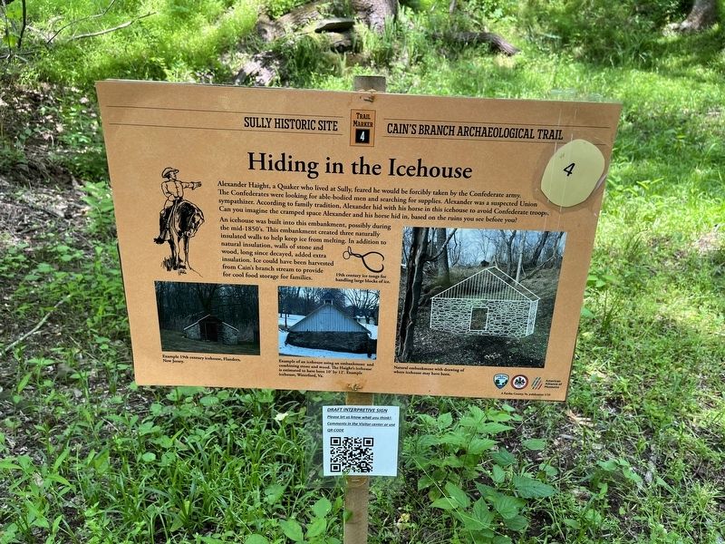
Alexander Haight, a Quaker who lived at Sully, feared he would be forcibly taken by the Confederate army. The Confederates were looking for able-bodied men and searching for supplies. Alexander was a suspected Union sympathizer. According to family tradition, Alexander hid with his horse in the icehouse to avoid Confederate troops. Can you imagine the cramped space Alexander and his horse hid in, based on the ruins you see before you.
An icehouse was built into this embankment, possibly during the mid-1850's. This embankment created three naturally insulated walls to help keep ice from melting. In addition to natural insulation, walls of stone and wood, long since decayed, added extra insulation. Ice could have been harvested from Cain's branch stream to provide for cool food storage for families.
[Captions:]
19th century ice tongs for handling large blocks of ice.
Example 19th century icehouse, Flanders, New Jersey.
Example of an icehouse using an embankment and combining stone and wood. The Haight's icehouse is estimated to have been 10' by 12'. Example icehouse, Waterford, Va.
Natural embankment with drawing of where icehouse may have been.
Erected 2022 by Fairfax County Park Authority. (Marker Number 4.)
Topics and series. This historical marker is listed in these topic lists: Anthropology & Archaeology • Churches & Religion • Natural Resources • Notable Buildings • War, US Civil. In addition, it is included in the Quakerism series list.
Location. 38° 54.369′ N, 77° 25.755′ W. Marker is in Chantilly, Virginia, in Fairfax County. Marker can be reached from Historic Sully Way, 0.8 miles south of Air and Space Museum Parkway, on the left when traveling south. Touch for map. Marker is at or near this postal address: 3650 Historic Sully Way, Chantilly VA 20151, United States of America. Touch for directions.
Other nearby markers. At least 8 other markers are within walking distance of this marker. Travelling Back in Time (within shouting distance of this marker); Finding a Slave Quarter and an 18th Century Roadbed (about 300 feet away, measured in a direct line); Old Barn and Other Farm Buildings (about 500 feet away); Sully (about 600 feet away); Excavating a 19th century Tenant Structure (about 600 feet away); The Sully Farms (about 700 feet away); Richard Bland Lee Served His Country (about 700 feet away); An 18th Century Enslaved Community at Sully (about 700 feet away). Touch for a list and map of all markers in Chantilly.
Credits. This page was last revised on May 21, 2022. It was originally submitted on May 21, 2022, by Devry Becker Jones of Washington, District of Columbia. This page has been viewed 145 times since then and 21 times this year. Photos: 1, 2. submitted on May 21, 2022, by Devry Becker Jones of Washington, District of Columbia.

