Woodbridge in Prince William County, Virginia — The American South (Mid-Atlantic)
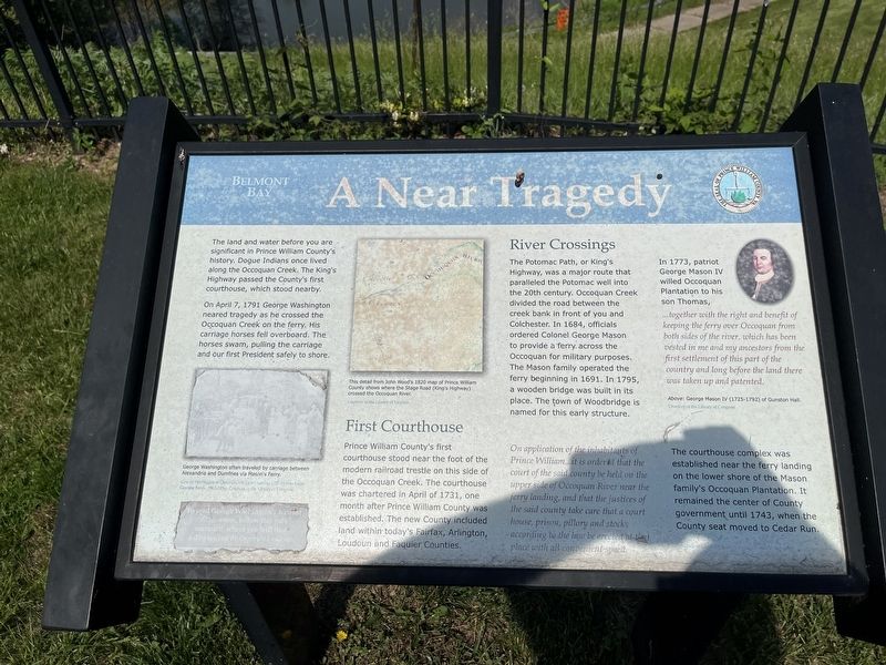
A Near Tragedy
Belmont Bay
The land and water before you are significant in Prince William County's history. Dogue Indians once lived along the Occoquan Creek. The King's Highway passed the County's first courthouse, which stood nearby.
On April 7, 1791 George Washington neared tragedy as he crossed the Occoquan Creek on the ferry. His carriage horses fell overboard. The horses swam, pulling the carriage and our first President safely to shore.
First Courthouse
Prince William County's first courthouse stood near the foot of the modern railroad trestle on this side of the Occoquan Creek. The courthouse was chartered in April of 1731, one month after Prince William County was established. The new County included land within today's Fairfax, Arlington, Loudoun and Fauquier Counties.
River Crossings
The Potomac Path, or King's Highway, was a major route that paralleled the Potomac well into the 20th century. Occoquan Creek divided the road between the creek bank in front of you and Colchester. In 1684, officials ordered Colonel George Mason to provide a ferry across the Occoquan for military purposes. The mason family operated the ferry beginning in 1691. In 1795, a wooden bridge was built in its place. The town of Woodbridge is named for this early structure.
On application of the inhabitants of Prince William…it is ordered that the court of the said county be held on the upper side of the Occoquan River near the ferry landing, and that the justices of the said county take care that a court house, prison, pillory and stocks according to the law be erected at that place with all convenient speed.
In 1773, patriot George Mason IV willed Occoquan Plantation to his son Thomas,
…together with the right and benefit of keeping the ferry over Occoquan from both sides of the river, which has been vested in me and my ancestors from the first settlement of this part of the country and long before the land there was taken up and patented.
The courthouse complex was established near the ferry landing on the lower shore of the Mason family's Occoquan Plantation. It remained the center of County government until 1743, when the County seat moved to Cedar Run.
[Captions:]
George Washington often traveled by carriage between Alexandria and Dumfries via Mason's Ferry.
To read George Washington's account of this event, follow this path eastward where you will find a display inside Osprey's Landing.
This detail from John Wood's 1820 map of Prince William County shows where the Stage Road (King's Highway) crossed the Occoquan River.
Topics and series. This historical marker is listed in these topic lists: Animals • Bridges & Viaducts • Colonial Era • Government & Politics • Notable Events • Political Subdivisions • Waterways & Vessels. In addition, it is included in the Former U.S. Presidents: #01 George Washington series list. A significant historical date for this entry is April 7, 1791.
Location. 38° 39.909′ N, 77° 14.489′ W. Marker is in Woodbridge, Virginia, in Prince William County. Marker is on Colchester Ferry Place just north of Potomac Path Drive, in the median. Touch for map. Marker is at or near this postal address: 13300 Colchester Ferry Pl, Woodbridge VA 22191, United States of America. Touch for directions.
Other nearby markers. At least 8 other markers are within one mile of this marker, measured as the crow flies. Colchester (approx. 0.4 miles away); End of the Water (approx. 0.7 miles away); The Trail to Victory at Yorktown (approx. 1.1 miles away); Welcome to Colchester on the Occoquan (approx. 1.1 miles away); The Nation's River (approx. 1.1 miles away); Revolutionary Army Life on the Road (approx. 1.1 miles away); In the Footsteps of History (approx. 1.1 miles away); Welcome to Occoquan Bay National Wildlife Refuge (approx. 1.1 miles away). Touch for a list and map of all markers in Woodbridge.
Credits. This page was last revised on May 22, 2022. It was originally submitted on May 22, 2022, by Devry Becker Jones of Washington, District of Columbia. This page has been viewed 342 times since then and 75 times this year. Photos: 1, 2. submitted on May 22, 2022, by Devry Becker Jones of Washington, District of Columbia.

