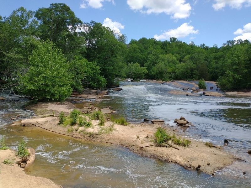
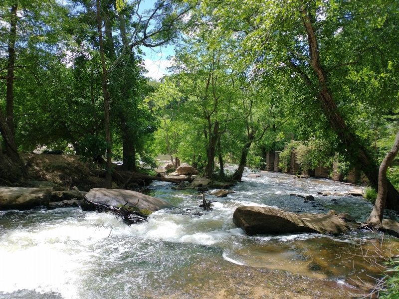
Near Fountain Inn in Greenville County, South Carolina — The American South (South Atlantic)
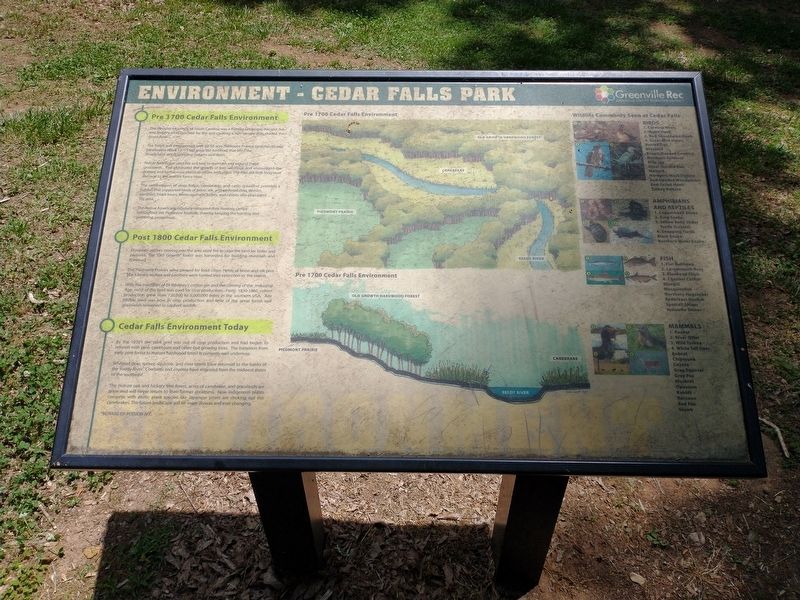
Environment – Cedar Falls Park
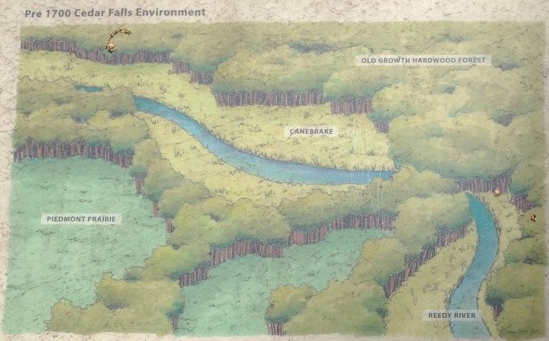
• The Piedmont foothills of South Carolina was a frontier landscape. Ancient oak and hickory trees reached for the sun creating a rich canopy that shaded the forest floor.
• The forest was interspersed with 20-30 acre Piedmont Prairie (grasslands) and canebrakes (thick 12’-15’ tall grass like bamboo) that filled the floodplains along sparkling streams and rivers.
• Native Americans used fire as a tool to maintain and expand these grasslands. Fire eliminated the growth of tree seedlings and encouraged the grasses and herbaceous plants to return with vigor. The fires did little long term damage to the mature forest trees.
• The combination of deep forest, canebrakes, and open grassland provided a habitat that supported herds of bison, elk, and whitetail deer. Wolves, panthers, black bears, foxes, squirrels, turkey, and rabbits also populated the area.
• The Native Americans regularly relocated their hunting camps throughout the Piedmont foothills, thereby keeping the hunting and gathering prosperous.
Post 1800 Cedar Falls Environment
• European settlers moving into the area used fire to clear the land for farms and pastures. The “Old Growth” forest was harvested for building materials and firewood.
• The Piedmont Prairies were plowed for food crops. Herds of bison and elk plus back bears, wolves and panthers were hunted into extinction in the region.
• With the invention of Eli Whitney’s cotton gin and the coming of the Industrial Age, most of the land was used for crop production. From 1830-1860, cotton production grew from 720,000 to 5,000,000 bales in the southern USA. Any tillable land was now in crop production and little of the great forest and grasslands remained to support wildlife.
Cedar Falls Environment Today
• By the 1930’s, the park land was out of crop production and had begun to reforest with pine, sweetgum and other fast growing trees. The transition from early pine forest to mature hardwood forest is currently well underway.
• Whitetail deer, turkey, squirrels, and river otters have returned to the banks of the Reedy River. Cowbirds and coyotes have migrated from the Midwest states to the southeast.
• The mature oak and hickory tree forest, acres of canebrake, and grasslands are gone and will never return to their former greatness. Now indigenous plants complete with exotic plant species like Japanese privet choking out the canebrakes. The future landscape will be more diverse and ever changing.
Wildlife Commonly Seen at Cedar Falls
Birds
1. Carolina Wren
2. Wood Duck
3. Red-Shouldered Hawk
4. Great blue Herons
Barred Owl
Bluebird
Brown Headed Cowbird
Northern Cardinal
Blue Jay
Great Horned Owl
Mallard
Northern Mockingbird
Red-Headed Woodpecker
Red-Tailed Hawk
Turkey Vulture
Amphibians and Reptiles
1. Copperhead Snake
2. King Snake
3. Yellow Belly Slider Turtle (Cooter)
4. Snapping Turtle
Black Snake
Northern Water Snake
Fish
1. Flat Bullhead
2. Largemouth Bass
3. Bluehead Chub
4. Channel Catfish
Bluegill
Mosquitofish
Northern Hogsucker
Redbreast Sunfish
Spottail Shiner
Yellowfin Shiner
Mammals
1. Beaver
2. River Otter
3. Wild Turkey
4. White Tail Deer
Bobcat
Chipmuck
Coyote
Gray Squirrel
Gray Fox
Muskrat
Opossum
Rabbit
Raccoon
Red Fox
Skunk
Erected by Greenville County Recreation District.
Topics. This historical marker is listed in these topic lists: Animals • Environment • Native Americans • Parks & Recreational Areas. A significant historical year for this entry is 1700.
Location. 34° 36.731′ N, 82° 17.917′ W. Marker is near Fountain Inn, South Carolina, in Greenville County. Marker
can be reached from the intersection of Cedar Falls Road and Turner Road, on the right when traveling north. Marker located in Cedar Falls Park. Touch for map. Marker is at or near this postal address: 201 Cedar Falls Road, Fountain Inn SC 29644, United States of America. Touch for directions.
Other nearby markers. At least 8 other markers are within 4 miles of this marker, measured as the crow flies. History – Cedar Falls Park (here, next to this marker); History - Cedar Falls Park (here, next to this marker); a different marker also named History - Cedar Falls Park (a few steps from this marker); Fork Shoals School (approx. one mile away); Fork Shoals Baptist Church (approx. one mile away); Hopkins Farm (approx. 3.2 miles away); Toney's Store / Militia Muster Ground (approx. 3.2 miles away); Battle of Great Cane Brake (approx. 3.2 miles away). Touch for a list and map of all markers in Fountain Inn.
Related markers. Click here for a list of markers that are related to this marker.
Credits. This page was last revised on May 26, 2022. It was originally submitted on May 25, 2022, by Tom Bosse of Jefferson City, Tennessee. This page has been viewed 213 times since then and 20 times this year. Photos: 1, 2, 3, 4, 5, 6. submitted on May 25, 2022, by Tom Bosse of Jefferson City, Tennessee. • Bernard Fisher was the editor who published this page.
