Denton in Caroline County, Maryland — The American Northeast (Mid-Atlantic)
The Martinak Boat
50th Anniversary
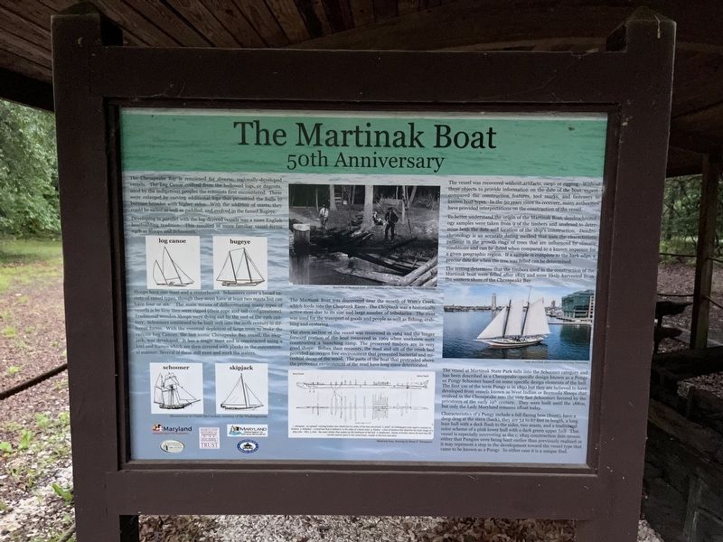
The Chesapeake Bay is renowned for diverse, regionally-developed vessels. The Log Canoe evolved from the hollowed logs, or dugouts used by the indigenous peoples the colonists encountered. These were enlarged by carving additional logs that permitted the hulls to become broader with higher sides. With the addition of masts, they could be sailed as well as paddled, and evolved in the famed Bugeye.
Developing in parallel with the log-derived vessels was more English boatbuilding tradition. This resulted in more vessel forms such as Sloops and Schooners.
Sloops have one mast and a centerboard. Schooners cover a broad variety of vessel types, though they must have at least two masts but can have four or six. The main means of differentiating many types of vessels is by how they were rigged (their rope and sail configurations). Traditional wooden Sloops were dying out by the end of the 19th century. Schooners continued to be built well into the 20th century in different forms. With the eventual depletion of large trees to make the various Log Canoes, the last iconic Chesapeake Bay vessel, the Skipjack, was developed. It has a single mast and is constructed using a keel and frames which are then covered with planks in the conventional manner. Several of these still exist and work the waters.
The Martinak Boat was discovered near the mouth of Watt's Creek, which feeds into the Choptank River. The Choptank was a historically active river due to its size and large number of tributaries. The river was used for the transport of goods and people as well as fishing, crabbing and oystering.
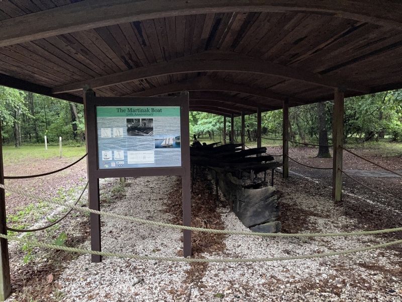
The stern section of the vessel was recovered in 1964 and the longer forward portion of the boat recovered in 1969 when workmen were constructing a launching ramp. The preserved timbers are in very good shape. Before their recovery, the mud and silt of the creek bed provided an oxygen free environment that prevented bacterial and microbial decay of the wood. The parts of the wood that protruded above the protective environment of the mud have long since deteriorated.
The vessel was recovered without artifacts, cargo or rigging. Without these objects to provide information on the date of the boat, experts compared the construction features, tool marks, and fasteners to known boat types. In the 50 years since its recovery, many authorities have provided interpretations on the construction of the vessel.
To better understands the origin of the Martinak Boat, dendrochronology samples were taken from 9 of the timbers and analyzed to determine both the date and location of the ship's construction. Dendrochronology is an accurate dating method that uses the patterns in the
The testing determine that the timbers used in the construction of the Martinak boat were felled after 1825 and were likely harvested from the western shore of the Chesapeake Bay
The vessel at Martinak State Park falls into the Schooner category and has been described as a Chesapeake-specific design known as a Pungy or Pungy Schooner based on some specific design elements of the hull. The first use of the term Pungy is in 1850 but they are believed to have evolved in the Chesapeake into the very fast Schooners favored by the privateers of the early 19th century. They were built until the 1880s, but only the Lady Maryland remains afloat today.
Characteristics of a Pungy include a full flaring bow (front), have a deep drag at the stern (back), they are 54 to 67 feet in length, a long lean hull with a deck flush to the sides, two masts, and a traditional color scheme of a pink lower hull with a dark green upper hull. This vessel is especially interesting as the c. 1825 construction date means either that Pungies were being built earlier than previously realized or it may represent a step in the development toward the vessel type that came to be known as Pungy. In either case it is a unique find.
Erected 2014 by Maryland Department of Planning; Jefferson Patterson Park & Museum; Maryland Historical Trust; Maryland Department of Natural Resources; Chesapeake Bay Maritime Museum.
Topics. This historical marker is listed in these topic lists: Anthropology & Archaeology • Native Americans • Waterways & Vessels. A significant historical year for this entry is 1964.
Location. 38° 51.583′ N, 75° 50.356′ W. Marker is in Denton, Maryland, in Caroline County. Marker can be reached from Martinak State Park Road, 0.4 miles south of Deep Shore Road, on the left when traveling south. Touch for map. Marker is at or near this postal address: 137 Deep Shore Road, Denton MD 21629, United States of America. Touch for directions.
Other nearby markers. At least 8 other markers are within 2 miles of this marker, measured as the crow flies. Mystery Ship (a few steps from this marker); The County Alms House, then Plaindealing (approx. 1.2 miles away); Ruth Ann Crouse (approx. 1.2 miles away); Denton (approx. 1.6 miles away); "29, Let's Go!" (approx. 1.7 miles away); American Legion (approx. 1.7 miles away); 6 PDR. Nordenfeldt 57 M.M., Rapid Fire Gun. (approx. 1.7 miles away); Bell from First Methodist Church (approx. 1.8 miles away). Touch for a list and map of all markers in Denton.
Credits. This page was last revised on May 29, 2022. It was originally submitted on May 28, 2022, by Devry Becker Jones of Washington, District of Columbia. This page has been viewed 125 times since then and 23 times this year. Photos: 1, 2. submitted on May 29, 2022, by Devry Becker Jones of Washington, District of Columbia.

