Fort Jefferson in Darke County, Ohio — The American Midwest (Great Lakes)
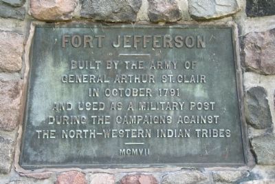
Fort Jefferson
General Arthur St. Clair
in October 1791
and used as a military post
during the campaigns against
the North-Western Indian tribes
MCMVII
Erected 1907.
Topics. This historical marker is listed in these topic lists: Forts and Castles • Native Americans • Wars, US Indian. A significant historical month for this entry is October 1791.
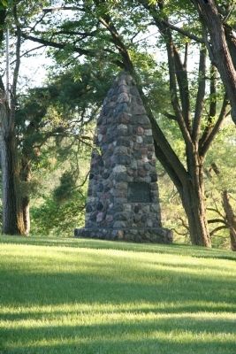
Location. 40° 1.546′ N, 84° 39.401′ W. Marker is in Fort Jefferson, Ohio, in Darke County. Marker can be reached from Weavers-Fort Jefferson Road, 0.1 miles west of Ohio Route 121, on the left when traveling west. This historic marker is located in the state park maintained by the Ohio Historical Society. It is attached to the stacked stone memorial that is featured in this park. Touch for map. Marker is in this post office area: Greenville OH 45331, United States of America. Touch for directions.
Other nearby markers. At least 8 other markers are within walking distance of this marker. Ash Pit (here, next to this marker); Trench (within shouting distance of this marker); Excavation (within shouting distance of this marker); Firepit (within shouting distance of this marker); Fort Jefferson: A Link in a Chain (within shouting distance of this marker); Underground Passage (within shouting distance of this marker); Well or Magazine Pit (within shouting distance of this marker); Fort Jefferson / St. Clair’s Defeat (within shouting distance of this marker). Touch for a list and map of all markers in Fort Jefferson.
More about this marker. To get to this historic marker take State Route 121 to Fort Jefferson, Ohio, and turn west onto Weavers-Fort Jefferson Road and travel one block (less than 0.1 mile). The state park that is situated on the site of Fort Jefferson will be on your left and the historic marker is featured at the top of the hill in the center of the park.
Also see . . .
1. Fort Jefferson. This link is published and made available by, "Ohio History Central," an online encyclopedia of Ohio History. (Submitted on June 12, 2009, by Dale K. Benington of Toledo, Ohio.)
2. "Seeking Site of Fort Jefferson". Ohio Memory website entry (Submitted on April 28, 2022, by Larry Gertner of New York, New York.)

Photographed By J. Wesley Baker, June 3, 2016
3. Fort Jefferson Memorial Park
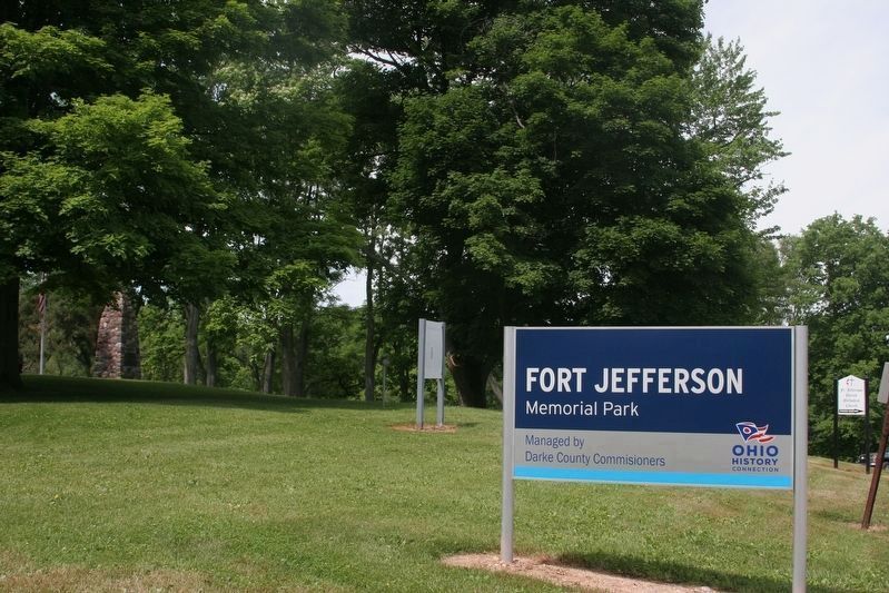
The Ohio History Connection sign for the site. The St. Clair's Defeat sign can be seen in the near background to the left of the sign and the stone monument is visible at the top of the knoll at the far left of the picture.
Credits. This page was last revised on April 28, 2022. It was originally submitted on June 12, 2009, by Dale K. Benington of Toledo, Ohio. This page has been viewed 1,422 times since then and 16 times this year. Photos: 1, 2. submitted on June 12, 2009, by Dale K. Benington of Toledo, Ohio. 3. submitted on December 8, 2018, by J. Wesley Baker of Springfield, Ohio. • Craig Swain was the editor who published this page.

