Trap Pond State Park near Laurel in Sussex County, Delaware — The American Northeast (Mid-Atlantic)
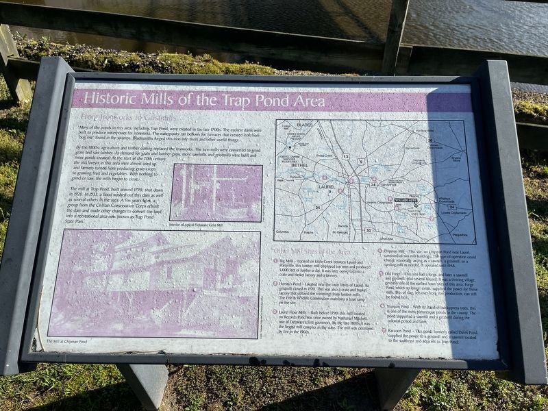
Historic Mills of the Trap Pond Area

Photographed By Devry Becker Jones (CC0), May 28, 2022
1. Historic Mills of the Trap Pond Area Marker
From Ironworks to Gristmills
Many of the ponds in this area, including Trap Pond, were created in the late 1700s. The earliest dams were built to produce waterpower for ironworks. The waterpower ran bellows for furnaces that created iron from "bog ore" found in the swamps. Blacksmiths forged this iron into tools and other useful things.
By the 1800s, agriculture and timber cutting replaced the ironworks. The iron mills were converted to grind grain and saw lumber. As demand for grain and lumber grew more sawmills and gristmills were built and more ponds created. At the start of the 20th century, the old forests in this area were almost used up and farmers turned from producing grain crops to growing fruit and vegetables. With nothing to grind or saw, the mills began to close.
The mill at Trap Pond, built around 1790, shut down in 1920. In 1933, a flood washed out this dam as well as several others in the area. A few years later, a group from the Civilian Conservation Corps rebuilt the dam and made other changes to convert the land into a recreational area now known as Trap Pond State Park.
Other Mill Sites of the Area:
❶ Big Mills — Located on Little Creek Between Laurel and Portsville, this lumber mill employed ten men and produced 5,000 feet of lumber a day. It was later converted into a crate and basket factory and a tannery.
❷ Horsey's Pond — Located near the town limits of Laurel, its gristmill closed in 1920. This was also a crate and basket factory that utilized the trimmings from lumber mills. The Fish & Wildlife Commission maintains a boat ramp on the site.
❸ Laurel Flour Mills — Built before 1790, this mill located on Records Pond was once owned by Nathaniel Mitchell, one of Delaware's first governors. By the late 1800s, it was the largest mill complex in the state. The mill was destroyed by fire in the 1960s
❹ Chipman Mill — This site, on Chipman Pond near Laurel, consisted of two mill buildings. The type of operation could change seasonally, acting as a sawmill, a gristmill, or a carding mill as needed. It operated until 1948.
❺ Old Forge — This site had a forge, and later a sawmill and gristmill, plus several house. It was a thriving village, possibly one of the earliest town sites of this area. Forge Pond, which no longer exists, supplied the power for these mills. Bits of slag, left over from iron production, can still be found here.
❻ Trossum Pond — With its stand of baldcypress trees, this is one of the most picturesque ponds in this country. The pond supported a sawmill and a gristmill during the colonial period and later.
❼

Photographed By Devry Becker Jones (CC0), May 28, 2022
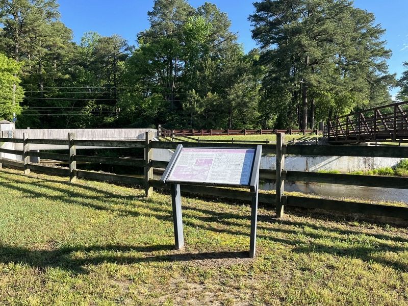
2. Historic Mills of the Trap Pond Area Marker
Erected by Delaware State Parks.
Topics and series. This historical marker is listed in these topic lists: Agriculture • Industry & Commerce • Settlements & Settlers • Waterways & Vessels. In addition, it is included in the Civilian Conservation Corps (CCC), and the Delaware State Parks series lists. A significant historical year for this entry is 1790.
Location. 38° 31.656′ N, 75° 28.934′ W. Marker is near Laurel, Delaware, in Sussex County. It is in Trap Pond State Park. Marker can be reached from the intersection of Trap Pond Road and Bald Cypress Lane, on the right when traveling east. Touch for map. Marker is at or near this postal address: 33582 Bald Cypress Ln, Laurel DE 19956, United States of America. Touch for directions.
Other nearby markers. At least 8 other markers are within 3 miles of this marker, measured as the crow flies. Welcome to Trap Pond State Park (approx. 0.2 miles away); Senator Robert "Bob" Venables (approx. 0.2 miles away); Hidden Forests (approx. half a mile away); Jason Beach (approx. 0.6 miles away); Ted Harvey: Innovator for Preservation (approx. 1˝ miles away); The Old Country Church (approx. 1.7 miles away); The Bethesda Church Lives On (approx. 1.7 miles away); Trinity Methodist Church (approx. 2.4 miles away). Touch for a list and map of all markers in Laurel.
Credits. This page was last revised on January 9, 2024. It was originally submitted on May 29, 2022, by Devry Becker Jones of Washington, District of Columbia. This page has been viewed 261 times since then and 65 times this year. Photos: 1, 2. submitted on May 29, 2022, by Devry Becker Jones of Washington, District of Columbia.