Downtown Kansas City in Jackson County, Missouri — The American Midwest (Upper Plains)
Slavery in Kansas City

Photographed by Jason Voigt, May 26, 2022
1. Slavery in Kansas City Marker
With the Missouri Compromise of 1820, the United States determined to maintain an equal balance of free and slave states. In 1821, Missouri entered statehood as a slave state while Maine was declared "free." Although many Missourians were decidedly against slavery, the area's rapid growth created a need for "bonded" laborers. For these bondsmen, life was filled with beatings, rape, branding, separation of families, no education and long hours of back-breaking work.
Missouri was bordered by four "free" territories - the most of any other slaveholding state in the nation. Many Missouri slaves escaped to freedom through a system of safe houses known as the Underground Railroad. Legends exist about abolitionist activities in Westport, Weston and Parkville but the most important documented site was the river town of Quindaro,
this page online
After three tumultuous decades, the slavery debate in Missouri came to a head.
In 1854, the Kansas-Nebraska Act declared that the inhabitants of the new Kansas Territory could determine whether it would be a free or slave state. Activists from both sides flocked to the region, intending to influence the vote. Violent political confrontations erupted between the pro-slavery "Border Ruffians" and anti-slavery Free-Staters, leading to the new territory's term of "Bleeding Kansas." After seven years as a "freesoil" territory, Kansas officially became a free state in early 1861, less than three months prior to the start of the Civil War.
For the next four years, the battle over slavery created bloody
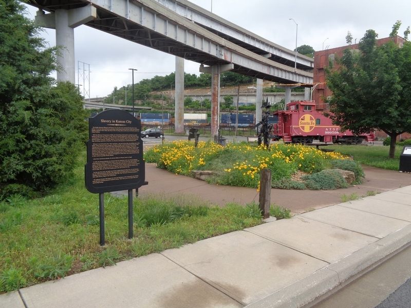
Photographed by Jason Voigt, May 26, 2022
2. Slavery in Kansas City Marker
Marker is located at Train Park.
The adjacent Freedom Mall depicts the trials and tribulations of the enumerable slave families from this most turbulent period of America's history. Their story is one of strength, hope, and unwavering courage.
Topics. This historical marker is listed in these topic lists: Abolition & Underground RR • African Americans • War, US Civil. A significant historical date for this entry is January 1, 1865.
Location. 39° 6.381′ N, 94° 35.701′ W. Marker is in Kansas City, Missouri, in Jackson County. It is in Downtown Kansas City. It is on Madison Street north of West 8th Street, on the right when traveling north. Marker is located at Train Park. Touch for map. Marker is at or near this postal address: 751 Madison St, Kansas City MO 64101, United States of America. Touch for directions.

Regionally, this marker is in the American Midwest, in the Lewis & Clark Corridor, in the Corn Belt, and on the Santa Fe Trail Corridor. Globally, it is in North America, the Western Hemisphere, the Western World, and the Anglosphere. Historically, it finds itself in what was once the territory of the Mississippian Culture, the Louisiana Purchase, and the Antebellum South.
Other nearby markers. At least 8 other markers are within walking distance of this marker: Ed Hogan (a few steps from this marker); Frontier Railroads in Kansas City (within shouting distance of this marker); Darby Trotter Spirit Mall (within shouting distance of this marker); Etienne Veniard - Sieur de Bourgemont (approx. 0.2 miles away); Lewis and Clark Expedition Across Missouri (approx. 0.2 miles away); The French and the Lewis & Clark Expedition (approx. 0.2 miles away); James Pendergast (approx. 0.2 miles away); Lewis and Clark (approx. 0.2 miles away). Touch for a list and map of all markers in Kansas City.
Credits. This page was last revised on February 10, 2023. It was originally submitted on June 5, 2022, by Jason Voigt of Glen Carbon, Illinois. This page has been viewed 2,673 times since then and 125 times this year. Photos: 1, 2. submitted on June 5, 2022, by Jason Voigt of Glen Carbon, Illinois.
