
Downtown in Mount Airy in Carroll County, Maryland — The American Northeast (Mid-Atlantic)
Sledding in Mount Airy in the Past
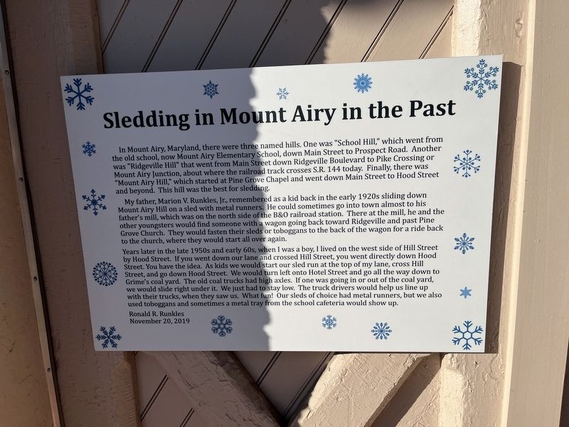
In Mount Airy, Maryland, there were three named hills. One was "School Hill," which went from the old school, now Mount Airy Elementary School, down Main Street to Prospect Road. Another was "Ridgeville Hill" that went from Main Street down Ridgeville Boulevard to Pike Crossing or Mount Airy Junction, about where the railroad track crosses S.R. 144 today. Finally, there was "Mount Airy Hill," which started at Pine Grove Chapel and went down Main Street to Hood Street and beyond. This hill was the best for sledding.
My father, Marion V. Runkles, Jr., remembered as a kid back in the early 1920s sliding down Mount Airy Hill on a sled with metal runners. He could sometimes go into town almost to his father's mill, which was on the north side of the B&O railroad station. There at the mill, he and the other youngsters would find someone with a wagon going back toward Ridgeville and past Pine Grove Church. They would fasten their sleds or toboggans to the back of the wagon for a ride back to the church, where they would start all over again.
Years later in the late 1950s and early 60s, when I was a boy, I lived on the
this page online
Erected 2019 by Ronald R. Runkles.
Topics and series. This historical marker is listed in these topic lists: Parks & Recreational Areas • Roads & Vehicles • Sports. In addition, it is included in the Baltimore and Ohio Railroad (B&O) series list.
Location. 39° 22.612′ N, 77° 9.253′ W. Marker is in Mount Airy, Maryland, in Carroll County. It is in Downtown. It is on South Main Street (Maryland

Regionally, this marker is in the Baltimore Metro Region and in Central Maryland. It is also in the American Mid-Atlantic. Globally, it is in North America, the Western Hemisphere, the Western World, and the Anglosphere. Historically, it finds itself in what was once one of the original Thirteen Colonies and also the Antebellum South.
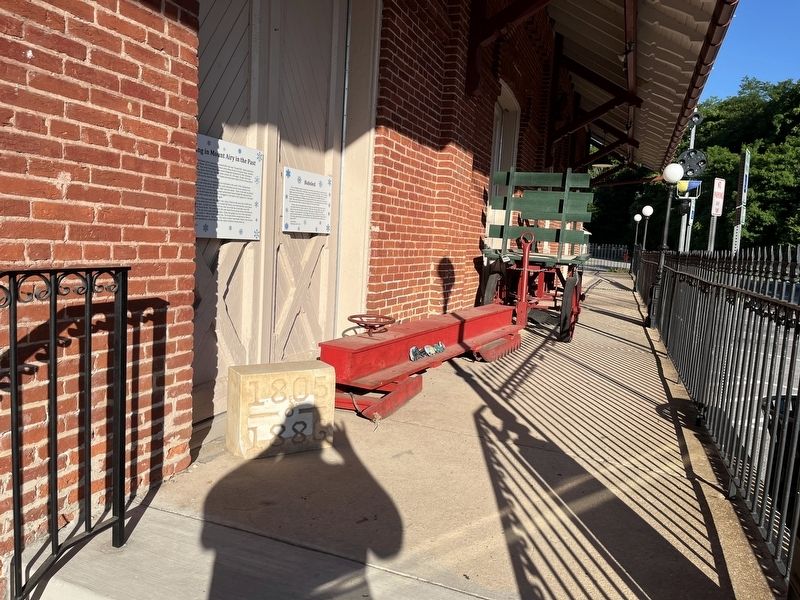
Other nearby markers. At least 8 other markers are within walking distance of this marker: Railway Express Agency Baggage Wagon (here, next to this marker); The Mount Airy Station (here, next to this marker); The Gillis Building (within shouting distance of this marker); The Mount Airy Founding (within shouting distance of this marker); Runkles Mill & The Mount Airy Milling Company (within shouting distance of this marker); William Hood Building (within shouting distance of this marker); Railroad Storage Building (within shouting distance of this marker); Bobsled (within shouting distance of this marker). Touch for a list and map of all markers in Mount Airy.
Other markers no longer nearby. The Mount Airy Rail Yard (was within shouting distance of this marker but has been replaced with another marker now near it); Runkles Mill and The Mt. Airy Milling Company (was within shouting distance of this marker but has been replaced with another marker now near it).
Additional keywords. winter sports
Credits. This page was last revised on June 5, 2022. It was originally submitted on June 5, 2022, by Devry Becker Jones of Washington, District of Columbia. This page has been viewed 503 times since then and 42 times this year. Photos: 1, 2. submitted on June 5, 2022, by Devry Becker Jones of Washington, District of Columbia.
