Iaeger in McDowell County, West Virginia — The American South (Appalachia)
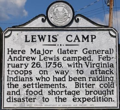
Lewis’ Camp
Photographed by Dawn Bowen, July 21, 2007
1. Lewis' Camp Marker
Erected 1975 by West Virginia Division of Archives and History.
Topics and series. This historical marker is listed in these topic lists: Colonial Era • Wars, US Indian. In addition, it is included in the West Virginia Archives and History series list. A significant historical date for this entry is February 26, 1907.
Location. 37° 27.859′ N, 81° 48.85′ W. Marker is in Iaeger, West Virginia, in McDowell County. It is on West Virginia Route 80 0 miles south of U.S. 52, on the left when traveling north. Touch for map. Marker is in this post office area: Iaeger WV 24844, United States of America. Touch for directions.

Regionally, this marker is in the Southern Coalfields. It is also in the American South, specifically in the Upper South, in Appalachia, and specifically in Southern Appalachia. Globally, it is in North America, the Western Hemisphere, the Western World, and the Anglosphere. Historically,
this page online
Other nearby markers. At least 6 other markers are within 16 miles of this marker, measured as the crow flies: Wilmore Dam - Est. 1906 (approx. 4.4 miles away); Bartley Mine Disaster (approx. 9.4 miles away); Transport Plane Crash Memorial (approx. 9.9 miles away); Thomas Smith (approx. 12 miles away); Battle of Beech Creek (approx. 15.3 miles away); Horsepen Mountain (approx. 16 miles away).
Photographed by Dawn Bowen, July 21, 2007
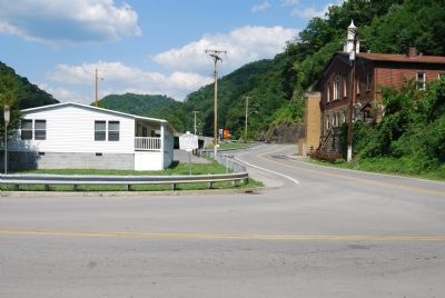
2. Marker along SR 80
Credits. This page was last revised on June 26, 2022. It was originally submitted on July 22, 2007, by Dawn Bowen of Fredericksburg, Virginia. This page has been viewed 1,848 times since then and 41 times this year. Last updated on June 24, 2022, by J. J. Prats of Springfield, Virginia. Photos: 1, 2. submitted on July 22, 2007, by Dawn Bowen of Fredericksburg, Virginia. • J. Makali Bruton was the editor who published this page.
