Monroe in Monroe County, Michigan — The American Midwest (Great Lakes)
River Raisin Legacy Project
Fish Passage 4
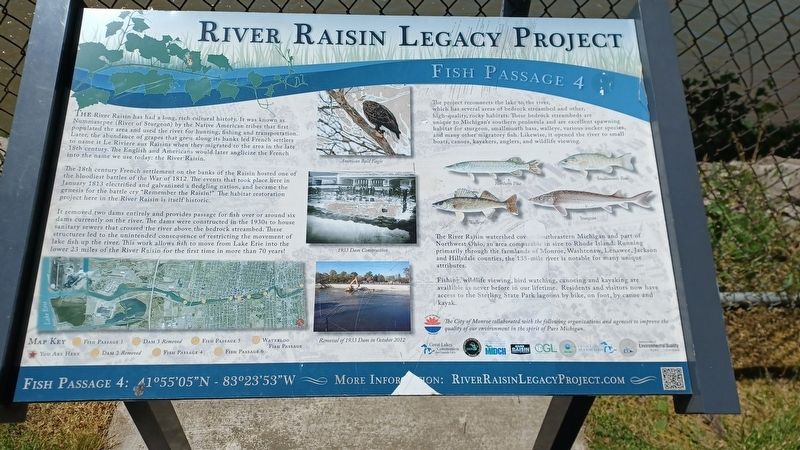
The River Raisin has had a long, rich cultural history. It was known as Nummasepee (River of Sturgeon) by the Native American tribes that first populated the area and used the river for hunting, fishing and transportation. Later, the abundance of grapes that grew along its banks led French settlers to name it Le Riviere aux Raisins when they migrated to the area in the late 18th century. The English and Americans would later anglicize the French into the name we use today: the River Raisin.
The 18th century French settlement on the banks of the Raisin hosted one of the bloodiest battles of the War of 1812. The events that took place here in January 1813 electrified and galvanized a fledgling nation, and became the genesis for the battle cry "Remember the Raisin!" The habitat restoration project here in the River Raisin is itself historic.
It removed two dams entirely and provides passage for fish over or around six dams currently on the river. The dams were constructed in the 1930s to house sanitary sewers that crossed the river above the bedrock streambed. These structures led to the unintended consequence of restricting the movement of lake fish up the river. This work allows fish to move from Lake Erie into the lower 23 miles of the River Raisin for the first time in more than 70 years!
The project reconnects the lake to the river, which has several areas of bedrock streambed and other, high-quality, rocky habitats. These bedrock streambeds are unique to Michigan's southern peninsula and are excellent spawning habitat for sturgeon, smallmouth bass, walleye, various sucker species, and many other migratory fish. Likewise, it opened the river to small boats, canoes, kayakers, anglers, and wildlife viewing.
The River Raisin watershed covers Southeastern Michigan and part of Northwest Ohio, an area comparable in size to Rhode Island. Running primarily through the farmlands of Monroe, Washtenaw, Lenawee, Jackson and Hillsdale counties, the 135-mile river is notable for many unique attributes.
Fishing, wildlife viewing, bird watching, canoeing and kayaking are available as never before in our lifetime. Residents and visitors now have access to the Sterling State Park lagoons by bike, on foot, by canoe and kayak,
Erected by City of Monroe.
Topics. This historical marker is listed in these topic lists: Environment • Settlements & Settlers • War of 1812 • Waterways & Vessels. A significant historical month for this entry is January 1813.
Location. 41° 55.088′ N, 83° 23.898′ W. Marker is in Monroe, Michigan, in Monroe County. Marker can be reached from West Elm Avenue
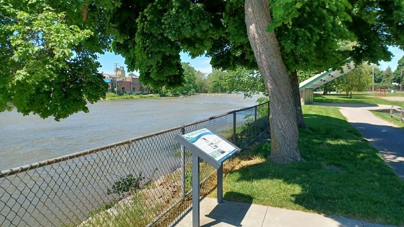
west of North Monroe Street (State Highway 125), on the left when traveling west. Marker is in St. Mary's Park along the River Raisin and west of the parking lot. Touch for map. Marker is at or near this postal address: 111 West Elm Avenue, Monroe MI 48162, United States of America. Touch for directions.
Other nearby markers. At least 8 other markers are within walking distance of this marker. Dr. Martin Luther King, Jr. (a few steps from this marker); a different marker also named River Raisin Legacy Project (about 300 feet away, measured in a direct line); Major-General George Armstrong Custer (about 400 feet away); General George A. Custer (about 400 feet away); St. Mary Catholic Church (about 400 feet away); George Armstrong Custer / Sighting the Enemy (about 500 feet away); Monroe Street Bridge (about 500 feet away); St. Mary of the Immaculate Conception (about 500 feet away). Touch for a list and map of all markers in Monroe.
Also see . . . River Raisin Legacy Project. Information about the River Raisin Legacy Project on the City of Monroe's website. (Submitted on June 28, 2022, by Joel Seewald of Madison Heights, Michigan.)
Credits. This page was last revised on June 28, 2022. It was originally submitted on June 28, 2022, by Joel Seewald of Madison Heights, Michigan. This page has been viewed 104 times since then and 31 times this year. Photos: 1, 2, 3. submitted on June 28, 2022, by Joel Seewald of Madison Heights, Michigan.


