Smithsonian National Zoo in Northwest Washington in Washington, District of Columbia — The American Northeast (Mid-Atlantic)
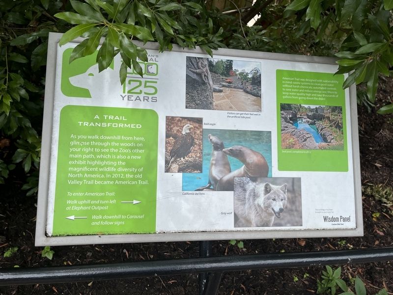
A Trail Transformed
Smithsonian's National Zoo
— 125 Years —
As you walk downhill from here, glimpse through the woods on your right to see the Zoo's other main path, which is also a new exhibit highlighting the magnificent wildlife diversity of North America. In 2012, the old Valley Trail became American Trail.
[Sidebar:]
American Trail was designed with sustainability in mind: ozone systems to clean pool water without harsh chemicals; automated controls to save water and reduce energy use; filters to keep water quality high and save thousands of gallons from going down the drain!
Erected by Smithsonian Institution.
Topics. This historical marker is listed in these topic lists: Architecture • Environment • Parks & Recreational Areas • Roads & Vehicles. A significant historical year for this entry is 2012.
Location. 38° 55.81′ N, 77° 2.944′ W. Marker is in Northwest Washington in Washington, District of Columbia. It is in Smithsonian National Zoo. Marker is on Olmsted Walk east of Connecticut Avenue Northwest, on the right when traveling east. Touch for map. Marker is at or near this postal address: 95 Olmsted Walk, Washington DC 20008, United States of America. Touch for directions.
Other nearby markers. At least 8 other markers are within walking distance of this marker. Bald Eagle (within shouting distance of this marker); A Capital Bird (within shouting distance of this marker); Smithsonian Conservation Biology Institute (about 300 feet away, measured in a direct line); Rebuilding in the Wild (about 300 feet away); The Nut Seekers (about 400 feet away); Pelicans in Peril (about 400 feet away); Aldabra Tortoise (about 400 feet away); Saving Chinese Alligators From Extinction (about 400 feet away). Touch for a list and map of all markers in Northwest Washington.
Credits. This page was last revised on January 30, 2023. It was originally submitted on July 3, 2022, by Devry Becker Jones of Washington, District of Columbia. This page has been viewed 54 times since then and 7 times this year. Photos: 1, 2. submitted on July 3, 2022, by Devry Becker Jones of Washington, District of Columbia.

