Angeles National Forest near Mount Wilson in Los Angeles County, California — The American West (Pacific Coastal)
Vetter Mountain Fire Lookout
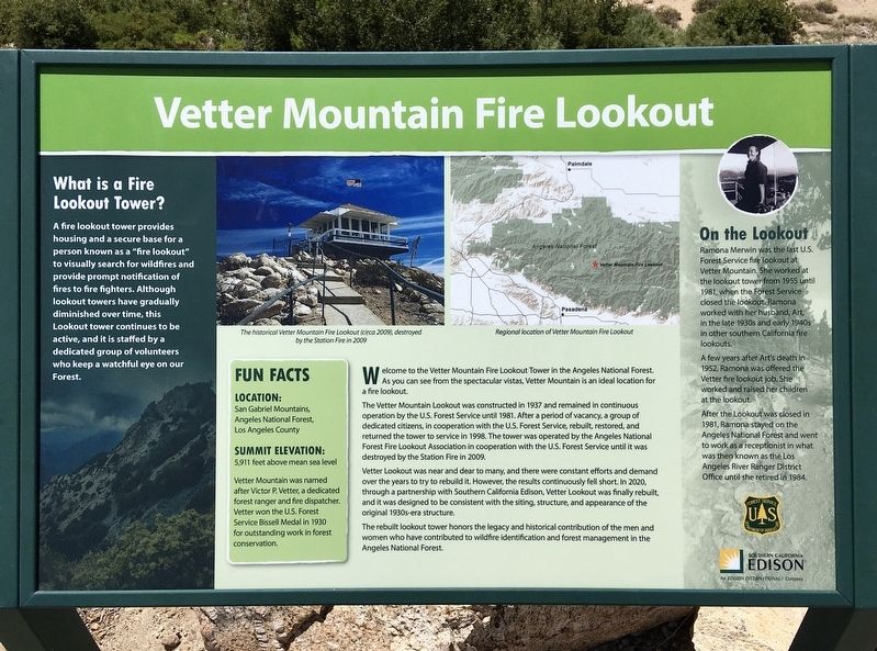
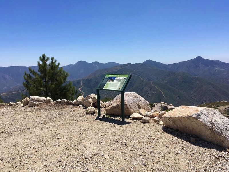
Welcome to the Vetter Mountain Fire Lookout Tower in the Angeles National Forest. As you can see from the spectacular vistas, Vetter Mountain is an ideal location for a fire lookout.
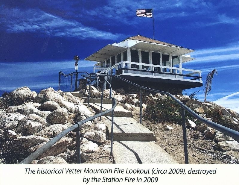
The Vetter Mountain Lookout was constructed in 1937 and remained in continuous operation by the U.S. Forest Service until 1981. After a period of vacancy, a group of dedicated citizens, in cooperation with the U.S. Forest Service, rebuilt, restored, and returned the tower to service in 1998. The tower was operated by the Angeles National Forest Fire Lookout Association in cooperation with the U.S. Forest Service until it was destroyed by the Station Fire in 2009.
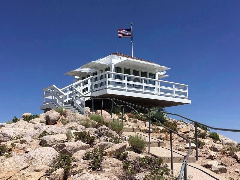
Vetter Lookout was near and dear to many, and there were constant efforts and demand over the years to try to rebuild it. However, the results continuously fell short. In 2020, through a partnership with Southern California Edison, Vetter Lookout was finally rebuilt, and it was designed to be consistent with the siting, structure, and appearance of the original 1930s-era structure.
The rebuilt lookout tower honors the legacy and historical contribution of the men and women who have contributed to wildfire identification and forest management in the Angeles National Forest.
What is a Fire Lookout Tower?
A fire lookout tower provides housing and a secure base for a person known as a "fire lookout" to visually search for wildfires and provide prompt notification of fires to fire fighters. Although lookout towers have gradually diminished over time, this lookout tower continues to be active, and it is staffed by a dedicated group of volunteers who keep a watchful eye on our Forest.
Fun Facts
Location: San Gabriel Mountains, Angeles National Forest, Los Angeles County.
Summit Elevation: 5,911 feet above mean sea level.
Vetter Mountain was named after Victor P. Vetter, a dedicated forest ranger and fire dispatcher. Vetter won the U.S. Forest Service Bissell Medal in 1930 for outstanding work in forest conservation.
On the Lookout
Ramona Merwin was the last U.S. Forest Service fire lookout at Vetter Mountain. She worked at the lookout tower from 1955 until 1981, when the
Forest Service
closed the lookout. Ramona
worked with her husband, Art,
in the late 1930s and early 1940s
in other southern California fire
lookouts.
A few years after Art's death in 1952, Ramona was offered the Vetter fire lookout job. She worked and raised her children at the lookout.
After the Lookout was closed in 1981, Ramona stayed on the Angeles National Forest and went to work as a receptionist in what was then known as the Los Angeles River Ranger District Office until she retired in 1984.
panel 2:
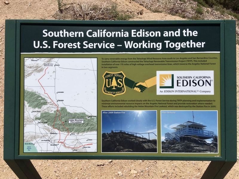
Southern California Edison and the U.S. Forest Service - Working Together
To carry renewable energy from the Tehachapi Wind Resource Area south to Los Angeles and San Bernardino Counties, Southern California Edison constructed the Tehachapi Renewable Transmission Project (TRTP). This included installation of over 170 miles of high-voltage overhead transmission lines, which traverse the Angeles National Forest in two segments.
Southern California Edison worked closely with the U.S. Forest Service during TRTP planning and implementation to minimize environmental resource impacts on the Angeles National Forest and provide restoration where needed. These efforts included rebuilding the Vetter Mountain Fire Lookout, which was destroyed by the Station Fire in 2009.
panel 3 - located one mile from summit:
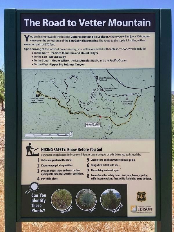
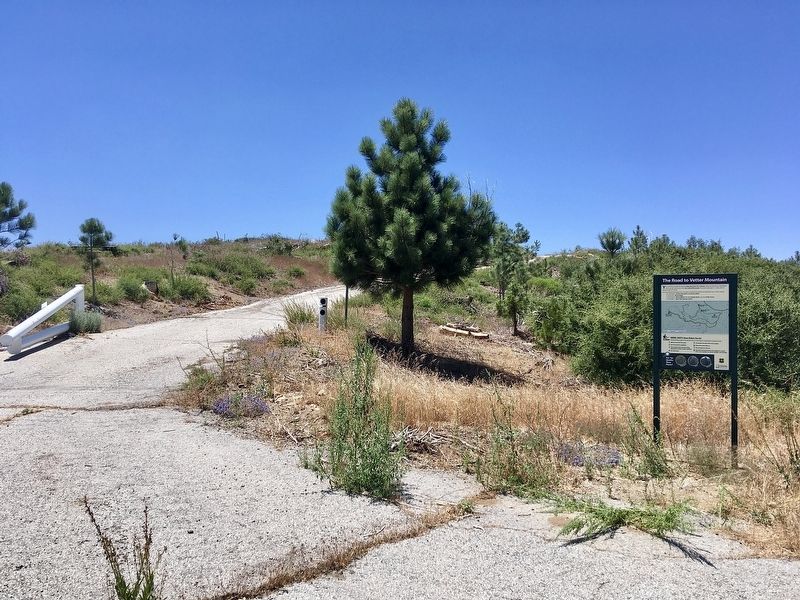
The Road to Vetter Mountain
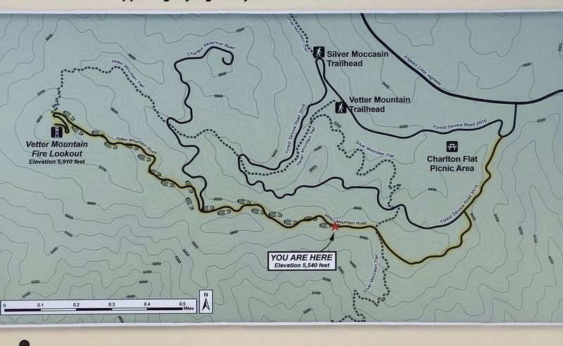
You are hiking towards the historic Vetter Mountain Fire Lookout, where you will enjoy a 360-degree view over the central area of the San Gabriel Mountains. The route to the top is 1.1 miles, with an elevation gain of 370 feet [note: this marker is located half way between the highway and the lookout]. Upon arriving at the lookout on a clear day, you will be rewarded with fantastic views, which include:
• To the North - Pacifico Mountain and Mount Hillyer.
• To the East - Mount Baldy.
• To the South - Mount Wilson, the Los Angeles Basin, and the Pacific Ocean.
• To the West - Upper Big Tujunga Canyon.
Hiking Safety: Know Before You Go!
Unexpected things happen in the outdoors. Here are several things to consider before you begin your hike:
1. Make sure you know the
route.
2. Know your physical capabilities.
3. Dress in proper shoes and wear clothes appropriate to today’s weather conditions.
4. Don't hike alone.
5. Let someone else know where you are going.
6. Bring a first aid kit with you.
7. Always bring water with you.
8. Remember other safety items: food, sunglasses, a pocket knife, insect repellant, first aid kit, flashlight, extra clothing.
Erected 2020 by Southern California Edison, and the U.S. Forest Service.
Topics. This historical marker is listed in these topic lists: Charity & Public Work • Horticulture & Forestry • Parks & Recreational Areas • Women. A significant historical year for this entry is 1937.
Location. 34° 17.835′ N, 118° 1.728′ W. Marker is near Mount Wilson, California, in Los Angeles County. It is in Angeles National Forest. Marker can be reached from Vetter Mountain Road, 2 miles west of Angeles Crest Highway (California Route 2). Hike two miles from Charlton Flat Picnic Area along Vetter Mountain Road to the summit, with an altitude gain of 600 feet. Touch for map. Marker is in this post office area: Palmdale CA 93550, United States of America. Touch for directions.
Other nearby markers. At least 8 other markers are within 7 miles of this marker, measured as the crow flies. West Fork Ranger Station (approx. 2.4 miles away); The Mount Wilson 100 Inch Telescope (approx. 5.2 miles away); The 100-Inch Hooker Telescope (approx. 5.2 miles away); Cogswell Dam (approx. 5.2 miles away); Harvard’s Mount Wilson Station (approx. 5.4 miles away); Michelson Pier on Mount Wilson (approx. 5.4 miles away); Benjamin Davis Wilson (approx. 5½ miles away); Adams Pack Station (approx. 7.1 miles away).
More about this marker.
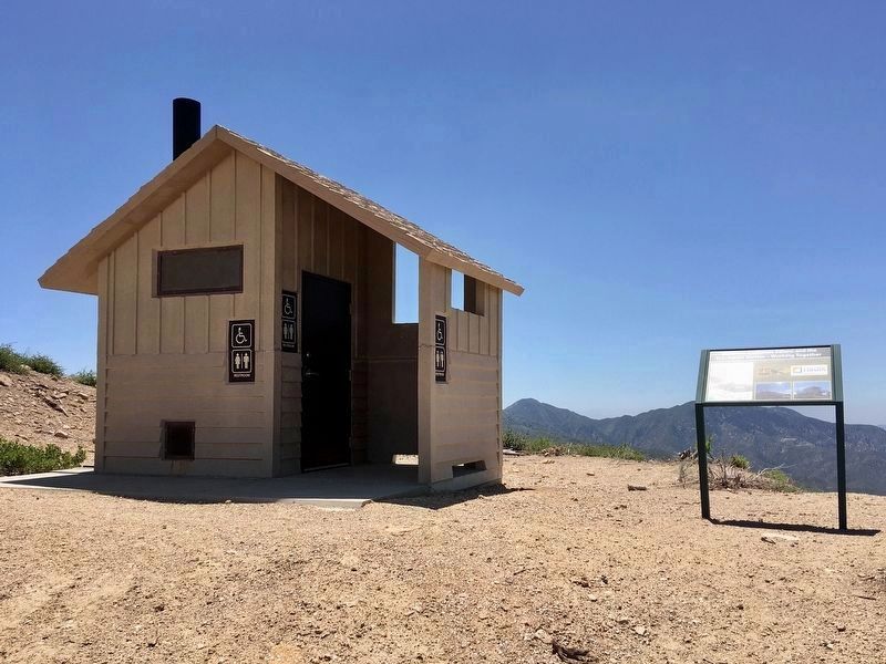
Sometimes Vetter Mountain Road is open to vehicles part of the way to Vetter Lookout.
A nearby hiking trail is often blocked by fallen trees.
Check with the Chilao Visitor Center or a local Ranger Station to see if the lookout is open to visitors.
Also see . . . Angeles National Forest Fire Lookout Association. Website with information about the volunteer organization,
the lookout towers, and the visitor center. (Submitted on July 4, 2022.)
Additional commentary.
1. Vetter Mountain Lookout
Ramona Merwin was my mother-in-law — the kindest person on the planet. I remember driving up to see her. Note To Editor only visible by Contributor and editor
— Submitted July 8, 2022, by Susan Merwin of McGill, Nevada.
Photographed By Craig Baker (CC0), August 23, 2009
10. Vetter Mountain Lookout
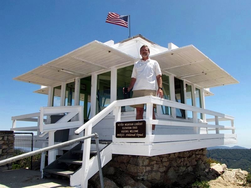
ANFFLA volunteer Craig Baker staffing the lookout in 2009.
Credits. This page was last revised on February 27, 2023. It was originally submitted on July 4, 2022, by Craig Baker of Sylmar, California. This page has been viewed 388 times since then and 59 times this year. Photos: 1, 2, 3, 4, 5, 6, 7, 8, 9, 10, 11. submitted on July 4, 2022, by Craig Baker of Sylmar, California.
