Ocala in Marion County, Florida — The American South (South Atlantic)
A Tale of Two Forts
Fort King National Historic Landmark
The First Fort
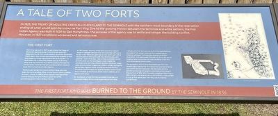
Fort King was built in 1827 to administer the Treaty of Moultrie Creek and protect the Seminole and their designated lands from white settlers. Governor Duval and Indian Agent Gad Humphrevs selected the location of Fort King based on three requirements for an Army fort - a defendable hill, a close and reliable source of drinking water and the presence of a nearby source of lumber for construction material. The site was also a short distance away from Humphreys’ Indian Agency.
The fort was named for Colonel William King, who had been the commanding officer of the Fourth Infantry before Duncan L Clinch. In 1818, Andrew Jackson had appointed Colonel King as civil and military governor of the provisional government of West Florida.
An 1827 design drawing of the fort's layout by Captain James M. Glassell indicates that the stockade wall was to be 162' x 152’. The main gate was on the north wall, with a second gate on the south wall. Two blockhouses were planned - both 14’ square - one on the northwest corner and the other on the southeast corner. Inside the stockade were barracks, officers quarters, kitchens, mess halls, and munitions magazines. Letters written during the period also mention other structures around the fort including a commissary and quartermasters' store house, sinks, hospital, guard house, sutler's store, stables, and a blacksmith’s shop.
An illustration of the first fort provided in the diary of Lieutenant Henry Prince while stationed at Fort King indicates the first fort was not built to the specifications provided in the design drawings but instead was an irregular pentagon. Archaeology supports the diary illustration. It is speculated that the U.S. Army ran out of funding, resulting in the first fort’s incomplete construction.
The occupancy of Fort King fluctuated over the next several years, leaving the fort vacant for a period of three years. With tensions between the Seminole and the settlers worsening the soldiers returned to Fort King in the summer of 1832. After Osceola's attack on Fort King in 1835, the fort was abandoned by the military in May of 1836. In July of that same year, Fort King was burned by the Seminole.
LT. Henry Prince’s sketch
Erected by Florida Department of State/Division of Historical Resources.
Topics. This historical marker is listed in these topic lists: Forts and Castles • Native Americans • Settlements & Settlers • Wars, US Indian. A significant historical year for this entry is 1827.
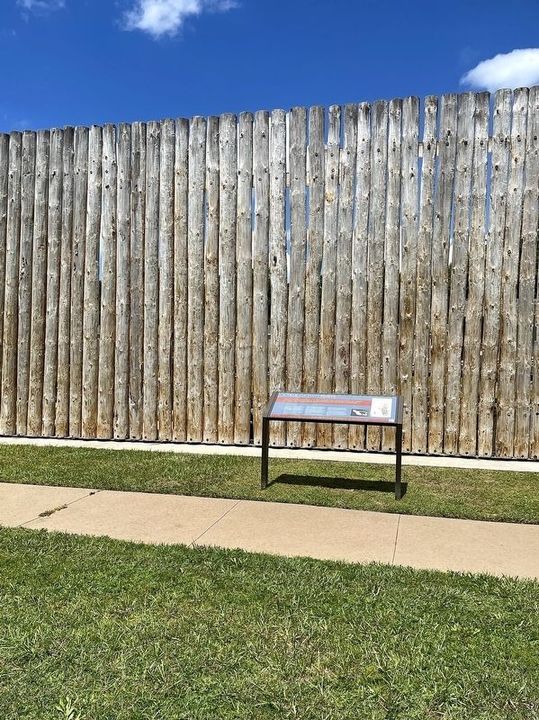
Location. 29° 11.239′ N, 82° 4.953′ W. Marker is in Ocala, Florida, in Marion County. Marker can be reached from the intersection of East Fort King Street and SE 39th Terrace, on the left when traveling east. Marker is located on the grounds of the Fort King National Historic Landmark. Touch for map. Marker is at or near this postal address: 3925 E Fort King St, Ocala FL 34470, United States of America. Touch for directions.
Other nearby markers. At least 8 other markers are within walking distance of this marker. The Second Fort (here, next to this marker); The Seminole War (a few steps from this marker); The First Seminole War (a few steps from this marker); Fort King Road (a few steps from this marker); The Second Seminole War / The Third Seminole War (a few steps from this marker); Fort King (a few steps from this marker); The U.S. Army on the frontier (within shouting distance of this marker); It was a Hard Life at Fort King (within shouting distance of this marker). Touch for a list and map of all markers in Ocala.
Also see . . .
1. Fort King National Historic Landmark. Trail of Florida's Indian Heritage, Inc. (Submitted on July 4, 2022, by Brandon D Cross of Flagler Beach, Florida.)
2. Fort King National Historic Landmark. Trail of Florida's Indian Heritage, Inc. (Submitted on July 4, 2022, by Brandon D Cross of Flagler Beach, Florida.)
Credits. This page was last revised on July 8, 2022. It was originally submitted on July 4, 2022, by Brandon D Cross of Flagler Beach, Florida. This page has been viewed 93 times since then and 16 times this year. Photos: 1, 2. submitted on July 4, 2022, by Brandon D Cross of Flagler Beach, Florida. • Bernard Fisher was the editor who published this page.

