Fort Stockton in Pecos County, Texas — The American South (West South Central)
Comanche Springs
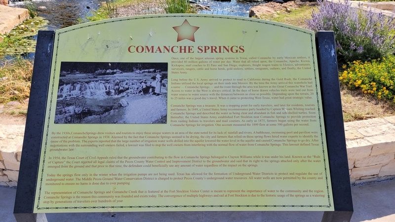
Long before the U.S. Army arrived to protect the road to California during the Gold Rush, the Comanche Indians utilized the local springs on their raids into Mexico. By the time the Army arrived this waterhole had name Comanche Springs-and the route through the area was known as the Great Comanche War Trail. Access to water in the West is always critical. In the days of horse drawn vehicles trails were laid out from water source to water source with the distances between as close as possible. Depending upon the terrain, 20 to 25 miles was a good day's travel. When it came to protecting West Texas, water had great strategic value.
Comanche Springs was a treasure. It was a stopping point for early travelers, and later for residents, tourists and farmers. In 1849, a United States Army reconnaissance party headed by Captain Wiam Whiting reached Comanche Springs and described the water as being clear and abundant in fish and soft-shelled turtles. Soon thereafter, the United States Army established Fort Stockton near Comanche Springs to provide protection from raiding Indians to travelers and mail couriers. As early as 1875, farmers began using the water from Comanche Springs for irrigation. One account measured the 1899 flow at some 500 gallons per second.
By the 1930s, Comanche Springs drew visitors and tourists to enjoy these unique waters in an area of the state noted for its lack of rainfall and rivers. A bathhouse, swimming pool and pavilion were constructed at Comanche Springs in 1938. Alarmed by the fact that Comanche Springs seemed to be drying, the city and farmers that relied on these spring flows hired water experts to identify the cause of the problem. The experts reported that the large number of irrigation water wells drilled into the aquifer lowered the water level in the aquifer and caused Comanche Springs to go dry. After negotiations with the surrounding well owners failed, a lawsuit was filed to stop the well owners from interfering with the normal flow of water from Comanche Springs. This lawsuit defined Texas groundwater law.
In 1954, the Texas Court of Civil Appeals ruled that the groundwater contributing to the flow in Comanche Springs belonged to Clayton Williams while it was under his land. Known as the "Rule of Capture" the Court rejected all legal claims of the Pecos County Water Control and Improvement District to the groundwater and said that its right to the springs attached only after the water emerged from the ground and that prior to that time, the defendant could beneficially use any amount of water regardless of the impact on the springs.
Today the springs flow only in the winter when the irrigation pumps are not being used. Texas has allowed for the formation of Underground Water Districts to protect and regulate the use of underground water. The Middle Pecos Ground Water Conservation District is charged to protect Pecos County's underground water resources. All water wells are now permitted by the county and monitored to ensure no harm is done due to over pumping.
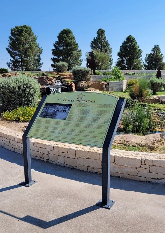
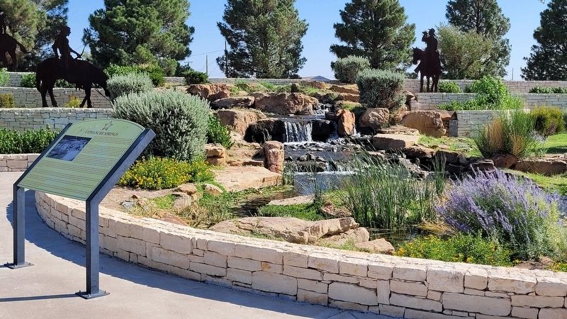
The representation of Comanche Springs and Comanche Creek that is featured at the Fort Stockton Visitor Center is meant to represent the importance of water to the community and the region. Comanche Springs is the reason this community was founded and exists today. The convergence of multiple highways and rail at Fort Stockton is due to the historic usage of the springs as a watering stop by generations of travelers over hundreds of year.
Erected by Fort Stockton Convention & Visitors Bureau.
Topics. This historical marker is listed in these topic lists: Animals • Forts and Castles • Native Americans • Wars, US Indian. A significant historical year for this entry is 1849.
Location. 30° 53.676′ N, 102° 52.722′ W. Marker is in Fort Stockton, Texas, in Pecos County. Marker can be reached from the intersection of Railroad Avenue and East 11th Street. The marker is located at the northwest section of the Fort Stockton Visitor Center. Touch for map. Marker is at or near this postal address: 1000 Railroad Avenue, Fort Stockton TX 79735, United States of America. Touch for directions.
Other nearby markers. At least 8 other markers are within walking distance of this marker. The Great Comanche War Trail (a few steps from this marker); The 9th Cavalry, Fort Stockton and Edward Hatch (a few steps from this marker); Pecos County Fort Stockton Renewable Energy Park (within shouting distance of this marker); Visitor Center (within shouting distance of this marker); Oil and Gas Industry in Pecos County (about 300 feet away, measured in a direct line); The "Prairie Schooner" and Early Settlers (about 300 feet away); Downtown Fort Stockton (about 700 feet away); Old Fort Cemetery (approx. 0.2 miles away). Touch for a list and map of all markers in Fort Stockton.
Credits. This page was last revised on July 5, 2022. It was originally submitted on July 4, 2022, by James Hulse of Medina, Texas. This page has been viewed 141 times since then and 38 times this year. Photos: 1, 2, 3. submitted on July 5, 2022, by James Hulse of Medina, Texas.


