Hanover in York County, Pennsylvania — The American Northeast (Mid-Atlantic)
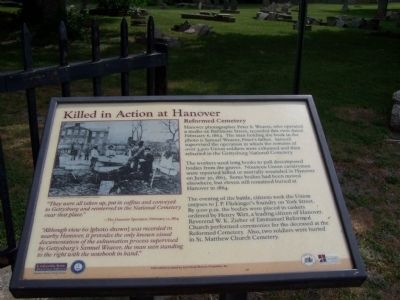
Killed in Action at Hanover
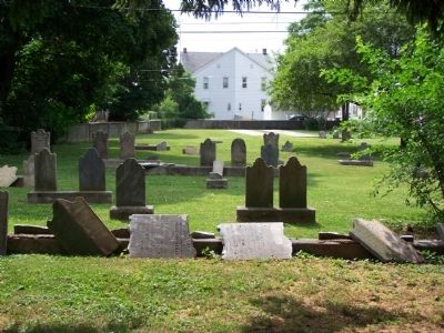
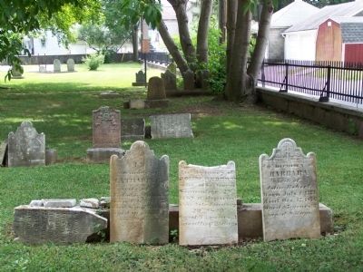
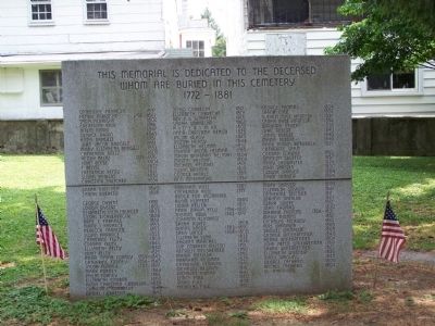
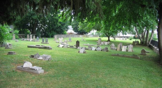
Reformed Cemetery
Hanover photographer Peter S. Weaver, who operated a studio on Baltimore Street, recorded this view dated February 6, 1864. The man holding the book in the photo is Samuel Weaver, Peter's father. Samuel supervised the operation in which the remains of over 3,500 Union soldiers were exhumed and then reburied in the Gettysburg National Cemetery.
The workers used long hooks to pull decomposed bodies from the graves. Nineteen Union cavalrymen were reported killed or mortally wounded in Hanover on June 30, 1863. Some bodies had been moved elsewhere, but eleven still remained buried at Hanover in 1864.
The evening of the battle, citizens took the Union corpses to J.P. Flickinger's foundry on York Street. By 9:00 p.m. the bodies were placed in caskets ordered by Henry Wirt, a leading citizen of Hanover. Reverend W. K. Zieber of Emmanuel Reformed Church performed ceremonies for the deceased at the Reformed Cemetery. Also, two soldiers were buried in St. Matthew Church Cemetery.
"They were all taken up, put in coffins and conveyed to Gettysburg and re-interred in the National Cemetery near that place." - The Hanover Spectator, February 12, 1864
"Although view 60 (photo shown) was recorded in nearby Hanover, it provides the only known visual documentation of the exhumation process supervised by Gettysburg's Samuel Weaver, the man seen standing to the right with the notebook in hand."
Topics and series. This historical marker is listed in these topic lists: Cemeteries & Burial Sites • Churches & Religion • War, US Civil. In addition, it is included in the Pennsylvania, Battle of Hanover Walking Tour series list. A significant historical date for this entry is February 6, 1964.
Location. This marker has been replaced by another marker nearby. It was located near 39° 48.067′ N, 76° 58.807′ W. Marker was in Hanover, Pennsylvania, in York County. Marker was on School Avenue east of East Walnut Street, on the left when traveling east. Touch for map. Marker was in this post office area: Hanover PA 17331, United States of America. Touch for directions.
Other nearby markers. At least 8 other markers are within walking distance of this location. The Aftermath & Stench of Death (a few steps from this marker); Trinity United Church of Christ (within shouting distance of this marker); Former United States Post Office (about 500 feet away, measured in a direct line); Abbottstown Street/Broadway (about 600 feet away); The Confederates Take Stock (about 600 feet away); Veterans Memorial (about 700 feet away); Titans of Hanover Industry (about 800 feet away); Market House (about 800 feet away). Touch for a list and map of all markers in Hanover.
More about this marker. Photo
Exhumation of Union Soldiers
Photo courtesy of William A. Frassanito, "Early Photograph at Gettysburg"
Credits. This page was last revised on March 1, 2023. It was originally submitted on June 29, 2008, by Bill Pfingsten of Bel Air, Maryland. This page has been viewed 1,825 times since then and 24 times this year. Last updated on July 6, 2022, by Carl Gordon Moore Jr. of North East, Maryland. Photos: 1, 2, 3, 4. submitted on June 29, 2008, by Bill Pfingsten of Bel Air, Maryland. 5. submitted on July 3, 2008, by Craig Swain of Leesburg, Virginia. • Bernard Fisher was the editor who published this page.
