Near Dundee in Monroe County, Michigan — The American Midwest (Great Lakes)
The River Raisin
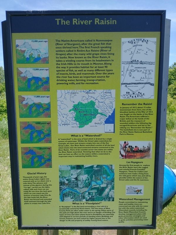
The Native Americans called it Nummasepee (River of Sturgeon), after the great fish that once thrived here. The first French speaking settlers called it Rivičre Aux Raisins (River of Grapes) after the many wild grape vines lining its banks. Now known as the River Raisin, it takes a winding course from its headwaters in the Irish Hills to its mouth in Monroe. Along the way it provides habitat for at least 90 species of fish, as well as many different types of insects, birds, and mammals. Over the years the river has been an important source for drinking water, farming, transportation, powering mills, and for recreation.
Glacial History
Thousands of years ago, the entire Great Lakes region was covered with an ice sheet over a mile thick. The advance and retreat of the glaciers during this "ice age” carved out the lakes, valleys, hills and rivers we see today. At one time the land upon which we now stand was the bottom of ancient Lake Erie. As the lake levels fell, the River Raisin was formed and extended itself eastward through the lake plains to empty into Lake Erie.
What is a "Watershed?"
A "watershed” is the area of land which is drained by a single system of waterways. Within the Great Lakes watershed, for example, all rivers and streams empty into one of the five Great Lakes. Our River Raisin watershed consists of all the land which drains into the interconnected streams connected to the River Raisin. Parts of six counties across two states are within the River Raisin watershed. Knowing that what we do to the land can have an effect on the waters within a watershed is important step in maintaining healthy rivers.
What is a "Floodplain?"
A "floodplain” is the flat land surrounding a river which is occasionally covered by flood waters. The low areas of West County Park are often under water in the spring. Other parts of the park are high above the river and in no danger of flooding. The types of trees and other plants found in floodplains are especially well adapted to survive periods of standing water. Buildings and homes, however, are best suited for higher ground due to the danger to life and property of swiftly moving flood waters.
Remember the Raisin!
In January of 1813, about 15 miles downstream from here, one of the bloodiest battles of the War of 1812 was fought on the banks of the River Raisin. The Americans suffered a major defeat at the hands of the British, and the massacre of wounded soldiers the following day enraged Americans and led to the rallying cry "Remember the Raisin." The battlefield site is now part of the River Raisin National Battlefield Park in Monroe.
Les Voyageurs
Among the first people to explore the River Raisin were the rugged and colorful French-Canadian Voyageurs. These fur traders and outdoors men made a living from the wild game which was, and still is, plentiful within the waters of the Great Lakes and the St. Lawrence.
Watershed Management
People committed to maintaining clean and healthy rivers are concerned not only with the water but with the entire watershed. Watershed councils, including the River Raisin Watershed Council, develop management plans with goals, protection strategies, and other information which are used to guide activities promoting water quality.
Topics. This historical marker is listed in these topic lists: Native Americans • Waterways & Vessels. A significant historical month for this entry is January 1813.
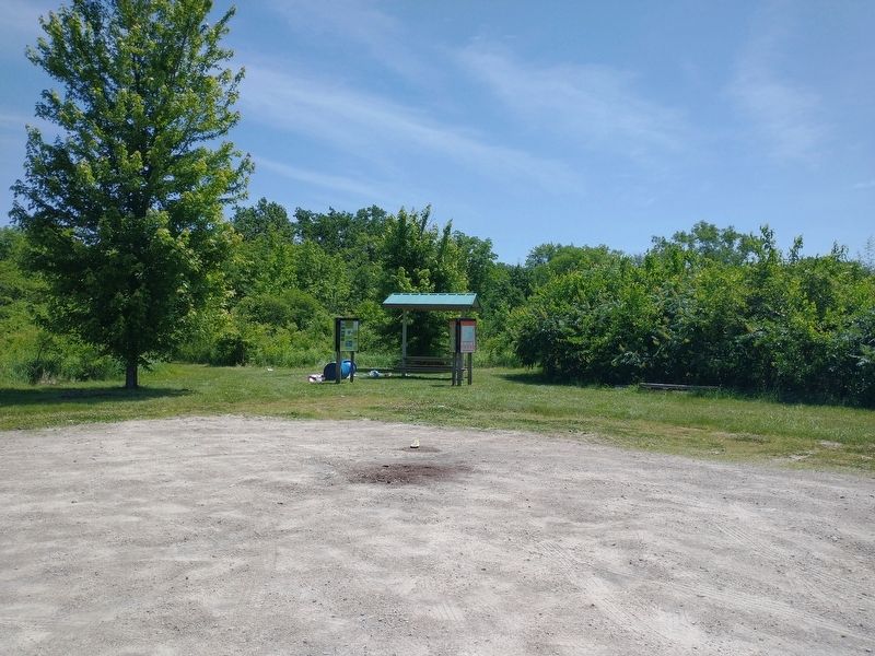
Location. 41° 57.76′ N, 83° 37.908′ W. Marker is near Dundee, Michigan, in Monroe County. Marker can be reached from Rightmire Road, half a mile east of Stowell Road, on the right when traveling east. Touch for map. Marker is at or near this postal address: 14003 Rightmire Rd, Dundee MI 48131, United States of America. Touch for directions.
Other nearby markers. At least 8 other markers are within 2 miles of this marker, measured as the crow flies. First People of Monroe County (here, next to this marker); West County Park (here, next to this marker); Macon Indian Reserve (approx. 1.2 miles away); Macon Reservation Unit (approx. 1˝ miles away); Old Mill Museum (approx. 1˝ miles away); Dundee's Old Mill (approx. 1˝ miles away); The Old Village Jail (approx. 1˝ miles away); The Mill or Grist Stone (approx. 1˝ miles away). Touch for a list and map of all markers in Dundee.
Credits. This page was last revised on July 11, 2022. It was originally submitted on July 8, 2022, by Craig Doda of Napoleon, Ohio. This page has been viewed 130 times since then and 22 times this year. Photos: 1, 2, 3, 4. submitted on July 8, 2022, by Craig Doda of Napoleon, Ohio. • Devry Becker Jones was the editor who published this page.


