Near Galveston in Galveston County, Texas — The American South (West South Central)
Karankawa Campsite
Photographed by Gregory Walker, April 17, 2010
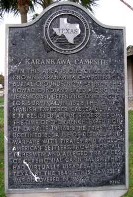
1. Karankawa Campsite Marker
In this area is one of several known Karankawa campsites or burial grounds. Now extinct, the nomadic Indians lived along the Texas coast, depending on the Gulf for survival. In 1528 they aided Spanish explorer Cabeza de Vaca, but resisted all intruders from the time of the French expedition of La Salle in 1685. The tribe later declined because of disease and warfare with pirates and Anglo-American settlers. Known for tall tribesmen and alleged practices of ceremonial cannibalism, they had virtually disappeared from Texas by the 1840s. This campsite was discovered in 1962.
Erected 1966 by Texas Historical Commission. (Marker Number 7502.)
Topics. This historical marker is listed in these topic lists: Colonial Era • Indigenous Peoples and Communities. A significant historical year for this entry is 1528.
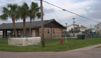
Location. 29° 11.219′ N, 94° 58.865′ W. Marker is near Galveston, Texas, in Galveston County. It is at the intersection of Bob Smith Road and Jolly Roger Road, on the right when traveling north on Bob Smith Road. Touch for map. Marker is in this post office area: Galveston TX 77550, United States of America. Touch for directions.

Regionally, this marker is in the Houston Metropolitan Area. It is also in the American South and on the Gulf Coast. Globally, it is in North America, a Gulf of Mexico state, the Western Hemisphere, the Western World, and the Anglosphere. Historically, it finds itself in what was once New Spain, the Republic of Texas, and one of the Confederate States of America.
Other nearby markers. At least 8 other markers are within 11 miles of this marker, measured as the crow flies: West Galveston Island (approx. 2 miles away); Lafitte's Grove (approx. 3.3 miles away); Campbell's Bayou (approx. 9.4 miles away); Site of Magnolia Grove Cemetery (approx. 9½ miles away); Galveston "News", C.S.A.
this page online
Another marker is no longer nearby. Civil War Fortifications at Virginia Point (was approx. 9.4 miles away but has been confirmed missing).
Photographed by Gregory Walker, April 17, 2010
2. Location of Karankawa Campsite
Photographed by Richard Denney
3. Karankawa Campsite Marker
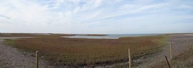
Panorama near and across from the marker that illustrates the Karankawa's coastal environment on Galveston Bay.
Credits. This page was last revised on July 11, 2022. It was originally submitted on May 7, 2010, by Gregory Walker of La Grange, Texas. This page has been viewed 3,143 times since then and 161 times this year. Last updated on July 11, 2022, by Joe Lotz of Flower Mound, Texas. Photos: 1, 2. submitted on May 7, 2010, by Gregory Walker of La Grange, Texas. 3. submitted on January 3, 2014, by Richard Denney of Austin, Texas. • J. Makali Bruton was the editor who published this page.
