Blackshear-Prospect Hill in Austin in Travis County, Texas — The American South (West South Central)
Sailor from the Belle Shipwreck
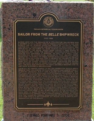
Buried here are the remains of a 17th-century sailor who was a member of an ill-fated 1684-87 French expedition to the new world led by Robert Cavelier, Sieur de La Salle. Texas Historical Commission archaeologists discovered the skeleton on October 31, 1996, during excavations of La Salleís ship, the Belle, which sank during a 1686 storm in Matagorda Bay. Near the skeleton, archaeologists found a pewter cup inscribed C. Barange, as well as a small cask. According to historical accounts, the Belleís crew exhausted its supply of fresh water while awaiting La Salleís return from an overland trek in search of the mouth of the Mississippi River, and archaeologists believe the sailor may have died of thirst. Forensic evidence indicates the sailor was between 35 and 45 years old and about 5 feet 4 inches tall. His back was arthritic, his teeth severely decayed and he had once suffered a broken nose.
Louis XIV of France hoped La Salleís expedition would break Spainís tight hold over the Gulf of Mexico and assert French claim to Louisiana, but it was plagued with misfortune. One of La Salleís four ships was lost to Spanish privateers in the Caribbean, another ran aground in Pass Cavallo at the mouth of Matagorda Bay and a third sailed back to France bearing disillusioned crew and colonists. La Salle failed to find the mouth of the Mississippi, where he planned to establish an outpost for trade with the indigenous peoples, and instead landed at Matagorda Bay along the Texas gulf coast. Several miles inland along Garcitas Creek he constructed a small settlement, Fort St. Louis, for the remaining colonists. The final blow to the colonial experiment came when the fourth ship, the Belle, sank with the expeditionís remaining supplies. The following year, La Salle met his death at the hands of his own men in east Texas while trying to reach French settlements in Canada. The ultimate demise of Fort St. Louis and the thwarted French colonization efforts opened the way for Spainís settlement of Texas and subsequent domination of the region.
Erected 2004.
Topics. This historical marker is listed in these topic lists: Cemeteries & Burial Sites • Exploration • Settlements & Settlers • Waterways & Vessels. A significant historical year for this entry is 1686.
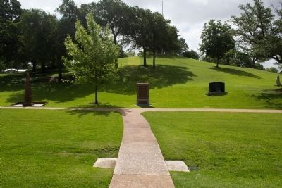
Location. 30° 16.01′ N, 97° 43.541′ W. Marker is in Austin, Texas, in Travis County. It is in Blackshear-Prospect Hill. Marker can be reached from East 11th Street east of Navasota Street, on the right when traveling east. The marker is in the Texas State Cemetery, on Monument Hill, Section 2 (H2), Row D, Number 1. Touch for map. Marker is at or near this postal address: 909 Navasota Street, Austin TX 78702, United States of America. Touch for directions.
Other nearby markers. At least 8 other markers are within walking distance of this marker. Texas Patriots (a few steps from this marker); Black Legislators Monument (a few steps from this marker); September 11, 2001 Memorial (within shouting distance of this marker); James Edward Box (within shouting distance of this marker); U.S. Events of World War II (within shouting distance of this marker); Gold Star Mothers of Texas Monument (within shouting distance of this marker); Vietnam War Memorial Monument (within shouting distance of this marker); Military Order of the Purple Heart Monument (within shouting distance of this marker). Touch for a list and map of all markers in Austin.
Credits. This page was last revised on February 1, 2023. It was originally submitted on January 23, 2010. This page has been viewed 3,424 times since then and 81 times this year. Last updated on July 11, 2022. Photos: 1. submitted on January 23, 2010, by Keith Peterson of Cedar Park, Texas. 2, 3. submitted on June 29, 2014, by Michael Heinich of Austin, Texas. • Bill Pfingsten was the editor who published this page.


