San Ramon in Contra Costa County, California — The American West (Pacific Coastal)
First People of the East Bay
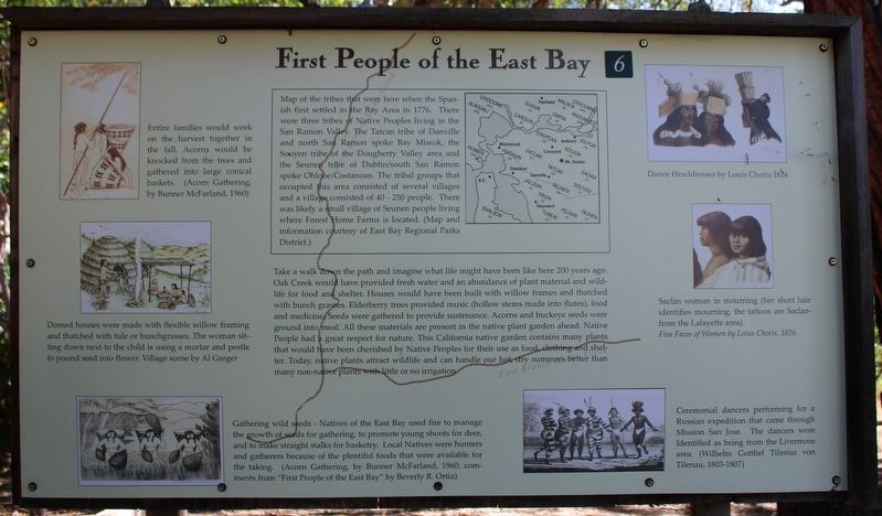
Take a walk down the path and imagine what life might have been like here 200 years ago. Oak Creek would have provided fresh water and an abundance of plant material and wildlife for food and shelter. Houses would have been built with willow frames and thatched with bunch grasses. Elderberry trees provided music (hollow stems made into flutes), food and medicine. Seeds were gathered to provide sustenance. Acorns and buckeye seeds were ground into meal. All these materials are present in the native plant garden ahead. Native People had a great respect for nature. This California native garden contains many plants that would have been cherished by Native Peoples for there use as food, clothing and shelter. Today, native plants attract wildlife and can handle our hot, dry summers better than many non-native plants with little or no irrigation.
[Captions:]
Maps of the tribes that were here when the Spanish first settled in the Bay Area in 1776. There were three tribes of Native Peoples living in the San Ramon Valley. The Tatcan Tribe of Danville and north San Ramon spoke Bay Miwok, the Souyen tribe of the Dougherty Valley area and the Seunen tribe of the Dublin/south San Ramon spoke Ohlone/Costanoan. The tribal groups that occupied this area consisted of several villages and a village consisted of 40 – 250 people. There was likely a small village of Seuyen people living where Forest Home Farms is located. (Map and information courtesy of East Bay Regional Parks District.)
Entire families would work on the harvest together in the fall. Acorns would be knocked from the trees and gathered into large conical baskets. (Acorn Gathering, by Bunner McFarland, 1960)
Domed houses were made with flexible willow framing and thatched with tule or bunchgrasses. The woman sitting down next to the child is using a mortar and pestle to pound seed into flower (sic). Village scene by Al Greger
Gathering wild seeds – Natives of the East Bay used fire to manage the growth of seeds for gathering, to promote young shoots for deer, and to make straight stalks for basketry. Local Natives were hunters and gatherers because of the plentiful foods that were available for the taking. (Acorn Gathering, by Bunner McFarland, 1960; comments from “First People of the East Bat” by Beverly R. Ortiz)
Dance headdresses by Louis Choris 1816
Saclan woman in mourning (her short hair identifies mourning, the tattoos are Saclan-from the Lafayette area). Five faces of Women by Louis Choris, 1816
Ceremonial dancers performing for a Russian expedition that came through Mission San Jose. The dancers were Identified as being from the Livermore area. (Wilhelm Gottlief Tilesius von Tilenau, 1803-1807)
Topics. This historical marker is listed in these topic lists: Agriculture • Anthropology & Archaeology • Exploration • Native Americans. A significant historical year for this entry is 1776.
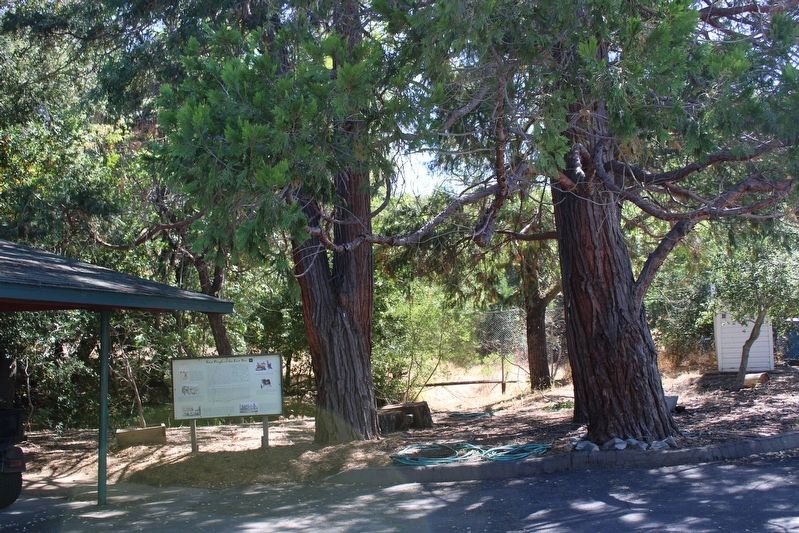
Location. 37° 44.092′ N, 121° 57.065′ W. Marker is in San Ramon, California, in Contra Costa County. Marker can be reached from San Ramon Valley Boulevard south of Pine Valley Road, on the right when traveling south. The marker is mounted in a wood frame next to the carport, behind the main house. Touch for map. Marker is at or near this postal address: 19953 San Ramon Valley Boulevard, San Ramon CA 94583, United States of America. Touch for directions.
Other nearby markers. At least 8 other markers are within walking distance of this marker. Bounty of the Land (within shouting distance of this marker); Sunrise to Sunset (within shouting distance of this marker); The Boone House (within shouting distance of this marker); The Business of Running a Farm (within shouting distance of this marker); Forest Home Farms Historic Park (within shouting distance of this marker); Working Together (within shouting distance of this marker); From Horse to Horsepower (about 400 feet away, measured in a direct line); Clement Pierre Elissondo (about 400 feet away). Touch for a list and map of all markers in San Ramon.
Credits. This page was last revised on July 13, 2022. It was originally submitted on July 12, 2022, by Joseph Alvarado of Livermore, California. This page has been viewed 483 times since then and 23 times this year. Photos: 1, 2. submitted on July 13, 2022, by Joseph Alvarado of Livermore, California. • Devry Becker Jones was the editor who published this page.

