San Ramon in Contra Costa County, California — The American West (Pacific Coastal)
Sunrise to Sunset
Forest Home Farms Historic Park
— Celebrate San Ramon's History —
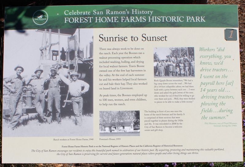
There was always work to be done on the ranch. Each year the Boones ran a walnut processing operation which included washing, hulling, and drying for local walnut farmers. Travis Boone owned one of the few hay harvesters in the valley. At the end of each summer he and his workers helped local farmers cut and bale their hay. They also worked on leased land in Livermore.
At Peak times, the Boones employed up to 100 men, women, and even children, to help run the ranch.
”Workers did everything, you know, we’d drive tractors…I went on the payroll here [at] 14 years old…driving tractors, plowing the fields…during the summer.”
- Phil Munson, son of Floyd Munson, foreman during the 1940s
[Captions:]
Ruth Quayle Boone remembers, “We had a big camp down across the road…We had 20 x 14 foot collapsible cabins; we had them built with a privy between each one… I went down and asked the girls [wives of the men who worked for us] if they’d be willing to go over there and pick… Well, they were thrilled to pieces to be able to make a little money.”
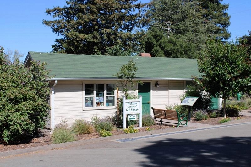
The building in front of you was once the home of the ranch foreman and his family. It is comprised of three sections that were pieced together in phases during the 1920s and 30s. It was remodeled in 2008 by the City of San Ramon to become a welcome center and gift shop.
Forest Home Farm Historic Park is on the National Register of Historic Places and the California Register of Historical Resources
The City of San Ramon encourages our residents to enjoy this beautiful park in celebration of our historic past. By acquiring, protecting and maintaining this valuable parkland, the City of San Ramon is preserving for current and future generations natural places where people and other living things can thrive.
Erected by City of San Ramon. (Marker Number 1.)
Topics. This historical marker is listed in these topic lists: Agriculture • Parks & Recreational Areas • Women. A significant historical year for this entry is 2008.
Location. 37° 44.114′ N, 121° 57.065′ W. Marker is in San Ramon, California, in Contra Costa County. Marker can be reached from San Ramon Valley Boulevard south of Pine Valley Road, on the right when traveling south. The resin marker is mounted to a metal stand in front of the ranch foreman's house that serves as the visitor center and gift shop. Touch for map. Marker is at or near this postal address: 19953 San Ramon Valley Boulevard, San Ramon CA 94583, United States of America. Touch for directions.
Other nearby markers. At least 8 other markers are within walking distance of this marker. Bounty of the Land (a few steps from this marker); Forest Home Farms Historic Park
(within shouting distance of this marker); First People of the East Bay (within shouting distance of this marker); The Business of Running a Farm (within shouting distance of this marker); The Boone House (within shouting distance of this marker); Working Together (within shouting distance of this marker); From Horse to Horsepower (about 400 feet away, measured in a direct line); Clement Pierre Elissondo (about 500 feet away). Touch for a list and map of all markers in San Ramon.
Credits. This page was last revised on July 15, 2022. It was originally submitted on July 12, 2022, by Joseph Alvarado of Livermore, California. This page has been viewed 89 times since then and 17 times this year. Photos: 1, 2. submitted on July 15, 2022, by Joseph Alvarado of Livermore, California. • Devry Becker Jones was the editor who published this page.

