Near Ansonia in Darke County, Ohio — The American Midwest (Great Lakes)
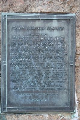
Camp Sulphur Springs
Photographed by Dale K. Benington, June 5, 2009
1. Camp Sulphur Springs Marker
Maj. General Arthur St. Clair
Distance eighty one miles from Fort Washington (Cincinnati).
Erected 1936 by Mrs. W. Omer Patty.
Topics. This historical marker is listed in these topic lists: Indigenous Peoples and Communities • Military • Wars, US Indian. A significant historical date for this entry is October 30, 1900.
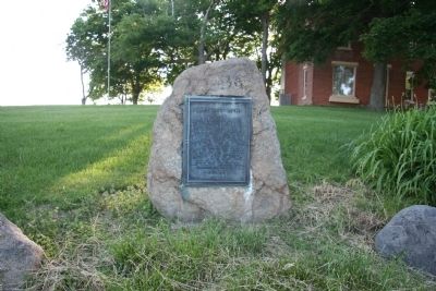
Location. 40° 12.708′ N, 84° 41.212′ W. Marker is near Ansonia, Ohio, in Darke County. It is on Ohio Route 49 0.7 miles south of Route 47, on the right when traveling south. This historical marker is affixed to a large rock, that is situated in front of a rural residence, along the west side of a State Highway. Touch for map. Marker is at or near this postal address: 10158 State Route 49, Ansonia OH 45303, United States of America. Touch for directions.

Regionally, this marker is in the Till Plains. It is also in the American Midwest and in the Corn Belt. Globally, it is in North America, the Western Hemisphere, the Western World, and the Anglosphere. Historically, it finds itself in what was once the Haudenosaunee (Iroquois) Confederacy, the territory of the Mississippian Culture, and the
this page online
Other nearby markers. At least 8 other markers are within 6 miles of this marker, measured as the crow flies: Veterans Memorial (approx. 0.9 miles away); Ansonia Area Veterans Memorial Park (approx. 2.2 miles away); Eck Ary - Douglas Dickey Post 353 Veterans Memorial (approx. 2.6 miles away); Min-23 Hawk (approx. 2.6 miles away); Camp Stillwater (approx. 2.9 miles away); Ansonia Schools Bell Tower (approx. 3.1 miles away); Ansonia Veterans Memorial (approx. 3.6 miles away); Paul L. Thornhill (approx. 5.2 miles away). Touch for a list and map of all markers in Ansonia.
Also see . . .
1. Arthur St. Clair. Wikipedia entry (Submitted on August 23, 2022, by Larry Gertner of New York, New York.)
2. St. Clair's Defeat. Village of Fort Recovery website entry (Submitted on August 23, 2022, by Larry Gertner of New York, New York.)
Photographed by Dale K. Benington, June 5, 2009
2. Camp Sulphur Springs Marker
Photographed by Dale K. Benington, June 5, 2009
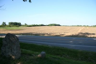
3. Camp Sulphur Springs Marker
View of the location of St.Clair's encampment, across the street from the historical marker.
Credits. This page was last revised on August 23, 2022. It was originally submitted on June 25, 2009, by Dale K. Benington of Toledo, Ohio. This page has been viewed 2,186 times since then and 67 times this year. Photos: 1, 2, 3. submitted on June 25, 2009, by Dale K. Benington of Toledo, Ohio. • Syd Whittle was the editor who published this page.
