Greenville in Greenville County, South Carolina — The American South (South Atlantic)
The Dam for Reservoir 2
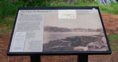
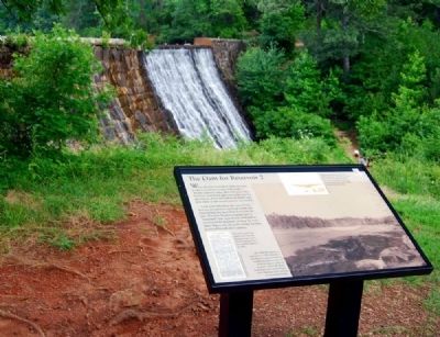
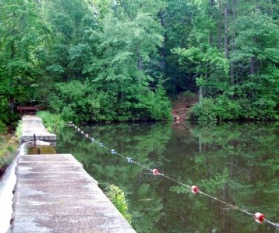
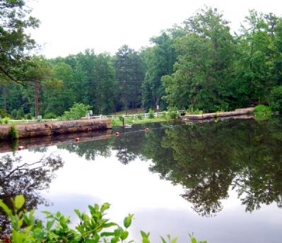
When this dam was built in 1898, the water it collects was known simply as Reservoir 2. The first reservoir, today called Mountain Lake, had been constructed eight years earlier, but the growing city demanded additional reliable and pure water, so this second reservoir was needed.
Look at the hills above the water. Notice how any precipitation that lands within this bowl-shaped area must drain down into the lake. Therefore, by protecting that land or "watershed" from agricultural, residential or commercial development, we keep the water clean. That is why this park's acreage has been preserved for well over a century.
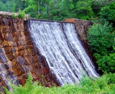
After forming Reservoir 2, the waters of Mountain Creek were either pumped from the lake into pipes that led to town, or were released over this dam to re-form Mountain Creek and flow onward to the Enoree River.
When this reservoir was added to the Greenville municipal water system, no one envisioned that it too, would be outgrown by 1904.
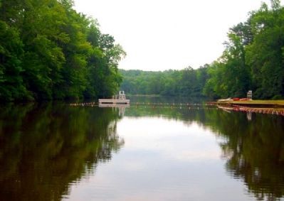
After Table Rock Reservoir's construction in 1930, Reservoir 2 was drained in preparation for its transformation from a source of drinking water to a source of recreation, called Lake Placid.
Topics. This historical marker is listed in these topic lists: Man-Made Features • Natural Resources • Waterways & Vessels. A significant historical year for this entry is 1898.
Location. 34° 55.7′ N, 82° 21.967′ W. Marker is in Greenville, South Carolina, in Greenville County. Marker can be reached from State Park Road. Marker is on the grounds of Paris Mountain State Park. Touch for map. Marker is at or near this postal address: 2401 State Park Road, Greenville SC 29609, United States of America. Touch for directions.
Other nearby markers. At least 10 other markers are within 2 miles of this marker, measured as the crow flies. What's So Special About this Bridge? (about 700 feet away, measured in a direct line); New Life for Old Bathhouse (approx. 0.2 miles away); Come On In, the Water's Fine! (approx. 0.2 miles away); Welcome to Paris Mountain State Park (approx. 0.2 miles away); "Mom, Can I Have a Nickel?" (approx. ¼ mile away); Open to the Sky (approx. ¼ mile away); Barracks in the Woods (approx. 0.9 miles away); Sulphur Spring (approx. one mile away); The Original Water Filter (approx. 1.1 miles away); Bull's Eye! (approx. 1.3 miles away). Touch for a list and map of all markers in Greenville.
More about this marker. It is the 6th marker in the park's Wayside Marker's Trail.
Also see . . .
1. Paris Mountain State Park. Paris Mountain State Park is a park located north of Greenville, South Carolina. (Submitted on June 25, 2009, by Brian Scott of Anderson, South Carolina.)
2. Paris Mountain State Park Historic District. Paris Mountain is significant for its association with the establishment and development of a system of state parks in South Carolina. (Submitted on June 25, 2009, by Brian Scott of Anderson, South Carolina.)
Additional commentary.
1. Park Lakes
Lake Placid is the man-made feature that forms the core of the park's design. It is one of three lakes in the park that were constructed by the Paris Mountain Water Company and used as reservoirs for the city of Greenville. The Lake Placid complex includes the stone dam, the CCC built lakeside nature trail, and a diving platform. All of these structures are property types associated with recreation and conservation.
Lake Placid was originally built as "Reservoir #2" by the Paris Mountain Water Company between 1888 and 1898. It is constructed of coursed ashlar topped with blocks of square granite. A central spillway allowed excess water to flow over the top and front of the dam and into the steam below. Two other reservoirs, built by the Paris Mountain Water Company between 1888 and 1904 using similar construction techniques exist in the park. These are the Mountain Lake and Lake Buckhorn reservoirs. (Source: National Register nomination form.)
— Submitted June 25, 2009, by Brian Scott of Anderson, South Carolina.
Photographed By Brian Scott, June 20, 2009
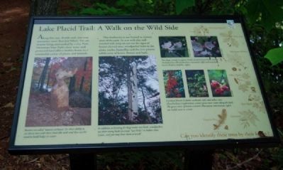
8. Lake Placid Trail: A Walk on the Wild Side Marker
5th marker in the Park's Wayside Marker's Trail
5th marker in the Park's Wayside Marker's Trail
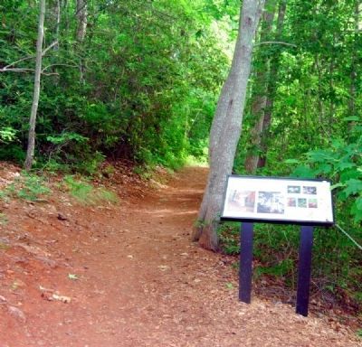
Along this easy .8-mile trail, you may encounter more than just hikers. You see, despite being surrounded by a city, Paris Mountain State Park's clean water and protected land offer a healthy home to a wonderful variety of plans and animals.
The biodiversity is not limited to remote areas of the park. As you walk this well-traveled road, keep an eye out for signs of beaver-chewed trees, woodpecker holes in the pines, turtles, butterflies and the ever-present subtle array of leaves, flowers and bark.
The biodiversity is not limited to remote areas of the park. As you walk this well-traveled road, keep an eye out for signs of beaver-chewed trees, woodpecker holes in the pines, turtles, butterflies and the ever-present subtle array of leaves, flowers and bark.
Credits. This page was last revised on November 17, 2020. It was originally submitted on June 25, 2009, by Brian Scott of Anderson, South Carolina. This page has been viewed 1,548 times since then and 58 times this year. Photos: 1, 2, 3, 4, 5, 6. submitted on June 25, 2009, by Brian Scott of Anderson, South Carolina. 7, 8, 9. submitted on June 27, 2009, by Brian Scott of Anderson, South Carolina. 10. submitted on June 25, 2009, by Brian Scott of Anderson, South Carolina.
