Franklin in Williamson County, Tennessee — The American South (East South Central)
The Carter Farm
Federal Artillery
Tennessee Civil War National Heritage Area
Photographed by Darren Jefferson Clay, July 26, 2022
1. The Carter Farm Marker
Inscription.
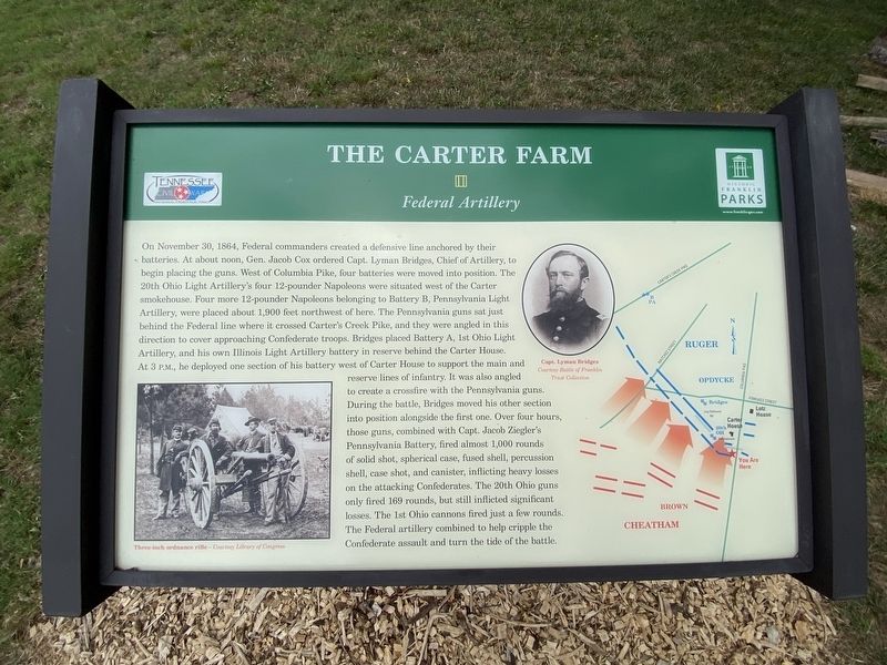
The Carter Farm. Federal Artillery. On November 30, 1864, Federal commanders created a defensive line anchored by their batteries. At about noon, Gen. Jacob Cox ordered Capt. Lyman Bridges, Chief of Artillery, to begin placing the guns. West of Columbia Pike, four batteries were moved into position, the 29th Ohio Light Artillery's four 12-pounder Napoleons were situated west of the Carter smokehouse. Four more 12-pounder Napoleons belonging to Battery B, Pennsylvania Light Artillery, were placed about 1,900 feet northwest of here. The Pennsylvania guns sat just behind the Federal line where it crossed Carter's Creek Pike, and they were angled in this direction to cover approaching Confederate troops. Bridges placed Battery A, 1st Ohio Light Artillery, and his own Illinois Light Artillery battery in reserve behind the Carter House. At 3 p.m., he deployed one section of the battery west of Carter House to support the main and reserve lines of infantry. It was also angled to create a crossfire with the Pennsylvania guns. During the battle, Bridges moved his other section into position alongside the first one. Over four hours those guns, combined with Capt. Jacob Zieglers Pennsylvania Battery, fired almost 1,000 rounds of solid shot, spherical case, fused shell, percussion shell, case shot, and canister, inflicting heavy losses on the attacking Confederates. The 20th Ohio guns only fired 169 rounds, but still inflicted significant losses. The 1st Ohio cannons fired just a few rounds. The Federal artillery combined to help cripple the Confederate assault and turn the tide of the battle.
On November 30, 1864, Federal commanders created a defensive line anchored by their batteries. At about noon, Gen. Jacob Cox ordered Capt. Lyman Bridges, Chief of Artillery, to begin placing the guns. West of Columbia Pike, four batteries were moved into position, the 29th Ohio Light Artillery's four 12-pounder Napoleons were situated west of the Carter smokehouse. Four more 12-pounder Napoleons belonging to Battery B, Pennsylvania Light Artillery, were placed about 1,900 feet northwest of here. The Pennsylvania guns sat just behind the Federal line where it crossed Carter's Creek Pike, and they were angled in this direction to cover approaching Confederate troops. Bridges placed Battery A, 1st Ohio Light
Artillery, and his own Illinois Light Artillery battery in reserve behind the Carter House. At 3 p.m., he deployed one section of the battery west of Carter House to support the main and reserve lines of infantry. It was also angled to create a crossfire with the Pennsylvania guns. During the battle, Bridges moved his other section into position alongside the first one. Over four hours those guns, combined with Capt.
Click or scan to see this page online
Jacob Zieglers Pennsylvania Battery, fired almost 1,000 rounds of solid shot, spherical case, fused shell, percussion shell, case shot, and canister, inflicting heavy losses on the attacking Confederates. The 20th Ohio guns only fired 169 rounds, but still inflicted significant losses. The 1st Ohio cannons fired just a few rounds. The Federal artillery combined to help cripple the Confederate assault and turn the tide of the battle.
Erected by Historic Franklin Parks.
Topics. This historical marker is listed in this topic list: War, US Civil. A significant historical date for this entry is November 30, 1864.
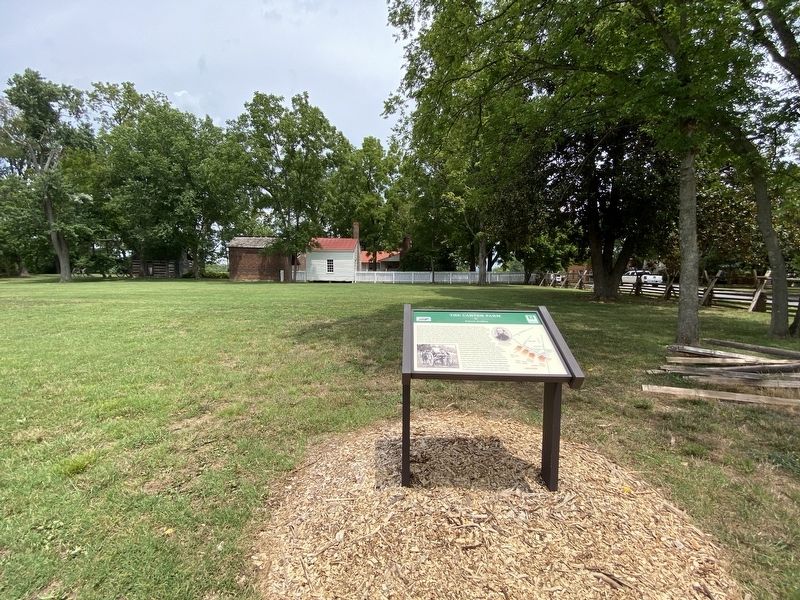
Location. 35° 54.994′ N, 86° 52.415′ W. Marker is in Franklin, Tennessee, in Williamson County. It is on Columbia Avenue, on the right when traveling south. Touch for map. Marker is at or near this postal address: 1152 Columbia Ave, Franklin TN 37064, United States of America. Touch for directions.

Regionally, this marker is in Middle Tennessee and in Greater Nashville. It is also in the American South and specifically in the Upper South. Globally, it is in North America, the Western Hemisphere, the Western World, and the Anglosphere.
Photographed by Darren Jefferson Clay, July 26, 2022
2. The Carter Farm Marker
Historically, it finds itself in what was once the territory of the Mississippian Culture, one of the Confederate States of America, and the Antebellum South.
Other nearby markers. At least 8 other markers are within walking distance of this marker: A different marker also named The Carter Farm (a few steps from this marker); a different marker also named The Carter Farm (within shouting distance of this marker); Cleburnes Division (within shouting distance of this marker); a different marker also named The Carter Farm (within shouting distance of this marker); a different marker also named The Carter Farm (within shouting distance of this marker); a different marker also named The Carter Farm (within shouting distance of this marker); a different marker also named The Carter Farm (within shouting distance of this marker); The Carter House (within shouting distance of this marker). Touch for a list and map of all markers in Franklin.
Another marker is no longer nearby. Epicenter of the Battle of Franklin (was within shouting distance of this marker but has been permanently removed).
Credits. This page was last revised on July 27, 2022. It was originally submitted on July 26, 2022, by Darren Jefferson Clay of Duluth, Georgia. This page has been viewed 280 times since then and 30 times this year. Photos:1, 2. submitted on July 26, 2022, by Darren Jefferson Clay of Duluth, Georgia. • Mark Hilton was the editor who published this page.