Wrightstown in Bucks County, Pennsylvania — The American Northeast (Mid-Atlantic)
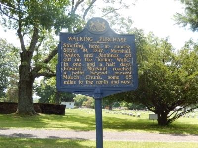
Walking Purchase
Erected 1949 by Pennsylvania Historical & Museum Commission.
Topics and series. This historical marker is listed in these topic lists: Colonial Era • Native Americans • Roads & Vehicles. In addition, it is included in the Pennsylvania Historical and Museum Commission series list. A significant historical date for this entry is September 19, 1737.
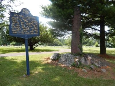
Location. 40° 15.978′ N, 74° 58.956′ W. Marker is in Wrightstown, Pennsylvania, in Bucks County. Marker is on Durham Road (Pennsylvania Route 413) east of Penns Park Road, on the right when traveling east. The marker is on the grounds of the Friends Meeting House with the cemetery in the background. Touch for map. Marker is at or near this postal address: 532 Durham Rd, Newtown PA 18940, United States of America. Touch for directions.
Other nearby markers. At least 8 other markers are within 4 miles of this marker, measured as the crow flies. Durham Road Toll House (approx. 3.2 miles away); Goodnoe Farm & Dairy Bar (approx. 3.2 miles away); Boyd-Yardley House (approx. 3.3 miles away); Brooks House (approx. 3.3 miles away); Randall Double House (approx. 3.3 miles away); Richboro Nike Missile Battery PH-07 (approx. 3.3 miles away); William Penn's New Town (approx. 3.3 miles away); Old Presbyterian Church (approx. 3.3 miles away).
Credits. This page was last revised on July 28, 2022. It was originally submitted on July 25, 2015, by Don Morfe of Baltimore, Maryland. This page has been viewed 591 times since then and 89 times this year. Last updated on July 26, 2022, by Carl Gordon Moore Jr. of North East, Maryland. Photos: 1, 2. submitted on July 25, 2015, by Don Morfe of Baltimore, Maryland. • Devry Becker Jones was the editor who published this page.

