Oakville in St. Louis County, Missouri — The American Midwest (Upper Plains)
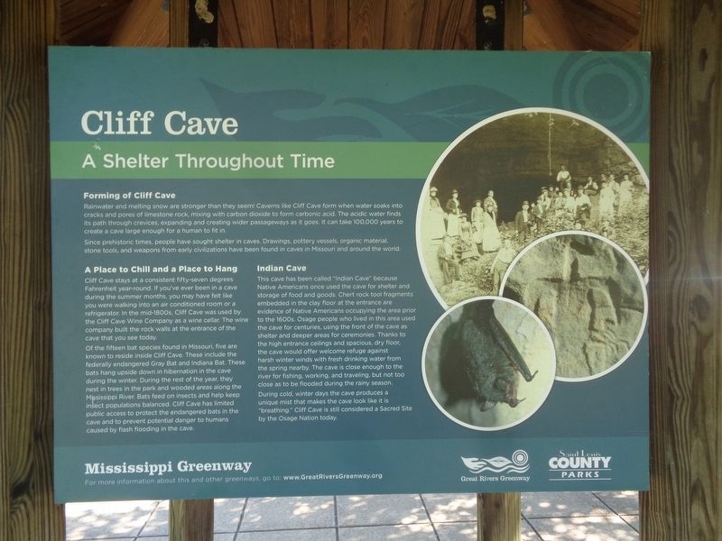
Cliff Cave
A Shelter Throughout Time
| — | Mississippi Greenway | — |
Photographed by Jason Voigt, July 11, 2022
1. Cliff Cave Marker
Forming of Cliff Cave
Rainwater and melting snow are stronger than they seem! Caverns like Cliff Cave form when water soaks into cracks and pores of limestone rock, mixing with carbon dioxide to form carbonic acid. The acidic water finds its path through crevices, expanding and creating wider passageways as it goes. It can take 100,000 years to create a cave large enough for a human to fit in.
Since prehistoric times, people have sought shelter in caves. Drawings, pottery vessels, organic material, stone tools, and weapons from early civilizations have been found in caves in Missouri and around the world.
A Place to Chill and a Place to Hang
Cliff Cave stays at a consistent fifty-seven degrees Fahrenheit year-round. If you've ever been in a cave during the summer months, you may have felt like you were walking into an air conditioned room or a refrigerator. In the mid-1800s, Cliff Cave was used by the Cliff Cave Wine Company as a wine cellar. The wine company built the rock walls at the entrance of the cave that you see today.
Of the fifteen bat species found in Missouri, five are known to reside inside Cliff
this page online
Indian Cave
This cave has been called "Indian Cave" because Native Americans once used the cave for shelter and storage of food and goods. Chert rock tool fragments embedded in the clay floor at the entrance are evidence of Native Americans occupying the area prior to the 1600s. Osage people who lived in this area used the cave for centuries, using the front of the cave as shelter and deeper areas for ceremonies. Thanks to the high entrance ceilings and spacious, dry floor, the cave would offer welcome refuge against harsh winter winds with fresh drinking water from the spring nearby. The cave is close enough to the river for fishing, working, and traveling, but
Photographed by Jason Voigt, July 11, 2022
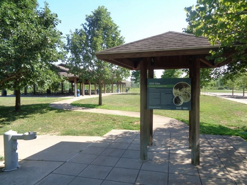
2. Cliff Cave Marker
Marker is located at the Cliff Cave Park lower trailhead parking lot
During cold, winter days the cave produces a unique mist that makes the cave look like it is "breathing." Cliff Cave is still considered a Sacred Site by the Osage Nation today.
Erected by Great Rivers Greenway and St. Louis County Parks.
Topics. This historical marker is listed in these topic lists: Animals • Indigenous Peoples and Communities • Parks & Recreational Areas.
Location. 38° 27.524′ N, 90° 17.271′ W. Marker is in Oakville, Missouri, in St. Louis County. It is on Cliff Cave Road south of Bluff Road. Marker is located at Cliff Cave Park, at the lower trailhead parking lot. Touch for map. Marker is at or near this postal address: 5972 Bluff Rd, Saint Louis MO 63129, United States of America. Touch for directions.

Regionally, this marker is in Greater St. Louis. It is also in the American Midwest, in the Lewis & Clark Corridor, in the Corn Belt, and in the Great River Road Region. Globally, it is in North America, the Western Hemisphere, the Western World, and the Anglosphere. Historically, it finds itself in what was once the Viceroyalty of New France, the territory of the Mississippian Culture, the Louisiana Purchase, and the Antebellum South.
Other nearby markers. At least 8 other markers are within 3 miles of this marker, measured as the crow flies: History of the Area (here, next to this marker); Veterans Path of Honor (approx. 2.3 miles away); World War I, St. Louis Veterans, Court of Honor (approx. 2.7 miles away); Combat Wounded Veterans (approx. 2.7 miles away); 82nd Airborne Infantry Division US Army (approx. 2.7 miles away); To The Confederate Dead 1861 - 1865 (approx. 2.7 miles away); Confederate Burials in the National Cemetery (approx. 2.7 miles away); Civil War Memorial (approx. 2.7 miles away).
Another marker is no longer nearby. Veterans Memorial (was approx. 2.3 miles away but has been confirmed missing).
Also see . . .
1. Cliff Cave Park. From the Saint Louis County Parks' website. Park information and history can be found here. (Submitted on July 27, 2022, by Jason Voigt of Glen Carbon, Illinois.)
2. Great Rivers Greenway. Official website (mentioned on the marker) (Submitted on July 27, 2022, by Jason Voigt of Glen Carbon, Illinois.)
Credits. This page was last revised on March 6, 2026. It was originally submitted on July 27, 2022, by Jason Voigt of Glen Carbon, Illinois. This page has been viewed 782 times since then and 52 times this year. Photos: 1, 2. submitted on July 27, 2022, by Jason Voigt of Glen Carbon, Illinois.
