Glendive in Dawson County, Montana — The American West (Mountains)
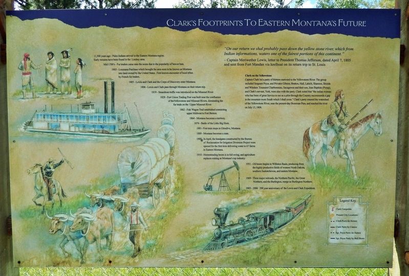
Clark's Footprints To Eastern Montana's Future
Clark on the Yellowstone
Inscription.
"On our return we shal probably pass down the yellow stone river, which from Indian informations, waters one of the fairest portions of this continent."
— Captain Meriwether Lewis, letter to President Thomas Jefferson, dated April 7, 1805 and sent from Fort Mandan via keelboat on its return trip to St. Louis
Clark on the Yellowstone
Captain Clark led a party of thirteen eastward to the Yellowstone River. The group included Sergeant Pryor, and Privates Gibson, Bratton, Hall, Labich, Shannon, Shields and Windsor. Toussaint Charbonneau, Sacagawea and their son, Jean Baptiste (Pomp), and Clark's servant, York, were also with the party. Clark noted that "the indian woman who has been of great Service to me as a pilot through the Country recommends a gap in the mountain more South which I shall cross." Clark's party entered the watershed of the Yellowstone River, near the present-day Bozeman Pass, and reached the river on July 15, 1806.
11,500 years ago - Paleo Indians arrived in the Eastern Montana region. Early remains have been found in the Lindsay area.
Mid 1700's - Fur traders came onto the scene due to the popularity of beaver hats.
1803 - Louisiana Purchase which brought the area soon to be known as Montana into land owned by the United States. First known encounter of local tribes by French fur traders.
1805 - Lewis and Clark and the Corps of Discovery enter Montana.
1806 - Lewis and Clark pass through Montana on their return trip.
1819 - Steamboat traffic was introduced on the Missouri River.
1828 - Fort Union Trading Post was built near the confluence of the Yellowstone and Missouri Rivers, dominating the fur trade on the Upper Missouri River.
1862 - Fisk Wagon Trail established connecting upper Midwest to Fort Benton.
1864 - Montana becomes a territory.
1876 - Battle of the Little Big Horn.
1881- First train stops in Glendive, Montana.
1889 - Montana becomes a state.
1909 - In April, the headgates constructed by the Bureau of Reclamation for Irrigation Diversion Project were opened for the first time delivering water to 67 farms in Eastern Montana.
1910 - Homesteading boom is in full swing, and agriculture replaces mining as Montana's top industry.
1951 - Oil boom begins in Williston Basin, producing from the highly productive fields of western North Dakota, southern Saskatchewan, and eastern Montana.
1969 - Three major railroads, the Northern Pacific, the Great Northern, and the Burlington, merge as Burlington Northern.
2003 - 2006 200 year anniversary of the Lewis and Clark Expedition.
Erected by
Lower Yellowstone Lewis & Clark Regional Committee; and Montana Lewis & Clark Commission.
Topics and series. This historical marker is listed in these topic lists: Exploration • Industry & Commerce • Native Americans • Waterways & Vessels. In addition, it is included in the Lewis & Clark Expedition series list. A significant historical date for this entry is July 15, 1806.
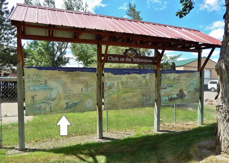
Location. 47° 7.512′ N, 104° 41.423′ W. Marker is in Glendive, Montana, in Dawson County. Marker is on Montana Avenue just north of State Street, on the left when traveling north. This is the leftmost of three markers in the Clark on the Yellowstone kiosk, located in an interpretive park on the east side of the Glendive Dinosaur and Fossil Museum. Touch for map. Marker is at or near this postal address: 139 State Street, Glendive MT 59330, United States of America. Touch for directions.
Other nearby markers. At least 8 other markers are within 2 miles of this marker, measured as the crow flies. Evidence Of The Expedition (here, next to this marker); Returning To The Plains (here, next to this marker); Orpha Zilpha Parke Bovee (approx. 1.1 miles away); Sacred Heart Church (approx. 1.7 miles away); First Methodist Episcopal Church and Parsonage (approx. 1.7 miles away); Dawson County World War Memorial (approx. 1.8 miles away); Dion Building / Exchange Bank (approx. 1.8 miles away); 107 West Bell Street (approx. 1.8 miles away). Touch for a list and map of all markers in Glendive.
Related markers. Click here for a list of markers that are related to this marker. Clark on the Yellowstone
Also see . . . Clark on the Yellowstone.
Parting with Lewis at Travelers’ Rest, Clark leads a large group back to the Beaverhead River to pick up the supplies and canoes cached there. Clark travels by horse to the Yellowstone and continues downriver to find cottonwood trees large enough to make canoes. After making two small canoes, Clark tasks Sgt. Pryor to take the horses to the Knife River Villages. Crow Indians steal all the horses, and Pryor’s group makes two bull boats, in which they journey down the Yellowstone. Everyone reunites on the Missouri River several miles below present-day Williston, North Dakota.(Submitted on August 2, 2022, by Cosmos Mariner of Cape Canaveral, Florida.)
Credits. This page was last revised on August 2, 2022. It was originally submitted on August 1, 2022, by Cosmos Mariner of Cape Canaveral, Florida. This page has been viewed 156 times since then and 23 times this year. Photos: 1, 2. submitted on August 2, 2022, by Cosmos Mariner of Cape Canaveral, Florida.

