Near Thomasville in Clarke County, Alabama — The American South (East South Central)
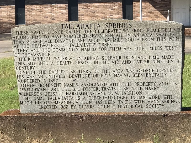
Tallahatta Springs
Photographed by Duane and Tracy Marsteller, August 7, 2022
1. Tallahatta Springs Marker
They and the community named for them are eight miles west of Thomasville.
Their mineral waters — containing sulphur, iron, and lime, made this site into a health resort in the mid and latter nineteenth century.
One of the earliest settlers of the area was George Lowder — his was an untimely death, reportedly having been brutally murdered in 1857.
Other prominent names associated with this property and its development are Col. B. C. Foster, Travis L. Bedsole, Harry Wilkerson, Jesse U. Harrison, Sr., and S. M. Harrison.
The name Tallahatta is a Creek (Muscogee) Indian word with much history — meaning “a town has been taken with many springs.”
Erected 1982 by Clarke County Historical Society.
Topics. This historical marker is listed in these topic lists: Indigenous Peoples and Communities • Industry & Commerce • Settlements & Settlers • Waterways & Vessels. A significant historical year for this entry is 1857.
Location. 31° 53.955′ N,
this page online

Regionally, this marker is in the American South and specifically in the Deep South. Globally, it is in North America, a Gulf of Mexico state, the Western Hemisphere, the Western World, and the Anglosphere. Historically, it finds itself in what was once New Spain, the territory of the Mississippian Culture, one of the Confederate States of America, and the Antebellum South.
Other nearby markers. At least 8 other markers are within 11 miles of this marker, measured as the crow flies: Choctaw Corner (approx. 5 miles away); Thomasville War Memorial (approx. 6.4 miles away); Thomasville's Early History (approx. 6½ miles away); Williams’ Temple CME Church (approx. 6.6 miles away); Mitcham Beat and the Mitcham War
Photographed by Duane and Tracy Marsteller, August 7, 2022
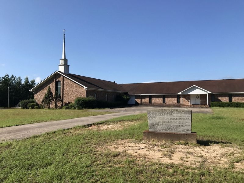
2. Tallahatta Springs Marker
Christian Fellowship Baptist Church in the background.
Credits. This page was last revised on August 12, 2022. It was originally submitted on August 12, 2022, by Duane and Tracy Marsteller of Murfreesboro, Tennessee. This page has been viewed 1,204 times since then and 104 times this year. Photos: 1, 2. submitted on August 12, 2022, by Duane and Tracy Marsteller of Murfreesboro, Tennessee.
