Downtown in Frederick in Frederick County, Maryland — The American Northeast (Mid-Atlantic)
North Market Street
"Now I shall see Cousin J."
| — | Gettysburg Campaign | — |
Photographed by Craig Swain, September 9, 2007
1. North Market Street Marker
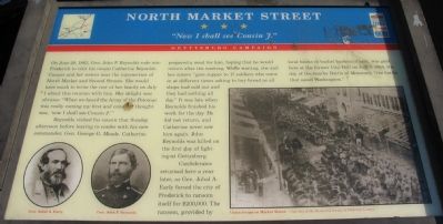
On June 28, 1863, Gen. John F. Reynolds rode into Frederick to visit his cousin Catherine Reynolds Cramer and her sisters near the intersection of North Market and Second Streets. She would have much to write the rest of her family on July 1 about this reunion with him. Her delight was obvious: "When we heard the Army of the Potomac was really coming my first and constant thought was, 'now I shall see Cousin J.'"
Reynolds visited his cousin that Sunday afternoon before leaving to confer with his new commander, Gen. George G. Meade. Catherine prepared a meal for him, hoping that he would return after the meeting. While waiting, she and her sisters "gave supper to 17 soldiers who came in at different times asking to buy bread as all shops had sold out and they had nothing all day." It was late when Reynolds finished his work for the day. He did not return, and Catherine never saw him again. John Reynolds was killed on the first day of fighting at Gettysburg.
Confederates returned here a year later, as Gen. Jubal A. Early forced the city of Frederick to ransom itself for $200,000. The ransom, provided by local banks in bushel
this page online
Erected by Maryland Civil War Trails.
Topics and series. This historical marker is listed in this topic list: War, US Civil. In addition, it is included in the Maryland Civil War Trails series list. A significant historical month for this entry is June 1822.
Location. This marker has been replaced by another marker nearby. It was located near 39° 24.964′ N, 77° 24.639′ W. Marker was in Frederick, Maryland, in Frederick County. It was in Downtown. It was on North Market Street (State Highway 355), on the right when traveling north. Touch for map. Marker was at or near this postal address: 124 North Market Street, Frederick MD 21701, United States of America. Touch for directions.

Regionally, this marker was in the Washington Metropolitan Area and in Central Maryland. It was also in the American Mid-Atlantic. Globally, it was in North America, the Western Hemisphere, the Western World, and the Anglosphere. Historically, it found itself in what was once one of the original Thirteen
Photographed by Craig Swain, September 9, 2007
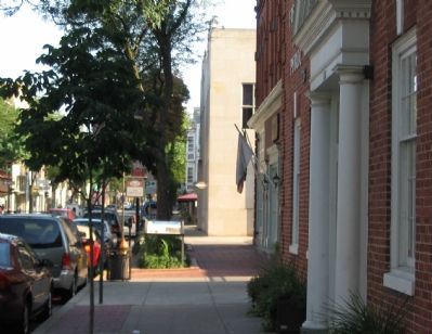
2. Looking North on Patrick Street
Other nearby markers. At least 8 other markers are within walking distance of this location: The Ransom of Frederick (here, next to this marker); Former Site of Tory Gaol (within shouting distance of this marker); Cultures Meet (about 300 feet away, measured in a direct line); Capital for a Summer (about 300 feet away); In April 1861 The Legislature Of Maryland Met Here In Special Session (about 300 feet away); Kemp Hall (about 300 feet away); Hood College (about 300 feet away); The Congregation in Frederick (about 300 feet away). Touch for a list and map of all markers in Frederick.
Other markers no longer nearby. North Market Street (has been replaced with this marker); Capital For A Summer (was about 300 feet away but has been replaced with another marker now near it).
More about this marker. The marker displays portraits of Generals Jubal A. Early and John F. Reynolds on the lower right. On the lower left is a photograph of "Union troops on Market Street."
Related marker. Click here for another marker that is related to this marker. This marker has been replaced by the
Photographed by Craig Swain, September 9, 2007
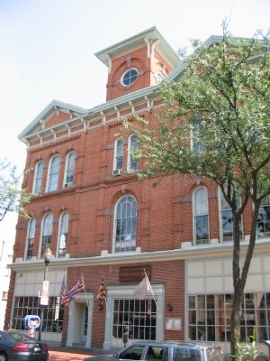
3. The Old Court House
The building was originally an opera house, but following a fire which destroyed the original court house (which dated to the 1750s) in 1861, this building became the city seat of government.
Credits. This page was last revised on September 9, 2022. It was originally submitted on October 7, 2007, by Craig Swain of Leesburg, Virginia. This page has been viewed 2,486 times since then and 27 times this year. Last updated on August 16, 2022, by Carl Gordon Moore Jr. of North East, Maryland. Photos: 1, 2, 3. submitted on October 7, 2007, by Craig Swain of Leesburg, Virginia. • Bernard Fisher was the editor who published this page.
