Kissimmee in Osceola County, Florida — The American South (South Atlantic)
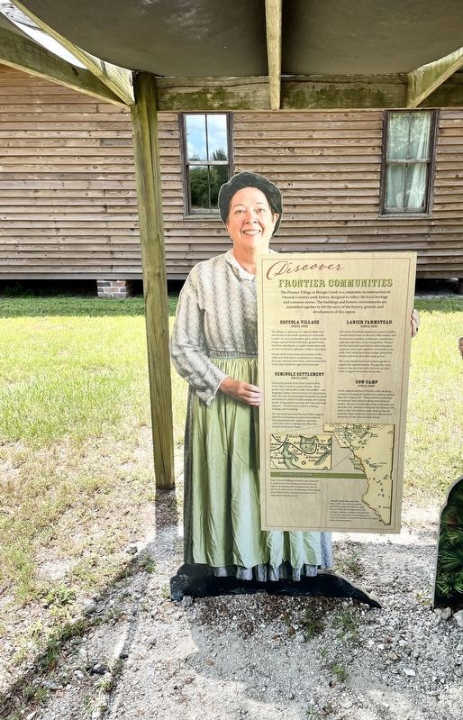
Discover Frontier Communities
| — | Pioneer Village at Shingle Creek | — |

Photographed by Brandon D Cross, August 19, 2022
1. Discover Frontier Communities Marker
Frontier Communities
The Pioneer Village at Shingle Creek is a composite reconstruction of Osceola County's early history designed to reflect the local heritage and common stories. The buildings and historic environments are assembled together to tell the story of the history, growth, and development of this region.
Osceola Village
circa 1900
The village is a depiction of a typical 1890s rural community in the north central part of Osceola County. As rural communities grew settlers in the villages opened blacksmith shops, general stores, churches, and schools to supply commodities and services to farmers, cattlemen, traders, and settlers.
Several small towns came into existence in the 1880s and 1890s due to several factors: swamp drainage railroad connections, and the promotion of the areas climate for agricultural pursuits.
Seminole Settlement
circa 1880
During the period of the First Seminole War (1818-1821), much of central Florida - from present day Gainesville to Lake Okeechobee - was designated “Indian Territory “ by the U.S. Government. After the wars, several hundred Seminoles remained and
this page online
The Seminoles harvested food and other supplies from the surrounding swamps and woodlands. They also hunted deer, alligators, and birds, which they sold to trading posts when they traveled to the local villages.
Lanier Farmstead
circa 1910
The Lanier Farmstead represents a typical middle income family home in the early 20th century, and the property included an outhouse, smokehouse, sugarcane operation, barn and gardens. Pioneer families had small-patch farms were they grew sugarcane, fruit and vegetables. Eventually, some made their living harvesting oranges, grapefruit, lemons and limes from their large groves.
The Lanier family lived and worked together to support the extended family. Though they were farmers, they also had cattle and took on other work to support themselves financially.
Cow Camp
circa 1890
In the original method of Florida cattle ranching, cowmen on horseback hunted wild cattle to establish large free- range herds. These cattlemen
Photographed by Brandon D Cross, August 19, 2022
2. Discover Frontier Communities Marker
Original Locations
Many of these buildings are historic and originated in small towns across Osceola County. Others are replicas of buildings that once existed, but did not survive the past century. The locations of the original sites of these historic structures are shown on this early map of Osceola County.
(caption)
Osceola County Map circa 1916
Prior to 1917, the western boundary of Osceola County followed man-made lines, as well as the Kissimmee River. The southern boundary stretched to the northwest area of Lake Okeechobee. As populations grew, many new counties were formed from Florida’s original three territorial counties.
Erected by Pioneer Village at Shingle Creek.
Topics. This historical marker is listed in these topic lists: Agriculture • Indigenous Peoples and Communities • Industry & Commerce • Settlements & Settlers. A significant historical year for this entry is 1880.
Location. 28° 19.107′ N, 81° 27.375′ W. Marker is in Kissimmee, Florida, in Osceola County. It can be reached from Babb Road 0.6 miles north of Old Vineland Road, on the right when traveling north. Marker located within the Frontier Village at Shingle Creek. Touch for map. Marker is at or near this postal address: 2491 Babb Rd, Kissimmee FL 34746, United States of America. Touch for directions.

Regionally, this marker is in Greater Orlando and in Central Florida. It is also in the American South. Globally, it is in the North Atlantic Region, North America, a Gulf of Mexico state, the Western Hemisphere,

Photographed by Brandon D Cross, August 19, 2022
3. Pioneer Village at Shingle Creek entrance
Other nearby markers. At least 8 other markers are within walking distance of this marker: Ranch House (a few steps from this marker); A General Store (a few steps from this marker); Congregations (a few steps from this marker); A British Officer Finds Paradise in Florida (a few steps from this marker); Community-Centered Schools (a few steps from this marker); Water Works (within shouting distance of this marker); Bunk House (within shouting distance of this marker); The Village Depot (within shouting distance of this marker). Touch for a list and map of all markers in Kissimmee.
Also see . . .
1. Pioneer Village at Shingle Creek. (Submitted on August 20, 2022, by Brandon D Cross of Flagler Beach, Florida.)
2. Pioneer Village - Osceola History. (Submitted on August 21, 2022.)
Photographed by Brandon D Cross, August 19, 2022
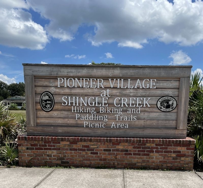
4. Pioneer Village at Shingle Creek sign
Credits. This page was last revised on August 21, 2022. It was originally submitted on August 20, 2022, by Brandon D Cross of Flagler Beach, Florida. This page has been viewed 279 times since then and 24 times this year. Photos: 1, 2, 3, 4. submitted on August 20, 2022, by Brandon D Cross of Flagler Beach, Florida. • J. J. Prats was the editor who published this page.
