Near West Point in Hardin County, Kentucky — The American South (East South Central)
The Louisville and Nashville (L&N) Turnpike Corridor Segment

Photographed by James Hulse, August 18, 2022
1. The Louisville and Nashville (L&N) Turnpike Corridor Segment Marker
Topics. This historical marker is listed in these topic lists: Railroads & Streetcars • Roads & Vehicles • War, US Civil. A significant historical year for this entry is 1996.
Location. 37° 58.106′ N, 85° 57.66′ W. Marker is near West Point, Kentucky, in Hardin County. It is at the intersection of Louisville-Nashville Turnpike (Kentucky Route 835) and Railroad Trestle, on the right when traveling south on Louisville-Nashville Turnpike. The marker is located in a small park at the trailhead to the Tioga Falls Trail. Touch for map.
this page online

Regionally, this marker is in the American South and specifically in the Upper South. Globally, it is in North America, the Western Hemisphere, the Western World, and the Anglosphere. Historically, it finds itself in what was once the territory of the Mississippian Culture and also the Antebellum South.
Other nearby markers. At least 8 other markers are within 2 miles of this marker, measured as the crow flies: Mom & Pops Place (within shouting distance of this marker); U.S Bullion Depository (approx. 1.2 miles away); Louisville, Henderson & St. Louis Bridge (approx. 1.8 miles away); Replica of Earthen Wall Cannon Emplacement (approx. 1.8 miles away); Fort Duffield (approx. 1.8 miles away); Redoubt (approx. 2 miles away); Civil War Fort Duffield (approx. 2 miles away); U.S. Fort Duffield (approx. 2 miles away). Touch for a list and map of all markers in West Point.
Another marker is no longer nearby. Fort Knox, Kentucky (was approx. 1.2 miles away but has been confirmed missing).
More about this marker. The
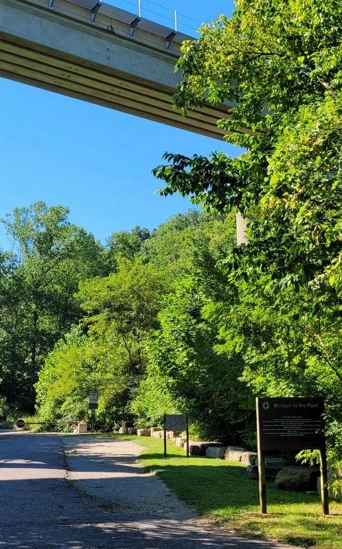
Photographed by James Hulse, August 18, 2022
2. The Louisville and Nashville (L&N) Turnpike Corridor Segment Marker and railroad bridge
It is the marker on the left of the two markers
Also see . . .
1. Louisville and Nashville Turnpike. Wikipedia
The western section was first proposed in 1825 by Kentucky Governor Joseph Desha. Approval of charters and allocation of funds was slow to come, typical of turnpike projects at the time, which represented very large endeavors. A portion was first approved in 1829 but was not started before the 3-year limit expired. Sections of the turnpike were approved in five separate Kentucky legislature bills, passed from 1833 to 1849.(Submitted on August 23, 2022, by James Hulse of Medina, Texas.)
2. Turnpike trust. Wikipedia
The term "turnpike" originates from the similarity of the gate used to control access to the road, to the barriers once used to defend against attack by cavalry (see Cheval de frise). The turnpike consisted of a row of pikes or bars, each sharpened at one end, and attached to horizontal members which were secured at one end to an upright pole or axle, which could be rotated to open or close the gate.(Submitted on August 23, 2022, by James Hulse of Medina, Texas.)
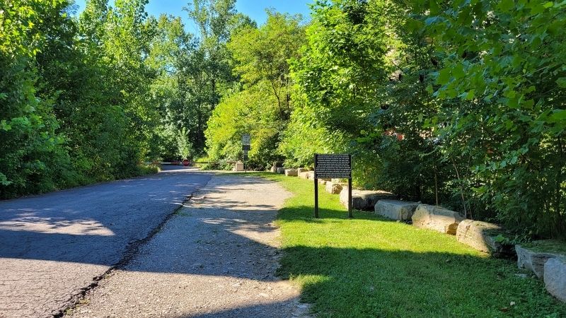
Photographed by James Hulse, August 18, 2022
3. The view of the Marker on the trail to the trail of the “Bridges to the Past”
Credits. This page was last revised on November 9, 2024. It was originally submitted on August 23, 2022, by James Hulse of Medina, Texas. This page has been viewed 759 times since then and 97 times this year. Photos: 1, 2, 3. submitted on August 23, 2022, by James Hulse of Medina, Texas.
