Near Hinckley in Pine County, Minnesota — The American Midwest (Upper Plains)
A Room With A View
Photographed by McGhiever, June 10, 2007
1. A Room With A View Marker
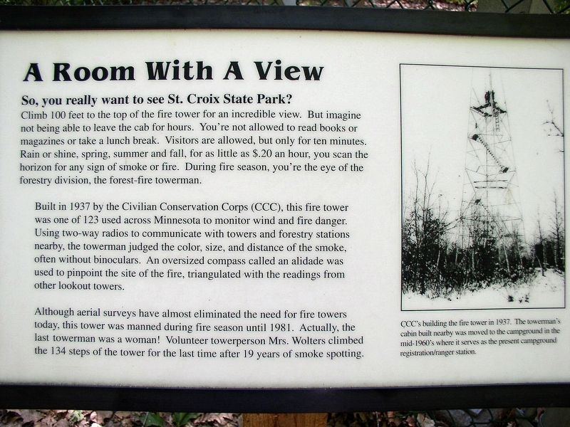
So, you really want to see St. Croix State Park?
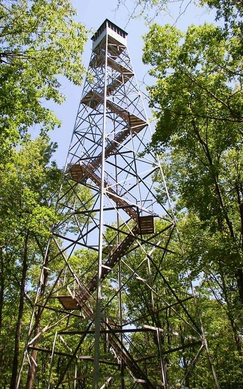
Climb 100 feet to the top of the fire tower for an incredible view. But imagine not being able to leave the cab for hours. You're not allowed to read books or magazines or take a lunch break. Visitors are allowed, but only for ten minutes. Rain or shine, spring, summer and fall, for as little as $.20 an hour, you scan the horizon for any sign of smoke or fire. During the fire season, you're the eye of the forestry division, the forest-fire towerman.
Built in 1937 by the Civilian Conservation Corps (CCC), this fire tower was one of 123 used across Minnesota to monitor wind and fire danger. Using two-way radios to communicate with towers and forestry stations nearby, the towerman judged the color, size, and distance of the smoke, often without binoculars. An oversized compass called an alidade was used to pinpoint the site of the fire, triangulated with the readings from other lookout towers.
Although aerial surveys have almost eliminated the need for fire towers today, this tower was manned during fire season until 1981. Actually, the last towerman was a woman! Volunteer
this page online
CCC's building the fire tower in 1937. The towerman's cabin built nearby was moved to the campground in the mid-1960's where it serves as the present campground registration/ranger station.
Erected by Minnesota Department of Natural Resources.
Topics. This historical marker is listed in these topic lists: Horticulture & Forestry • Parks & Recreational Areas • Women. A significant historical year for this entry is 1937.
Location. 45° 56.977′ N, 92° 43.625′ W. Marker is near Hinckley, Minnesota, in Pine County. It can be reached from St. Croix Park Road. The marker is in St. Croix State Park (vehicle permit required), at the base of the fire tower, a well-marked stop along the main park road. Touch for map. Marker is at or near this postal address: 30065 St Croix Park Road, Hinckley MN 55037, United States of America. Touch for directions.

Regionally, this marker is in Central Minnesota. It is also in the American Midwest and in the Corn Belt. Globally, it is in North America, the Great North Woods, the
Photographed by McGhiever, June 10, 2007
2. St. Croix State Park fire tower
Other nearby markers. At least 4 other markers are within 15 miles of this marker, measured as the crow flies: Crex Meadows (approx. 6.8 miles away in Wisconsin); The Great Hinckley Fire (approx. 10.4 miles away); Governor Knowles State Forest (approx. 12½ miles away in Wisconsin); Sandstone Area Veterans Memorial (approx. 14.3 miles away).
Another marker is no longer nearby. 1980 Ekdall Church Fire (was approx. 4.8 miles away in Wisconsin but has been confirmed missing).
Credits. This page was last revised on September 7, 2022. It was originally submitted on September 7, 2022, by McGhiever of Minneapolis, Minnesota. This page has been viewed 350 times since then and 37 times this year. Photos: 1, 2. submitted on September 7, 2022, by McGhiever of Minneapolis, Minnesota. • J. Makali Bruton was the editor who published this page.
