Springettsbury Township near North York in York County, Pennsylvania — The American Northeast (Mid-Atlantic)
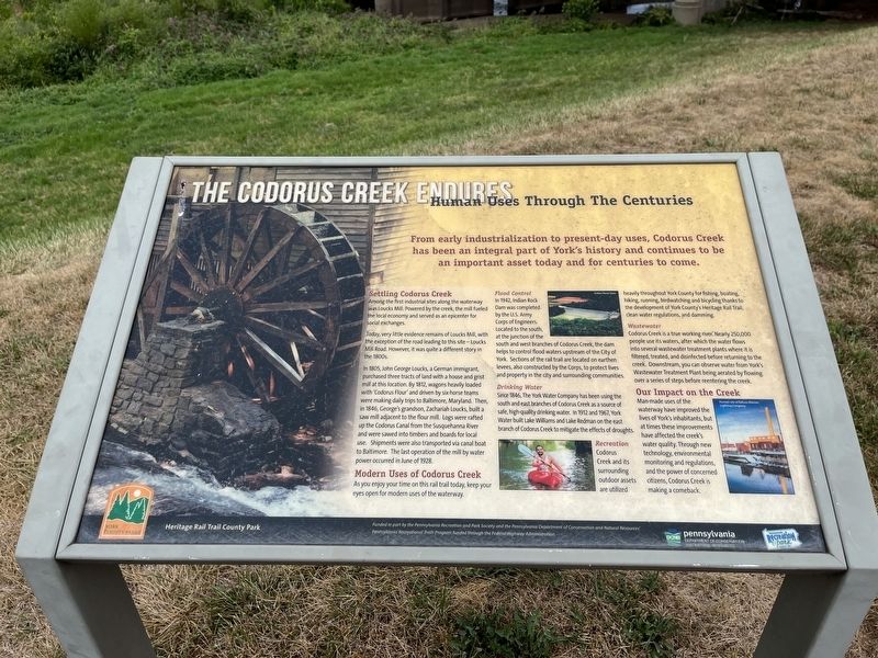
Human Uses Through The Centuries
The Codorus Creek Endures
— Heritage Rail Trail County Park —

Photographed By Devry Becker Jones (CC0), September 5, 2022
1. Human Uses Through The Centuries Marker
From early industrialization to present-day uses, Codorus Creek has been an integral part of York's history and continues to be an important asset today and for centuries to come.
Settling Codorus Creek
Among the first industrial sites along the waterway was Loucks Mill. Powered by the creek, the mill fueled the local economy and served as an epicenter for social exchanges.
In 1805, John George Loucks, a German immigrant, purchased three tracts of land with a house and grist mill at this location. By 1812, wagons heavily loaded with 'Codorus Flour' and driven by six-horse teams were making daily trips to Baltimore, Maryland. Then, in 1846, George's grandson, Zachariah Loucks, built a saw mill adjacent to the flour mill. Logs were rafted up the Codorus Canal from the Susquehanna River and were sawed into timbers and boards for local use. Shipments were also transported via canal boat to Baltimore. The last operation of the mill by water power occurred in June of 1928.
Modern Uses of Codorus Creek
As you enjoy your time on this rail trail today, keep your eyes open for modern uses of the waterway.
Flood Control
In 1942, Indian Rock Dam was completed by the U.S. Army Corps of Engineers. Located to the south, at the junction of the south and west branches of Codorus Creek, the dam helps to control flood waters upstream of the City of York. Sections of the rail trail are located on earthen levees, also constructed by the Corps, to protect lives and property in the city and surrounding communities.
Drinking Water
Since 1846, The York Water Company has been using the south and east branches of Codorus Creek as a source of safe, high-quality drinking water. In 1912 and 1967, York Water built Lake Williams and Lake Redman on the east branch of Codorus Creek to mitigate the effects of droughts.
Recreation
Codorus Creek and its surrounding outdoor assets are utilized heavily throughout York County for fishing, boating, hiking, running, birdwatching and bicycling thanks to the development of York County's Heritage Rail Trail clean water regulations, and damming.
Wastewater
Codorus Creek is a true working river. Nearly 250,000 people use its waters, after which the water flows into several wastewater treatments plants where it is filtered, treated, and disinfected before returning to the creek. Downstream, you can observe water

Photographed By Devry Becker Jones (CC0), September 5, 2022
2. Human Uses Through The Centuries Marker
Our Impact on the Creek
Man-made uses of the waterway have improved the lives of York's inhabitants, but at times these improvements have affected the creek's water quality. Through new technology, environmental monitoring and regulations, and the power of concerned citizens, Codorus Creek is making a comeback.
Erected by York County Parks; Pennsylvania Department of Conservation and Natural Resources.
Topics. This historical marker is listed in these topic lists: Environment • Industry & Commerce • Natural Resources • Parks & Recreational Areas • Waterways & Vessels. A significant historical month for this entry is June 1928.
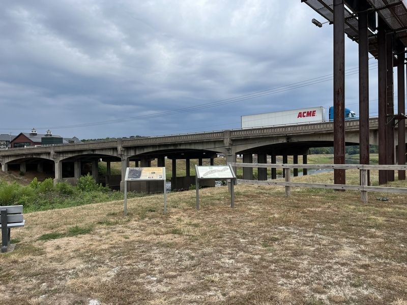
Location. 39° 59.004′ N, 76° 43.38′ W. Marker is near North York, Pennsylvania, in York County. It is in Springettsbury Township. Marker is on Loucks Mill Road just south of Arsenal Road (U.S. 30), on the right when traveling south. Touch for map. Marker is in this post office area: York PA 17406, United States of America. Touch for directions.
Other nearby markers. At least 8 other markers are within walking distance of this marker. Codurus Creek Water Trail (here, next to this marker); York (approx. 0.4 miles away); York City Cemetery (approx. 0.7 miles away); Margaret Duncan Beitzel / Jacob Horlebein (approx. 0.9 miles away); Henry Bayler / Sarah Ann Bayler (approx. 0.9 miles away); Prospect Hill Soldiers' Lot (approx. 0.9 miles away); Philip Livingston (approx. 0.9 miles away); Civil War Memorial (approx. 0.9 miles away). Touch for a list and map of all markers in North York.
Credits. This page was last revised on February 7, 2023. It was originally submitted on September 9, 2022, by Devry Becker Jones of Washington, District of Columbia. This page has been viewed 80 times since then and 7 times this year. Photos: 1, 2. submitted on September 9, 2022, by Devry Becker Jones of Washington, District of Columbia.