Fenwick Island in Sussex County, Delaware — The American Northeast (Mid-Atlantic)
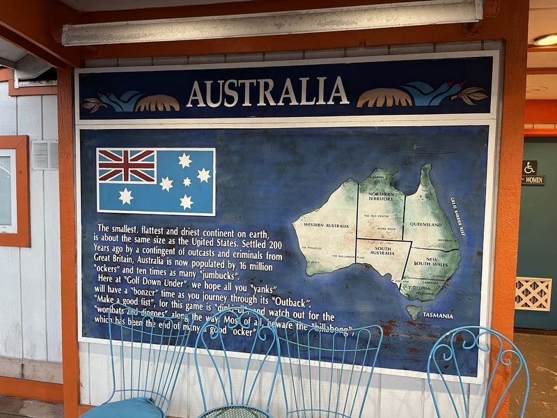
Australia
The smallest, flattest and driest continent on earth is about the same size as the United States. Settled 200 Years ago by a contingent of outcasts and criminals from Great Britain, Australia is now populated by 16 million "ockers" and ten times as many "jumbucks".
Here at "Golf Down Under" we hove all you "yanks" will have a "bonzer" time as you journey through its "outback". "Make a good fist", for this game is "dinki-di", and watch out for the "wombats and dingoes" along the way. Most of all, beware the "billabong", which has been the end of many a good "ocker".
Erected by Golf Down Under, Nick's Mini Golf.
Topics. This historical marker is listed in these topic lists: Colonial Era • Law Enforcement • Settlements & Settlers. A significant historical year for this entry is 1770.
Location. 38° 27.094′ N, 75° 3.155′ W. Marker is on Fenwick Island, Delaware, in Sussex County. Marker is on Coastal Highway (Delaware Route 1) south of Lighthouse Road (Delaware Route 54), on the right when traveling south. Touch for map. Marker is at or near this postal address: 31 Coastal Hwy, Fenwick Island DE 19944, United States of America. Touch for directions.
Other nearby markers. At least 8 other markers are within 5 miles of this marker, measured as the crow flies. Eastern End of Transpeninsular Line Between Maryland and Three Lower Counties of Pennsylvania (about 400 feet away, measured in a direct line in Maryland); The Fenwick Island Lighthouse (about 700 feet away); Mason and Dixon Line-Survey Start (about 700 feet away); Transpeninsular Line (about 700 feet away); Sam Wilkinson (1994 - 2003) (approx. 1.2 miles away in Maryland); South Bethany's Local Government Evolves Over the Years (approx. 4.8 miles away); Key Dates and Events in the Town's History (approx. 4.8 miles away); Life in South Bethany Through the Years (approx. 4.8 miles away). Touch for a list and map of all markers in Fenwick Island.
Additional keywords. penal colonies
Credits. This page was last revised on February 13, 2023. It was originally submitted on September 18, 2022, by Devry Becker Jones of Washington, District of Columbia. This page has been viewed 98 times since then and 27 times this year. Photos: 1, 2. submitted on September 18, 2022, by Devry Becker Jones of Washington, District of Columbia.

