Cahokia Heights in St. Clair County, Illinois — The American Midwest (Great Lakes)
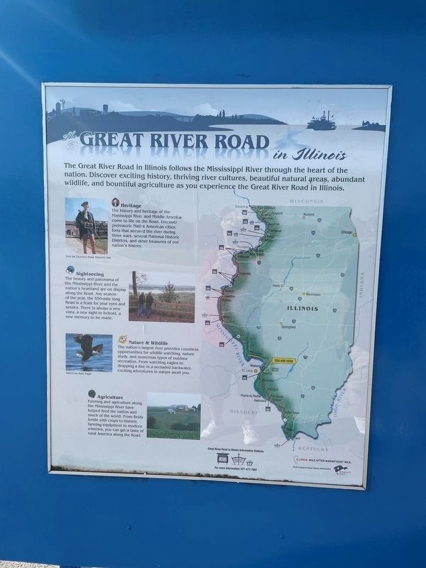
Great River Road
in Illinois
The Great River Road in Illinois follows the Mississippi River through the heart of the nation. Discover exciting history, thriving river cultures, beautiful natural areas, abundant wildlife, and bountiful agriculture as you experience the Great River Road in Illinois.
Heritage
The history and heritage of the Mississippi Rive and Middle America come to life on the Road. Discover prehistoric Native American cities, forts that second the river during three wars several National Historic Districts, and other treasures of our nation's history.
Sightseeing
The beauty and panorama of the Mississippi River and the nation's heartland are on display along the Road. Any season of the year, the 550 m long Road is a feast for your eyes and senses. There is always a new vista, a new sight to behold a new memory to be made.
🦋 Nature & Wildlife
The nation's largest river provides countless opportunities for wild watching, nature study, and numerous types of outdoor recreation. From watching eagles to dropping line in a secluded backwater exciting adventures in nature await you.
🚜 Agriculture
Farming and agriculture along the Mississippi River have helped food the nation and much of the world. From fields fertile with crops to bit farming equipment mode wineries, you can get a taste of rural America along the Road.
Topics. This historical marker is listed in these topic lists: Agriculture • Animals • Notable Places • Parks & Recreational Areas.
Location. 38° 34.254′ N, 90° 11.214′ W. Marker is in Cahokia Heights, Illinois, in St. Clair County. Marker is at the intersection of Camp Jackson Road (State Road 157) and Falling Springs Road, on the right when traveling east on Camp Jackson Road. Touch for map. Marker is at or near this postal address: 3160 Falling Springs Rd, East Saint Louis IL 62206, United States of America. Touch for directions.
Other nearby markers. At least 8 other markers are within walking distance of this marker. Jarrot Mansion (within shouting distance of this marker); a different marker also named Jarrot Mansion (within shouting distance of this marker); French-Colonial Home Site Of Jean Baptiste Hamelin (about 300 feet away, measured in a direct line); This Stretch of Road (about 300 feet away); Fort Bowman (about 300 feet away); Chief Pontiac (about 400 feet away); The Grand Plan (about 400 feet away); 13 Star Day (about 400 feet away). Touch for a list and map of all markers in Cahokia Heights.
Credits. This page was last revised on August 2, 2023. It was originally submitted on September 19, 2022, by Thomas Smith of Waterloo, Ill. This page has been viewed 79 times since then and 11 times this year. Photo 1. submitted on September 19, 2022, by Thomas Smith of Waterloo, Ill. • Devry Becker Jones was the editor who published this page.
Editor’s want-list for this marker. A wide shot of the marker in context. • Can you help?
