Verona Hills in Kansas City in Jackson County, Missouri — The American Midwest (Upper Plains)
New Santa Fe
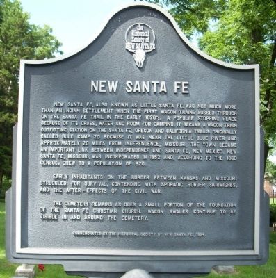
New Santa Fe, also known as Little Santa Fe, was not much more than an Indian settlement when the first wagon trains passed through on the Santa Fe Trail in the early 1820's. A popular stopping place because of its grass, water and room for camping, it became a wagon train outfitting station on the Santa Fe, Oregon, and California Trails. Originally called Blue Camp 20 because it was near the Little Blue River and approximately 20 miles from Independence, Missouri, the town became an important link between Independence and Santa Fe, New Mexico. New Santa Fe, Missouri was incorporated in 1852 and, according to the 1860 census, grew to a population of 670.
Early inhabitants on the border between Kansas and Missouri struggled for survival, contending with sporadic border skirmishes, and the after-effects of the Civil War.
The cemetery remains as does a small portion of the foundation of the Santa Fe Christian Church. Wagon Swales continue to be visible in and around the cemetery.
Erected 1994 by Historical Society of New Santa Fe.
Topics and series. This historical marker is listed in these topic lists: Cemeteries & Burial Sites • Notable Places • Roads & Vehicles • Settlements & Settlers. In addition, it is included in the California Trail, the Oregon Trail, and the Santa Fe Trail series lists. A significant historical year for this entry is 1852.
Location. 38° 54.422′ N, 94° 36.349′ W. Marker is in Kansas City, Missouri, in Jackson County. It is in Verona Hills. Marker is on Santa Fe Trail, 0.1 miles west of Belleview Road, on the right when traveling west. Touch for map. Marker is in this post office area: Kansas City MO 64145, United States of America. Touch for directions.
Other nearby markers. At least 8 other markers are within 3 miles of this marker, measured as the crow flies. Oregon and California National Historical Trails / Santa Fe National Historic Trail (here, next to this marker); Trail Remnants (a few steps from this marker); a different marker also named New Santa Fe (within shouting distance of this marker); Santa Fe Trail (about 600 feet away, measured in a direct line); Trail Hazards (approx. 2 miles away); Amache Prowers (approx. 2.1 miles away); James Beckwourth (approx. 2.1 miles away); Jim Bridger (approx. 2.2 miles away). Touch for a list and map of all markers in Kansas City.
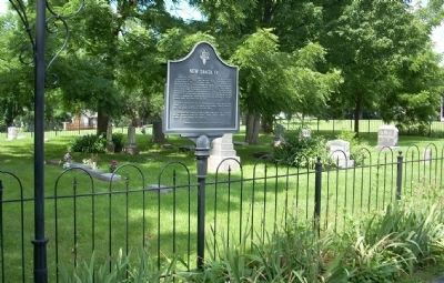
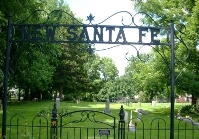
More about this marker. This is the Black marker to the right of the cemetery
gate along with the pair of flat panels to the left of the gate.
Also see . . .
1. Santa Fe Trail. National Park Service website homepage (Submitted on July 7, 2009, by Thomas Onions of Olathe, Kansas.)
2. Santa Fe Trail – Highway to the Southwest. Legends of America website entry (Submitted on July 7, 2009, by Thomas Onions of Olathe, Kansas.)
3. Mileposts Along the Oregon Trail. The Oregon Trail and its Pioneers website entry (Submitted on July 7, 2009, by Thomas Onions of Olathe, Kansas.)
4. Map of Oregon Trail. (Submitted on July 7, 2009, by Thomas Onions of Olathe, Kansas.)
5. Oregon National Historic Trail. National Park Service website entry (Submitted on July 7, 2009, by Thomas Onions of Olathe, Kansas.)
6. California National Historic Trail. National Park Service website homepage (Submitted on July 7, 2009, by Thomas Onions of Olathe, Kansas.)
Additional keywords. Santa Fe Trail Oregon Trail California Trail

4. Horse Thief 1898 by Debra Kornfield
This historical novel was inspired by the gravestone in this cemetery with this simple inscription. 2022 Book available on Amazon.com.
Click for more information.
This website may earn income if you use this link to make a purchase.
Click for more information.
This website may earn income if you use this link to make a purchase.
Credits. This page was last revised on February 10, 2023. It was originally submitted on July 7, 2009, by Thomas Onions of Olathe, Kansas. This page has been viewed 3,273 times since then and 117 times this year. Last updated on July 11, 2009, by Thomas Onions of Olathe, Kansas. Photos: 1, 2, 3. submitted on July 7, 2009, by Thomas Onions of Olathe, Kansas. 4. submitted on December 13, 2022, by J. J. Prats of Powell, Ohio. • Syd Whittle was the editor who published this page.


