Marietta in Washington County, Ohio — The American Midwest (Great Lakes)
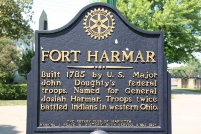
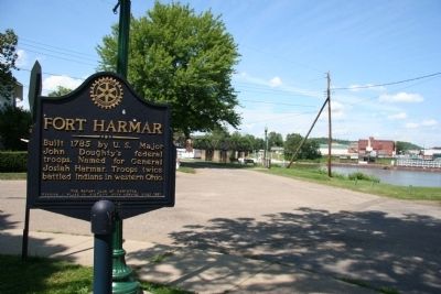
Fort Harmar
Rotary International
Erected by The Rotary Club of Marietta.
Topics and series. This historical marker is listed in these topic lists: Forts and Castles • Military • Native Americans • Settlements & Settlers • Wars, US Indian. In addition, it is included in the Rotary International series list. A significant historical year for this entry is 1785.
Location. 39° 24.589′ N, 81° 27.471′ W. Marker is in Marietta, Ohio, in Washington County. Marker is at the intersection of Fort Street and Fort Square, on the left when traveling north on Fort Street. This historical marker is located where the Muskingum River empties into the Ohio River, on the high north bank of the Ohio River, and on the west side of the Muskingum River. Touch for map. Marker is in this post office area: Marietta OH 45750, United States of America. Touch for directions.
Other nearby markers. At least 8 other markers are within walking distance of this marker. Site of the United States Fort Harmar (within shouting distance of this marker); Barber House (within shouting distance of this marker); Lewis and Clark Expedition / Letter to the President (within shouting distance of this marker); Save Harmar Bridge (about 500 feet away, measured in a direct line); B&O Harmar Bridge (about 500 feet away); Harmar Post Office (about 600 feet away); Harmar Lodge No. 390 (about 600 feet away); Fearing House (about 600 feet away). Touch for a list and map of all markers in Marietta.
Also see . . .
1. Fort Harmar. This link is published and made available by, "Ohio History Central," an online encyclopedia of Ohio History. (Submitted on July 11, 2009, by Dale K. Benington of Toledo, Ohio.)
2. Josiah Harmar. This web link was both published and made available by, "Absolute Astronomy.com," in it's quest to enable "exploring the universe of knowledge" (Submitted on July 11, 2009, by Dale K. Benington of Toledo, Ohio.)
Credits. This page was last revised on November 30, 2022. It was originally submitted on July 11, 2009, by Dale K. Benington of Toledo, Ohio. This page has been viewed 1,302 times since then and 25 times this year. Photos: 1, 2. submitted on July 11, 2009, by Dale K. Benington of Toledo, Ohio. 3. submitted on October 28, 2022, by Craig Doda of Napoleon, Ohio. • Syd Whittle was the editor who published this page.


