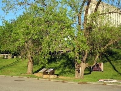
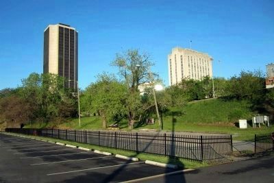
Upper Shockoe Valley in Richmond, Virginia — The American South (Mid-Atlantic)
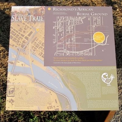
Richmond's African Burial Ground
— Richmond Slave Trail —
Inscription.
(left panel)
“Se wo were fin a wosankofa a yenkyi.”
“It is not wrong to go back for that which you have forgotten.”
-A proverb of the Akan people of West Africa
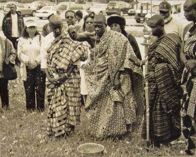
An elder once said that cemeteries are not for the dead, but for the living. They are a place where the living come and pay homage to those to whom a debt is owed. This reclaimed sacred ground is where the living descendants of those enslaved and free Africans who rest here now come to pay homage to those upon whose shoulders we stand, and to find that which has been forgotten.
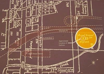
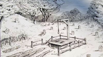
On October 10, 1800, the last of the rebels executed in Richmond at the city gallows – the “usual place” – was Gabriel, the famous 1800 conspiracy’s leader. The gallows are roughly marked with the letter “N” on the 1810 Young Map within the Burial Ground. When citizens had pleaded that the executions that occurred near Gamble’s Hill had caused distress to their families, Henrico County authorities agreed to relocate the gallows to “the ground adjacent to the powder magazine.”1 Condemned people were often hanged by strangulation, the most painful execution method at that time. Attached to the gallows – two upright post and a cross piece – a rope and noose suspended and strangled the condemned person as the cart that had carried the victim to the gallows was moved away, causing a slow death known as the “short drop”. This kind of torturous capital punishment of an enslaved man, Billy Harris, had occurred in Richmond just four years earlier in 1796.2
An advocate for a dramatically improved burial site, free African Chritopher McPherson (b 1763?) pointedly observed, “the humiliating circumstances, that this [burial ground] is the very express gallows ground where malefactors are interred.”3 It is likely that Gabriel was buried there. Historian Douglas Egerton assumes the site is now below an overpass and “rusty cars leak oil onto the blacktop just above Gabriel’s bones.”4
About the Trail
Designed as a walking path, the Richmond Slave Trail chronicles the history of the trade in enslaved Africans from their homeland to Virginia until 1778, and away from Virginia, especially Richmond, to other locations in the Americas until 1865. The trail begins at the Manchester Docks, which, alongside Rocketts Landing on the north side of the river, operated as a major port in the massive downriver slave trade, making Richmond the largest source of enslaved blacks on the east coast of America from 1830 to 1860. While many of the slaves were shipped on to New Orleans and to other Deep South ports, the trail follows the footsteps of those who remained here and crossed the James River, often chained
together in a coffle. Once reaching the northern riverbank, the trail then follows a route through the slave markets and auction houses of Richmond, beside the Reconciliation Statue commemorating the international triangular slave trade and on to the site of the notorious Lumpkin’s Slave Jail and leading on to Richmond’s African Burial Ground, once called the Burial Ground for Negroes, and the First African Baptist Church, a center of African American life in pre-Civil War Richmond. - Richmond Slave Trail Commission – 2011 –
Title image: “After the Sale: Slaves Going South”, 1853, Painted from live by Eyre Crowe, courtesy the Chicago History Museum
(right panel)
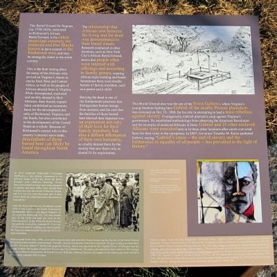
This Burial Ground for Negroes (ca. 1750-1816), reclaimed as Richmond’s African Burial Ground, is the oldest municipal cemetery for enslaved and free Blacks known to have existed in the Richmond area, and may be among the oldest in the entire country.
This is the final resting place for many of the Africans who arrived on Virginia’s shores in chains from West and Central Africa, as well as for people of African descent born in Virginia. While disrespected, exploited and terribly abused in their lifetimes, their forced, unpaid labor established an economic basis for the development not only of Richmond, Virginia, and the South, but also contributed to the development
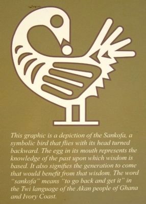
3. Sankofa
This graphic is a depiction of the Sankofa, a symbolic bird that flies with its head turned backward. The egg in its mouth represents the knowledge of the past upon which wisdom is based. It also signifies the generation to come that would benefit from that wisdom. The word “sankofa” means “to go back and get it” in the Twi language of the Akan people of Ghana and Ivory Coast.
The relationship that Africans saw between the living and the dead was demonstrated in their burial ritua1s. Research conducted at other locations, such as New York City’s African Burial Ground, shows that people often were interred with offerings and according to family groups, wearing African-style clothing and beads. Sometimes there were double burials of family members, such as a parent and a child.
Burying the dead is one of the fundamental practices that distinguishes human beings from animals, and the care that the families of those buried here showed their departed was an expression not only of their love for their family members, but also a defiant affirmation of their own humanity, so cruelly denied them by the society that saw them only as chattel fit for exploitation.
The Burial Ground was also the site of the Town Gallows, where Virginia’s young freedom-fighting hero Gabriel of the nearby Prosser plantation was executed on Oct. 10, 1800, for his role in attempting to lead a mass rebellion against slavery. Courageously, Gabriel planned a coup against Virginia’s government. He established methodology from observing the American Revolution and the triumphs
of enslaved Africans in Haiti. Gabriel and 25 other enslaved Africans were executed here or in three other locations after courts convicted them for their roles in the conspiracy. In 2007, Governor Timothy M. Kaine pardoned Gabriel, saying, “Gabriel’s cause -- the end of slavery and the furtherance of equality for all people -- has prevailed in the light of history.”
Henrico County, Court Records, Judgements 1793-1800, folder “Sep-Oct 1800”: Commonwealth Causes, Gabriel’s Rebellion, Petition, Dunscomb et al. (12 others) ti the Worshipfull Justices of Henrico County, September 18, 1800, EP; Robert Gamble, Mutual Assurance Society policy no. 635, 1802, http://image.lva.virginia.gov/cgi-bin/GetMU.pl?dir=0526/G0034&card=103 Document Image; Jeffery Ruggles, “The Burial Ground: an Early African American Site in Richmond,” http://www.scribd.com/doc/42051809/Burial-Ground-Ruggles-12-09; The Virginia Journals of Benjamin Henry Latrobe, 1795-1708, Edward C. Carter II, ed. (New Haven, 1977), I, 191-93; Richmond City Hustings Court Order Book, 1792-1797, 492; McPherson, A Short History of the Life of Christopher McPherson (Lynchburg, Va., 1885); Douglas R. Egerton, Death or Liberty: African Americans and Revolutionary America (N.Y., 2009), 281
(sidebar)
In 1810, prominent Richmonder Christopher McPherson, a free African, complained to the political leaders of the day about the Burial Ground’s poor condition, observing, “Every heavy rain commits ravages upon some one grave or another, and some coffins have already been washed away into the current of Shockoe stream, and in a very few years the major part of them will no doubt be washed down into the current of James River.”
After the Burial Ground was abandoned around 1816, it was covered under layers of successive development, and was later largely forgotten. At one point the Richmond City Jail was located here. In the 1930s this land was used for the City dog pound. In the 1950s the Burial Ground was partially covered by Interstate 95. From the 1970s it was used as a parking lot, most recently by Virginia Commonwealth University (VCU), a state institution.
Rediscovered in the early 1990s, community organizations and advocates began demanding that the site of the Burial Ground be reclaimed and properly memorialized. Through a process of research, education and protest, this goal is being accomplished. In 2011 Governor Robert F. McDonnell proposed funding, which was apporved by the Virginia House of Delegates and the Senate, to allow the transfer of land from VCU to the City of Richmond. The parking lot asphalt has been removed. This signage is the next effort to memorialize the Burial Ground. With the continued interest and support of the community,
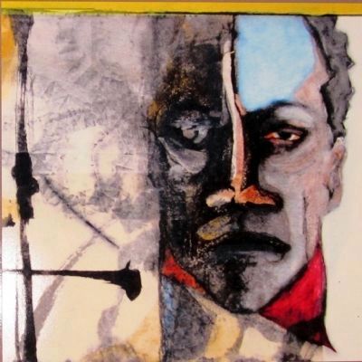
6. Painting of Gabriel Prosser, Ana Edwards, 2004
The title of the original painting is "Portrait of Gabriel". "Prosser" is not a name used by or for Gabriel during his lifetime. It was most likely added because someone thought he should have a last name in some later account. But the historical records of the day all refer to him only as Gabriel or Prosser's Gabriel.
Erected 2011 by Richmond Slave Trail Commission. (Marker Number 16.)
Topics. This historical marker is listed in these topic lists: Abolition & Underground RR • African Americans • Cemeteries & Burial Sites. A significant historical date for this entry is September 18, 1665.
Location. 37° 32.271′ N, 77° 25.646′ W. Marker is in Richmond, Virginia. It is in Upper Shockoe Valley. Marker can be reached from the intersection of East Marshall Street and North 16th Street, on the left when traveling west. Touch for map. Marker is at or near this postal address: 1540 East Broad Street, Richmond VA 23219, United States of America. Touch for directions.
Other nearby markers. At least 8 other markers are within walking distance of this marker. Execution of Gabriel (within shouting distance of this marker); Slave Rebellion leader Gabriel Prasser… (about 300 feet away, measured in a direct line); Lumpkin's Jail (about 600 feet away); First African Baptist Church (about 600 feet away); a different marker also named First African Baptist Church (about 600 feet away); Winfree Cottage (about 700 feet away); Egyptian Building (about 800 feet away); The Virginia Convention of 1788 (approx. 0.2 miles away). Touch for a list and map of all markers in Richmond.
Also see . . . African Burial Ground. (Submitted on June 15, 2022.)
Credits. This page was last revised on February 1, 2023. It was originally submitted on April 19, 2011, by Bernard Fisher of Richmond, Virginia. This page has been viewed 2,833 times since then and 68 times this year. Last updated on October 7, 2022, by Ana Edwards of Richmond, Virginia. Photos: 1, 2, 3, 4, 5, 6, 7, 8, 9. submitted on April 19, 2011, by Bernard Fisher of Richmond, Virginia.
