Near Sharpsburg in Washington County, Maryland — The American Northeast (Mid-Atlantic)
A Simple Farm Lane Changed Forever
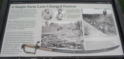
During the early hours of the battle, Col. John Brown Gordon promised Robert E. Lee, "These men are going to stay here, General, till the sun goes down or victory is won." The Confederate troops that Gordon commanded were part of a well protected line of over 2,200 men hunkered down behind piled-up fence rails in this well worn sunken road.
When the Federal attacks shifted south at approximately 9:30 a.m., the Confederates held their fire until the last possible second. Then, as Gordon remembered, "My rifles flamed and roared in the Federals' faces like a blinding blaze of lightning...the entire line, with few exceptions, went down in the consuming blast."
For more than three hours thousands of men blazed away at each other at point-blank range. Eventually the overwhelming Union numbers and confusion in the Confederate ranks forced the defenders back. When the fighting subsided, 5,500 soldiers lay dead or wounded on the field and in the road. That number included Col. Gordon, who had been hit five different times. After the deadly struggle for this sunken road, soldiers who fought here described it as the "road of death" and a "ghastly flooring." From that day forward, the road has been known as Bloody Lane.
Erected 2009 by Antietam National Battlefield - National Park Service - U.S. Department of the Interior.
Topics. This historical marker is listed in this topic list: War, US Civil.
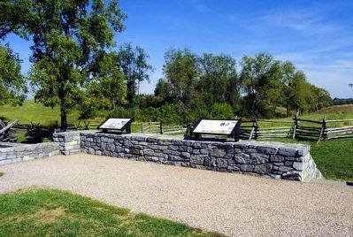
Location. 39° 28.259′ N, 77° 44.364′ W. Marker is near Sharpsburg, Maryland, in Washington County. Marker is on Richardson Avenue, on the left when traveling east. Located at the Sunken Road overlook stop. Touch for map. Marker is in this post office area: Sharpsburg MD 21782, United States of America. Touch for directions.
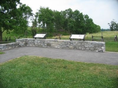
Other nearby markers. At least 8 other markers are within walking distance of this marker. "These Men Are Going to Stay Here" (here, next to this marker); "The End of the Confederacy Was In Sight" (here, next to this marker); Heaps Upon Heaps Were There in Death's Embrace (here, next to this marker); The 14th Indiana Infantry (within shouting distance of this marker); 8th Ohio Regiment (within shouting distance of this marker); 132nd Pennsylvania Volunteer Infantry (within shouting distance of this marker); Second Army Corps (about 300 feet away, measured in a direct line); Jackson's Command (about 300 feet away). Touch for a list and map of all markers in Sharpsburg.
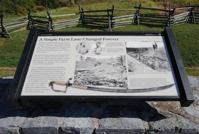
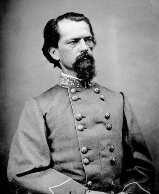
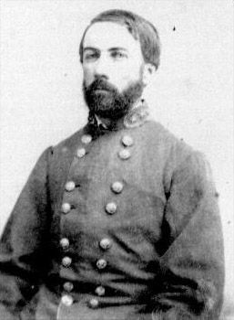
More about this marker. In the upper center are portraits of Col. Gordon and General D.H. Hill. Col. John Gordon (left) survived his five wounds at Antietam. He fought for the Confederacy for the rest of the war. Later he was Governor of Georgia and a U.S. Senator. West Pointer and Confederate division commander, Gen. Daniel Harvey Hill (right), commanded the soldiers who fought in the Sunken Road.
In the lower center and right are photos taken after the battle. Photographer Alexander Gardner took these two photographs of the aftermath in Bloody Lane.
At the bottom is a sword. Union soldiers captured this sword from Capt. Edwin Osborne, 4th North Carolina Infantry. A soldier in his unit wrote how at Antietam "the roar of musketry was incessant... soon Capt. Marsh was mortally wounded - Capt. Osborne was wounded and borne from the field. One by one the other company officers fell, either killed or wounded until 2Lt. Weaver was in command of the handful of men who were left, and then he was killed bearing the colors of the regiment in his hand."
Related marker. Click here for another marker that is related to this marker. This marker replaced a previous one titled "These Men Are Going to Stay Here."
Also see . . .
1. Antietam Battlefield. National Park Service site. (Submitted on July 11, 2009, by Craig Swain of Leesburg, Virginia.)
2. John Brown Gordon. John Brown Gordon (February 6, 1832 – January 9, 1904) was one of Robert E. Lee's most trusted Confederate generals[1] by the end of the American Civil War. After the war, he was a strong opponent of Reconstruction, and he served as a U.S. Senator from 1873 to 1880, and 1891 to 1897. He also served as the 53rd Governor of Georgia from 1886 to 1890. (Submitted on September 27, 2015, by Brian Scott of Anderson, South Carolina.)
3. Daniel Harvey Hill. Daniel Harvey Hill (July 12, 1821 – September 24, 1889) was a Confederate general during the American Civil War and a Southern scholar. He was known as an aggressive leader, and as an austere, deeply religious man, with a dry, sarcastic humor. (Submitted on September 27, 2015, by Brian Scott of Anderson, South Carolina.)
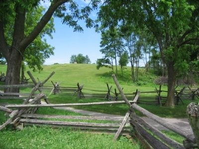
Photographed By Craig Swain, July 5, 2009
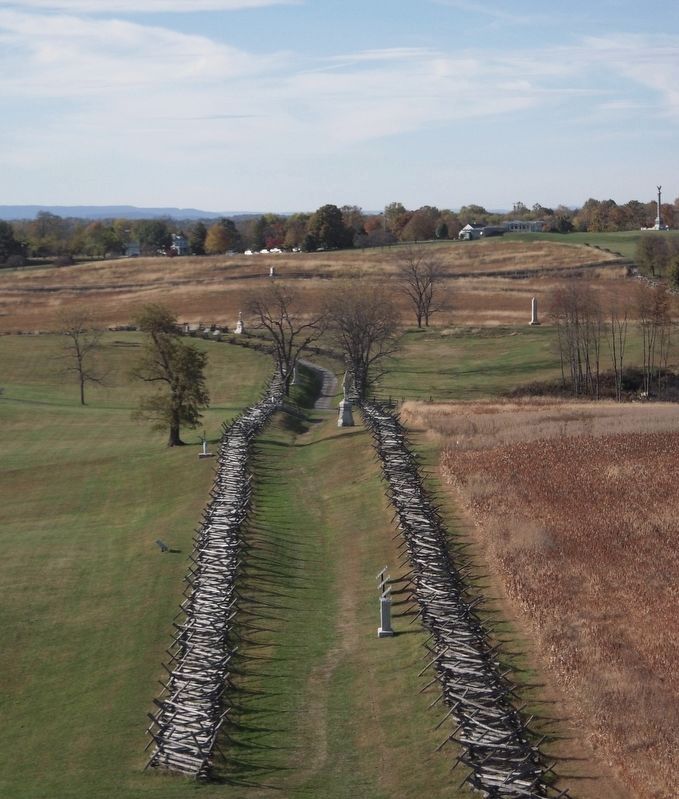
6. The Sunken Road or Bloody Lane
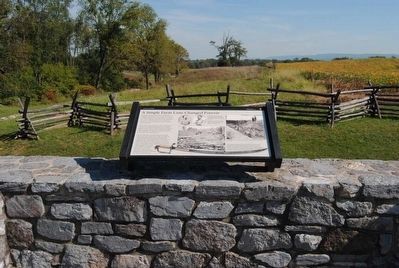
Looking from near the observation point to the northeast. The farm lane was bordered by two snake rail fences, as reconstructed here. Federals in French's Division first approached the sunken lane from across the open ground on the other side of the fences. The Confederates were concealed by the road embankment.
Credits. This page was last revised on April 1, 2022. It was originally submitted on July 11, 2009, by Craig Swain of Leesburg, Virginia. This page has been viewed 1,553 times since then and 47 times this year. Photos: 1. submitted on July 11, 2009, by Craig Swain of Leesburg, Virginia. 2. submitted on September 27, 2015, by Brian Scott of Anderson, South Carolina. 3. submitted on July 11, 2009, by Craig Swain of Leesburg, Virginia. 4, 5. submitted on September 27, 2015, by Brian Scott of Anderson, South Carolina. 6. submitted on July 11, 2009, by Craig Swain of Leesburg, Virginia. 7. submitted on July 4, 2021, by Bradley Owen of Morgantown, West Virginia. 8, 9. submitted on September 27, 2015, by Brian Scott of Anderson, South Carolina.
