
Hopwood in Fayette County, Pennsylvania — The American Northeast (Mid-Atlantic)
Jumonville Glen
Fort Necessity National Battlefield
Photographed by Craig Swain, October 6, 2022
1. Jumonville Glen Marker
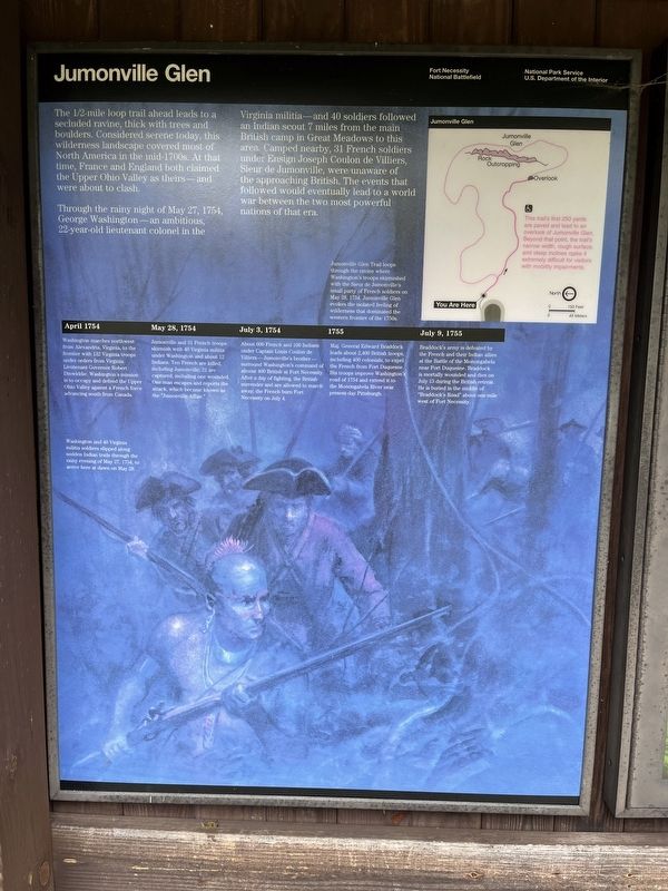
The 1/2-mile loop trail ahead leads to a secluded ravine, thick with trees and boulders. Considered serene today, this wilderness landscape covered most of North America in the mid-1700s. At that time, France and England both claimed the Upper Ohio Valley as theirs - and were about to clash.
Through the rainy night of May 27, 1754, George Washington - an ambitious, 22-year-old lieutenant colonel in the Virginia militia - and 40 soldiers followed an Indian scout 7 miles from the main British camp in Great Meadows to this area. Camped nearby, 31 French soldiers under Ensign Joseph Coulon de Villiers, Sieur de Jumonville, were unaware of the approaching British. The events that followed would eventually lead to a world war between the two most power full nations of that era.
Jumonville Glen Trail loops through the ravine where Washington's troops skirmished with Sieur de Jumonville's small party of French soldiers on May 28, 1754. Jumonville Glen evokes the isolated feeling of wilderness that dominated the western frontier of the 1750s.
Timeline
April 1754
Washington marches northwest from Alexandria, Virginia to the
this page online
May 28, 1754
Jumonville and 31 French troops skirmish with 40 Virginia militia under Washington and about 12 Indians. Ten French are killed including Jumonville; 21 are captured, including one wounded. One man escapes and reports the attack, which became known as the "Jumonville Affair."
July 3, 1754
About 600 French and 100 Indians under Captain Louis Coulon de Villiers - Jumonville's brother - surrounded Washington's command of almost 400 British at Fort Necessity. After a day of fighting, the British surrender and are allowed to march away, the French burn Fort necessity on July 4
1755
Maj. General Edward Braddock leads about 2,400 British troops including 400 colonials, to expel the French from Fort Duquesne. His troops improve Washington's road of 1754 and extend it to the Monongahela River near present-day Pittsburgh.
July 9, 1755
Braddock's army is defeated by the French and their Indian allies at the Battle
Photographed by Craig Swain, October 6, 2022
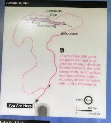
2. Jumonville Glen Trail Map
The trail's first 250 yards are paved and lead to an overlook of Jumonville Glen. Beyond that point, the trail's narrow width, rough surface, and steep inclines make it extremely difficult for visitors with mobility impairments.
Right Side of Kiosk:
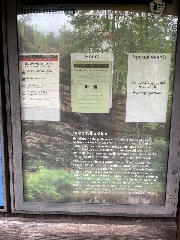
Jumounville Glen
By following the path you will reach a secluded glen. At this spot on May 28, 1754 three cultures collided in what many historians recognize as the opening shots of the French and Indian War. The site still retains its remoteness and one can easily be transported back in time to the fifteen minute skirmish that changed the world.
This glen was where a young George Washington, his Virginia troops, and Native allies, ambushed a small number of French, under the command of Joseph Coulon de Jumonville. While the exact events are unknown, the British killed or captured all but one of the French soldiers, including their commander. That lone survivor fled to Fort Duquesne, modern day Pittsburgh, to get reinforcements and retaliate against the British. This retaliation took place at Fort Necessity on July 3, 1754. These events culminated in the outbreak of the French and Indian War.
Erected by National
Photographed by Craig Swain, October 6, 2022
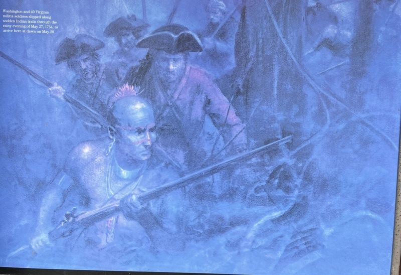
3. Close Up of Illustration
Washington and 40 Virginia militia soldiers slipped along sodden Indian trails through the rainy evening of May 27, 1754, to arrive here at dawn on May 28.
Topics. This historical marker is listed in this topic list: War, French and Indian. A significant historical month for this entry is April 1754.
Location. 39° 52.796′ N, 79° 38.54′ W. Marker is in Hopwood, Pennsylvania, in Fayette County. It can be reached from Jumonville Road (County Route 2021), on the right when traveling north. Located in the parking lot for the Jumonville Glen unit of the Fort Necessity National Battlefield. Touch for map. Marker is in this post office area: Hopwood PA 15445, United States of America. Touch for directions.

Regionally, this marker is in Pennsylvania’s Laurel Highlands. It is also in the American Northeast, in the Mid-Atlantic, in Appalachia, and specifically in Northern Appalachia. Globally, it is in North America, the Western Hemisphere, the Western World, and the Anglosphere. Historically, it finds itself in what was once the Viceroyalty of New France, the Haudenosaunee (Iroquois) Confederacy, and one of the original Thirteen Colonies.
Other nearby markers. At least 8 other markers are within walking distance of this marker: From Jumonville to a World War
Photographed by Craig Swain, October 6, 2022
4. Right Side of Kiosk
The right side of the Kiosk displays park operating hours and regulations. And the text on the bottom half is transcribed into this marker entry.
Also see . . .
1. Fort Necessity National Battlefield. National Park Service website entry:
The park has three primary units - the Fort Necessity and Washington Tavern's unit, Braddock's Grave unit, and Joumonville Glen. The last, and where this marker is located, is the most remote of the three. The other two are astride the National Road (US Highway 40). (Submitted on October 8, 2022, by Craig Swain of Leesburg, Virginia.)
2. Jumonville Glen Skrimish. George Washington's Mount Vernon website entry:
The article details the events leading up to May 28, 1754 and explains some of the controversies surrounding the action. (Submitted on October 8, 2022, by Craig Swain of Leesburg, Virginia.)
Photographed by Craig Swain, October 6, 2022
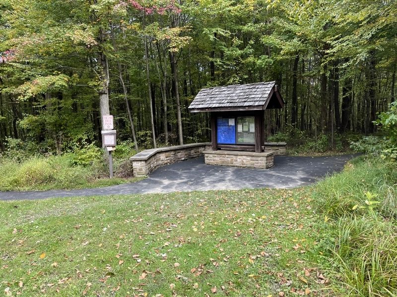
5. Jumonville Glen Marker and trailhead kiosk
Located at the parking lot for the Jumonville Glen unit of the Fort Necessity National Battlefield Park.
Photographed by Craig Swain, October 6, 2022
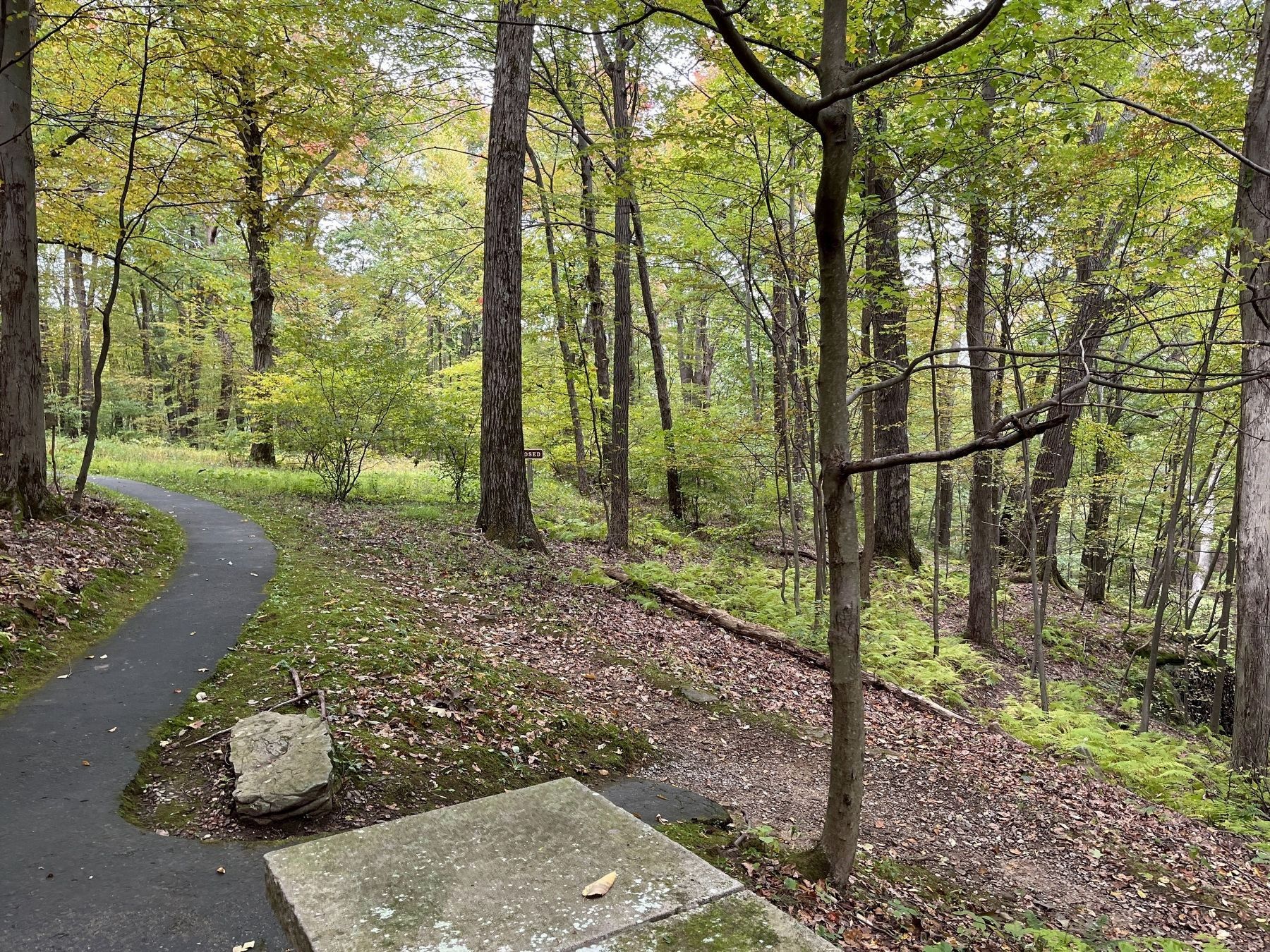
6. Overlooking Jumonville Glen
At the end of the paved trail is this overlook of the glen. In the foreground is the high ground and rock outcroppings used by Washington's men. On the right, below the outcroppings, is Jumonville's camp site and the glen now named for him.
Credits. This page was last revised on January 12, 2025. It was originally submitted on October 8, 2022, by Craig Swain of Leesburg, Virginia. This page has been viewed 1,597 times since then and 164 times this year. Photos: 1, 2, 3, 4, 5, 6. submitted on October 8, 2022, by Craig Swain of Leesburg, Virginia.
