Charleston on Staten Island in Richmond County, New York — The American Northeast (Mid-Atlantic)
The Gericke / Winant Farm
New York State, Office of Parks, Recreation, Historic Preservation
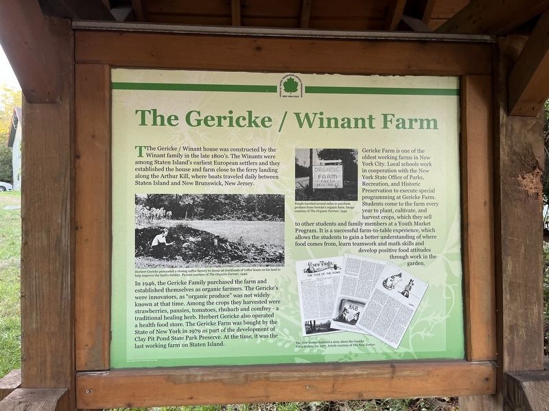
The Gericke / Winant house was constructed by the Winant family in the late 1800's. The Winants were among Staten Island's earliest European settlers and they established the house and farm close to the ferry landing along the Arthur Kill, where boats traveled daily between Staten Island and New Brunswick, New Jersey.
In 1946, the Gericke Family purchased the farm and established themselves as organic farmers. The Gericke's were innovators, as "organic produce" was not widely known at that time. Among the crops they harvested were strawberries, pansies, tomatoes, rhubarb and comfrey - a traditional healing herb. Herbert Gericke also operated a health food store. The Gericke Farm was bought by the State of New York in 1979 as part of the development of Clay Pit Pond State Park Preserve. At the time, it was the last working farm on Staten Island.
Gericke Farm is one of the oldest working farms in New York City. Local schools work in cooperation with the New York State Office of Parks, Recreation, and Historic Preservation to execute special programming at Gericke Farm. Students come to the farm every year to plant, cultivate, and harvest crops, which they sell to other students and family members at a Youth Market Program. It is a successful farm-to-table experience, which allows the students to gain a better understanding of where food comes from, learn teamwork and math skills and develop positive food attitudes through work in the garden.
[Captions:]
Herbert Gericke persuaded a closing coffee factory to dump 56 truckloads of coffee beans on his land to help improve the land's fertility. Picture courtesy of The Organic Farmer, 1949.
People traveled several miles to purchase produce from Gericke's organic farm. Image courtesy of The Organic Farmer, 1949.
The New Yorker featured a story about the Gericke Farm in June 2020, 1977. Article courtesy of The New Yorker.
Erected by New York State, Office of Parks, Recreation, Historic Preservation.
Topics. This historical marker is listed in these topic lists: Agriculture • Education • Parks & Recreational Areas • Settlements & Settlers • Waterways & Vessels. A significant historical month for this entry is June 2020.
Location. 40° 32.836′ N, 74° 13.654′ W. Marker is on Staten Island, New York, in Richmond County. It is in Charleston. Marker is on Arthur Kill Road, 0.1 miles east of Grille Court, on the right when traveling east. Touch for map. Marker is at or near this postal address: 2876 Arthur Kill Rd, Staten Island NY 10309, United States of America. Touch for directions.
Other nearby markers. At least 8 other markers are within 2 miles of this marker,
Credits. This page was last revised on January 31, 2023. It was originally submitted on October 10, 2022, by Devry Becker Jones of Washington, District of Columbia. This page has been viewed 625 times since then and 80 times this year. Photos: 1, 2. submitted on October 10, 2022, by Devry Becker Jones of Washington, District of Columbia.

