Near Middlesboro in Bell County, Kentucky — The American South (East South Central)
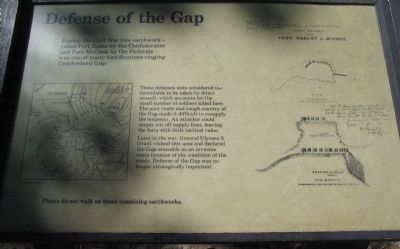
Defense of the Gap
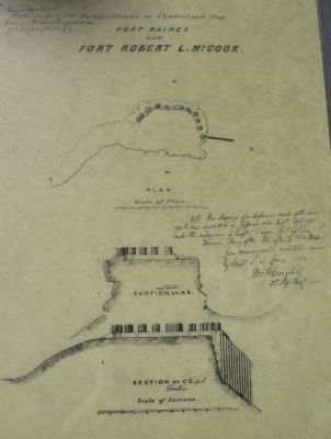
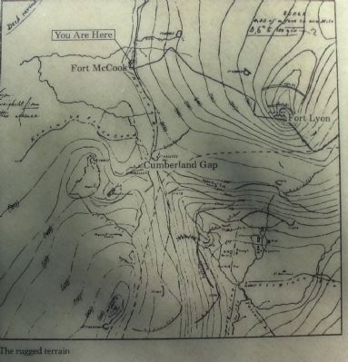
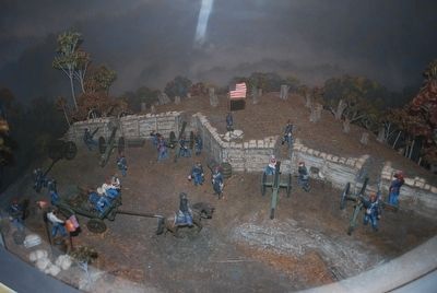
These defenses were considered too formidable to be taken by direct assault, which accounts for the small number of soldiers killed here. The poor roads and rough country of the Gap made it difficult to resupply the outposts. An attacker could simply cut off supply lines, leaving the forts with little tactical value.
Later in the war, General Ulysses S. Grant visited this area and declared the Gap unusable as an invasion route because of the condition of the roads. Defense of the Gap was no longer strategically important.
Please do not walk on these remaining earthworks.
Erected by National Park Service, U.S. Department of the Interior.
Topics. This historical marker is listed in these topic lists: Forts and Castles • War, US Civil.
Location. Marker has been permanently removed. It was located near 36° 36.518′ N, 83° 40.468′ W. Marker was near Middlesboro, Kentucky, in Bell County. Marker could be reached from Pinnacle Road, on the right when traveling east. Located on a foot path leading from a parking area to the Fort McCook site in Cumberland Gap National Historical Park. Touch for map. Marker was in this post office area: Middlesboro KY 40965, United States of America.
We have been informed that this sign or monument is no longer there and will not be replaced. This page is an archival view of what was.
Other nearby markers. At least 8 other markers are within walking distance of this location. Forts and Batteries, North and South (here, next to this marker); Two Armies, One Railroad (a few steps from this marker); A Masterful Retreat (approx. 0.2 miles away); Cumberland Gap / Grant Visits Cumberland Gap (approx. 0.2 miles away); Dirt-and-Log Forts (approx. 0.2 miles away); An Object Lesson Road (approx. 0.2 miles away); Two-Way Traffic (approx. 0.2 miles away); a different marker also named An Object Lesson Road (approx. 0.2 miles away). Touch for a list and map of all markers in Middlesboro.
More about this marker. This marker was replaced by "Forts and Batteries, North and South" https://www.hmdb.org/m.asp?m=205087
Related markers. Click here for a list of markers that are related to this marker. Cumberland Gap Civil War Defenses
Also see . . . Cumberland Gap National Historical Park. (Submitted on September 14, 2010, by Craig Swain of Leesburg, Virginia.)
Photographed By Craig Swain, September 5, 2010
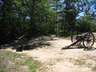
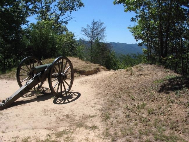
5. Bastion of Fort McCook
The field piece is a rifled 6-pdr field gun. It was made in 1861 by Marshall & Company of St. Louis, Missouri. It has registry number 31 on the muzzle and a weight stamp of 869 under the knob. It has seven groove, right-hand twist rifling.
Credits. This page was last revised on October 13, 2022. It was originally submitted on September 14, 2010, by Craig Swain of Leesburg, Virginia. This page has been viewed 1,535 times since then and 32 times this year. Last updated on October 13, 2022. Photos: 1, 2, 3, 4, 5. submitted on September 14, 2010, by Craig Swain of Leesburg, Virginia. 6, 7. submitted on September 14, 2015, by Brandon Fletcher of Chattanooga, Tennessee. • Mark Hilton was the editor who published this page.
