Perth in Lanark County, Ontario — Central Canada (North America)
Thousands of Years of Algonquin Homeland
Inscription.
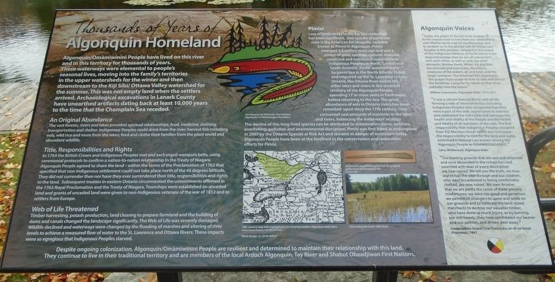
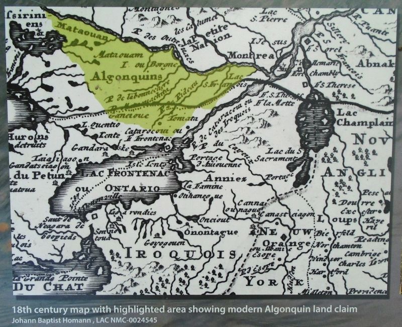
Algonquin/Omŕměwinini People have lived on this river and in this territory for thousands of years. These waterways were elemental to people's seasonal lives, moving into the family's territories in the upper watersheds for the winter and then downstream to the Kiji Síbí/Ottawa Valley watershed for the summer. This was not empty land when the settlers arrived. Archaeological excavations in Lanark County have unearthed artifacts dating back at least 10,000 years to the time that the Champlain Sea receded.
An Original Abundance
The vast forests, rivers and lakes provided spiritual relationships, food, medicine, clothing, transportation and shelter. Indigenous Peoples could drink from the river; harvest fish including eels, wild rice and more from the lakes; feed and clothe their families from the plant world and abundant wildlife.
Title, Responsibilities and Rights
In 1764 the British Crown and Indigenous Peoples met and exchanged wampum belts, using ceremonial protocols to confirm a nation-to-nation relationship in the Treaty of Niagara. Algonquin People agreed to share the land - within the terms of the Proclamation of 1763 that specified that non-Indigenous settlement could not take place north of the 45 degrees latitude. They did not surrender then nor have they ever surrendered their title, responsibilities and rights to the land. Subsequent treaties in eastern Ontario circumvented the commitments affirmed in the 1763 Royal Proclamation and the Treaty of Niagara. Townships were established on unceded land and grants of unceded land were given to non-Indigenous veterans of the war of 1812 and to settlers from Europe.
Web of Life Threatened
Timber harvesting, potash production, land clearing to prepare farmland and the building of dams and canals changed the landscape significantly. The Web of Life was severely damaged. Wildlife declined and waterways were changed by the flooding of marshes and altering of river levels to achieve a measured flow of water to the St. Lawrence and Ottawa Rivers. These impacts were so egregious that Indigenous Peoples starved.
Pimisi
Loss of biodiversity in the Kiji Síbí watershed has been significant. One species of particular note is the American Eel (Anguillar rostrata) known as Pimisi in Algonquin. Pimisi emerged 3.5 million years ago and was a source of great spiritual, cultural, material, medicinal and nutritional sustenance to Indigenous Peoples in North, Central and South America. Pimisi spawned in the Sargasso Sea in the North Atlantic Ocean and migrated up the St. Lawrence to Lake Ontario, the Ottawa River and to the other lakes and rivers in the ancestral territory of the
Algonquin People, spending 17 or more years in fresh water before returning to the Sea. The great abundance of eels in Ontario rivers has been remarked upon since the 17th century. They consumed vast amounts of nutrients in the lakes and rivers, balancing the waterways' ecology. The decline of this long-lived species can be attributed to colonization: dams, turbines, overfishing, pollution and environmental disruption. Pimisi was first listed as endangered in 2007 by the Ontario Species at Risk Act and remains in danger of extinction today. Algonquin People have been at the forefront in the conservation and restoration efforts for Pimisi.
Despite ongoing colonization, Algonquin/Omŕměwinini People are resilient and determined to maintain their relationship with this land. They continue to live in their traditional territory and are members of the local Ardoch Algonquin, Tay River and Shabot Obaadjiwan First Nations.
[Illustration captions, top to bottom, read]
• The American Eel (Pimisi) by Tony Amikons
• 18th century map with highlighted area showing modern Algonquin land claim
• Ancient eel-shaped fishing lure (18" long) found at the Perth archaeological site
• Harvesting Manňmin (Wild Rice)
Algonquin Voices
"Today, the plight of the Eel must awaken us to the crucial need to transform our relationship with Mother Earth and All Our Relations, and to awaken us to the pivotal role of Indigenous Peoples in this process. Inherent in the prayer of the Indigenous Nations of Turtle Island is the deep knowledge that we are all connected [...] with each other, as well as with the chief elements, Mother Earth, Water, Air and Fire, the animate and inanimate, the plants, creatures of the waters, air and land, and the larger universe. The American Eel reanimates this prayer from ocean to river to lake and across the timelines. I pray for its return as that silver pathway into the future."
William Commanda, Algonquin Elder, 1913-2011
"It was a vibrant Natural World with all life forming a web of interconnection including Indigenous Peoples who recognized that they were a part of the web, appreciated its entirety and celebrated the indivisible link between the health and vitality of the People and the health and vitality of all members of the web. The first responsibility that Indigenous Peoples accepted from Kiji Manitou (Great Spirit) was to honour the responsibility to care for the land and water, enshrined in Natural Law known among the Algonquin People as GINAWAYDAGANUC."
Larry McDermott, Algonquin Elder
"Our hunting grounds that are vast and extensive and once abounded in the richest furs and swarmed with deer of every description are now ruined. We tell you the truth, we now starve half the year through and our children who were accustomed to being comfortably clothed, are now naked. We own, brother, that we are partly the cause of these present misfortunes; we were too good and generous; we permitted strangers to come and settle on our grounds and to cultivate the land; wood merchants to destroy our valuable timber, who have done us much injury, as by burning our rich forests, they have annihilated our beaver and our peltries, and driven deer away."
Omŕměwinině Grand Chief Francis Ka-on-di-no-ketch
(Papineau), 1841
Topics. This historical marker is listed in these topic lists: Animals • Anthropology & Archaeology • Native Americans • Waterways & Vessels. A significant historical year for this entry is 1764.
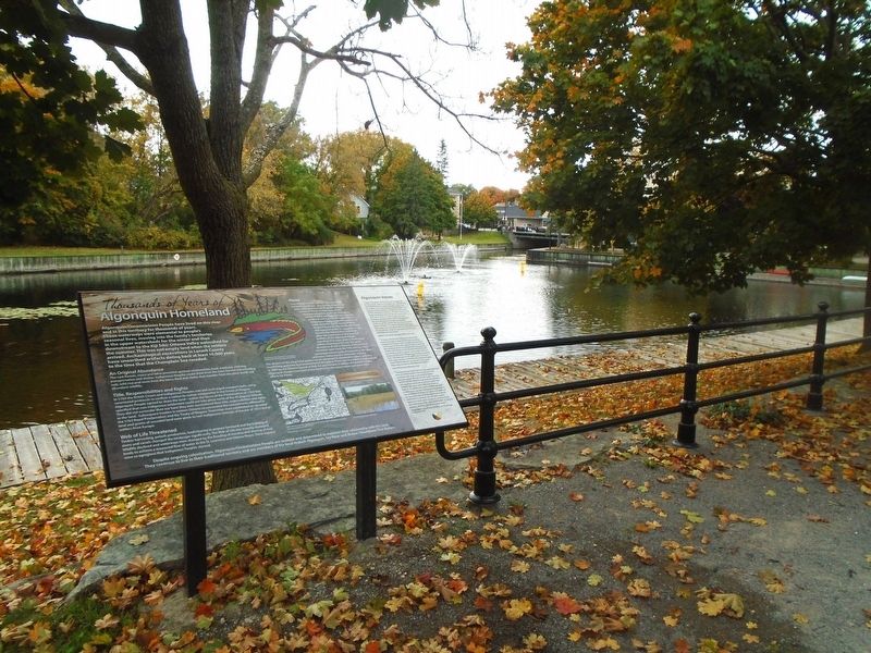
Location. 44° 53.991′ N, 76° 14.862′ W. Marker is in Perth, Ontario, in Lanark County. Marker is adjacent to the southeast side of the "Crystal Palace," along the Tay Basin. Touch for map. Touch for map. Marker is at or near this postal address: 28 Drummond Street East, Perth ON K7H 1E9, Canada. Touch for directions.
Other nearby markers. At least 8 other markers are within walking distance of this marker. International Friendship Fountains (within shouting distance of this marker); Perth, A Unique Blend / Perth un mélange exceptionnel (within shouting distance of this marker); The First Canal/ Le premier canal Tay (within shouting distance of this marker); By Barge and Bateau / Par barges et chalands (within shouting distance of this marker); Tay Canal Revival / Renaissance du canal Tay (within shouting distance of this marker); The Canal Evolves / l'Évolution du canal (within shouting distance of this marker); Canal Fever / la Fičvre des canaux du Canada (within shouting distance of this marker); 50th Anniversary of the World's Largest Cheese (within shouting distance of this marker). Touch for a list and map of all markers in Perth.
Also see . . . Algonquins of Ontario: Our Proud History. (Submitted on October 14, 2022, by William Fischer, Jr. of Scranton, Pennsylvania.)
Additional keywords. Thousands of Years of Algonquin Homeland
Credits. This page was last revised on October 14, 2022. It was originally submitted on October 14, 2022, by William Fischer, Jr. of Scranton, Pennsylvania. This page has been viewed 503 times since then and 332 times this year. Photos: 1, 2, 3. submitted on October 14, 2022, by William Fischer, Jr. of Scranton, Pennsylvania.


