Point Pleasant in Mason County, West Virginia — The American South (Appalachia)
Colonel Andrew Lewis
1720 - 1781
Inscription.
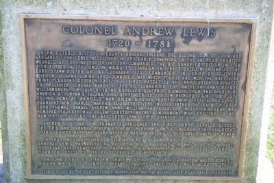
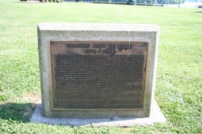
Born October 9, 1720, in County Donegal, Ireland. The second son of John and Margaret Lynn Lewis. He served in the early campaigns on the American frontier. Wounded at Fort Necessity in 1754. Commanded the Big Sandy Expedition in 1756. With Forbes in 1758 and on Bouquet's Campaign in 1764. Treated with Indians at Fort Stanwix 1768 and at Lochaber 1770. Commander-in-Chief of the Southern Division of Army during Lord Dunmore's War which fought and won the Battle of Point Pleasant October 19, 1774...first battle of the Revolution. Elevated to Brigadier General March 1, 1776. He commanded the American Army before Williamsburg. On July 9 - 10 he expelled Governor Dunmore from the shores of America at Gwynn's Island. Died September 25, 1781 in Bedford County en route to his home at "Richfield," now Salem, Virginia. Buried on his estate beside his youngest son, Charles. Married Elizabeth Givens in 1749. Father of seven children, John, Thomas, Samuel, Andrew, Anna, William and Charles. In 1897 his body was removed to East Hill Salem Cemetery where a monument was erected to his memory in 1902 by the Margaret Lynn Lewis Chapter of DAR.
Andrew's second son, Thomas, established the first ferry service across the Ohio and Kanawha Rivers at Point Pleasant on December 9, 1791. His great-granddaughter, Mary Ann Adams Maverick, was San Antonio's first pioneer American woman.
In 1909, West Virginia's historian, Virgil A. Lewis, wrote: "General Lewis was a leading actor in all the events in which he took part, yet fame has trumpeted to the world his exploits with far feebler tone than the deeds of others of far less importance."
On June 3, 1965, at 3:45 P.M., Andrew Lewis' fifth great-grandson, Major Edward Higgins White II of Gemini 4, became the first American to walk in outer space.
Erected 1977 by The Point Pleasant Rotary Club and the Mason County Bicentennial Commission.
Topics and series. This historical marker is listed in these topic lists: Industry & Commerce • Native Americans • War, US Revolutionary • Wars, US Indian • Waterways & Vessels. In addition, it is included in the Rotary International series list. A significant historical date for this entry is March 1, 1539.
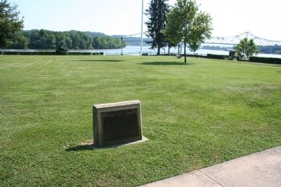
Location. 38° 50.358′ N, 82° 8.457′ W. Marker is in Point Pleasant, West Virginia, in Mason County. Marker is on Main Street, 0 miles west of 1st Street, on the right when traveling south. This historical marker is just one of several historical markers that are situated at the Point Pleasant Battlefield State Park, in downtown Point Pleasant, West Virginia. The park itself is located on the east side of the Kanawha River at the point of its confluence with the Ohio River. Touch for map. Marker is in this post office area: Point Pleasant WV 25550, United States of America. Touch for directions.
Other nearby markers. At least 8 other markers are within walking distance of this marker. The Mansion House (a few steps from this marker); The Battle of Point Pleasant (a few steps from this marker); Water Panther Stone (within shouting distance of this marker); Col. Charles Lewis (within shouting distance of this marker); Liberty Tree (within shouting distance of this marker); The Magazine (within shouting distance of this marker); The Sallie Marmet Anchor (within shouting distance of this marker); Revolutionary Soldiers (within shouting distance of this marker). Touch for a list and map of all markers in Point Pleasant.
Also see . . .
1. Lord Dunmore's War. This link is published and made available by, "Ohio History Central," an online encyclopedia of Ohio History. (Submitted on July 13, 2009, by Dale K. Benington of Toledo, Ohio.)
2. Andrew Lewis (soldier). This web link was both published and made available by, "Absolute Astronomy.com," in it's quest to enable "exploring the universe of knowledge" (Submitted on July 13, 2009, by Dale K. Benington of Toledo, Ohio.)
Credits. This page was last revised on December 28, 2019. It was originally submitted on July 13, 2009, by Dale K. Benington of Toledo, Ohio. This page has been viewed 2,787 times since then and 31 times this year. Photos: 1, 2, 3. submitted on July 13, 2009, by Dale K. Benington of Toledo, Ohio. • Syd Whittle was the editor who published this page.


