Near Sharpsburg in Washington County, Maryland — The American Northeast (Mid-Atlantic)
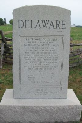
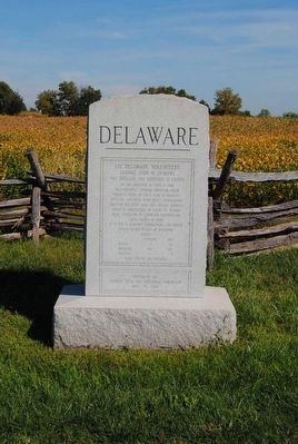
1st Delaware Volunteers
1st Delaware Volunteers
Colonel John W. Andrews
3rd Brigade, 3rd Division, II Corps
On the morning of Sept. 17, 1862
this regiment crossed Antietam Creek
forming right of first line of French's
Division. Advanced with heavy skirmishing
through Roulette Farm and became fiercely
engaged immediately in front of Sunken
Road. Withdrew to stronger position 100 yards
north of here.
8 of the 10 company commanders and entire
color-guard killed or wounded
Losses
Officers Men
Killed 3 26
Wounded 10 172
Missing - 17
Total 230 of 708 engaged
Erected by the
Delaware Civil War Centennial Commission
May 26, 1962
Erected 1962 by Delaware Civil War Centennial Commission.
Topics. This historical marker is listed in this topic list: War, US Civil. A significant historical date for this entry is September 17, 1862.
Location. 39° 28.28′ N, 77° 44.492′ W. Marker is near Sharpsburg, Maryland, in Washington County. Marker is on Bloody Lane, on the left when traveling east. Touch for map. Marker is in this post office area: Sharpsburg MD 21782, United States of America. Touch for directions.
Other nearby markers. At least 8 other markers are within walking distance of this marker. Couch's Division, Fourth Army Corps (within shouting distance of this marker); Sixth Army Corps (within shouting distance of this marker); a different marker also named Sixth Army Corps (within shouting distance of this marker); 5th Maryland Infantry (within shouting distance of this marker); Jackson's Command (within shouting distance of this marker); French's Division, Second Army Corps (within shouting distance of this marker); Second Army Corps (within shouting distance of this marker); a different marker also named Second Army Corps (within shouting distance of this marker). Touch for a list and map of all markers in Sharpsburg.
Regarding 1st Delaware Volunteers. This marker is included on the Sunken Road or Bloody Lane Virtual Tour by Markers see the Virtual tour link below to see the markers in sequence.
Related markers. Click here for a list of markers that are related to this marker. Delaware Monuments at Antietam
Also see . . . 1st Delaware Monument. National Park Service site detailing the monument. (Submitted on February 18, 2008, by Craig Swain of Leesburg, Virginia.)
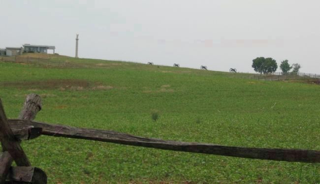
Photographed By Craig Swain, August 5, 2007
5. 1st Delaware Position
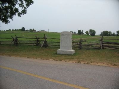
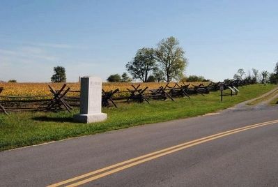
Initially the Regiment advanced down on the Sunken Road from the north (directly toward the camera). Their left flank was generally at the right edge of the photo here. The regiment's right flank was anchored on the Mumma's Farm Lane (distant left of photo) After pressing the Confederates holding the Sunken Road (modern day Richardson Avenue at this section), the 1st Delaware fell back to a slight spur to the north (about 120 yards based on pace counts). The depression formed by the spur is seen here where the Mummas Lane boundary fence drops out of sight in the center of the photo. In the distance is the park visitors center and the spire of the New York State monument.
The cannon on the distant ridge line represent the 1st Rhode Island Light Artillery, Battery A (Thompkins' Battery) which moved up to fire on the Confederates. The battery expended over 1,000 rounds of ammunition during the battle.
The cannon on the distant ridge line represent the 1st Rhode Island Light Artillery, Battery A (Thompkins' Battery) which moved up to fire on the Confederates. The battery expended over 1,000 rounds of ammunition during the battle.
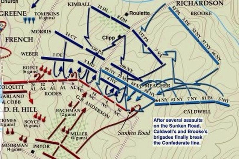
Photographed By Larry Gertner, April 3, 2022
6. Sunken Road or Bloody Lane Virtual Tour by Markers.
A collection of markers interpreting the action of during the Battle of Antietam around the Sunken Road.
(Submitted on February 23, 2008, by Craig Swain of Leesburg, Virginia.)
Click for more information.
(Submitted on February 23, 2008, by Craig Swain of Leesburg, Virginia.)
Click for more information.
Credits. This page was last revised on October 17, 2022. It was originally submitted on February 18, 2008, by Craig Swain of Leesburg, Virginia. This page has been viewed 1,102 times since then and 14 times this year. Last updated on October 16, 2022, by Carl Gordon Moore Jr. of North East, Maryland. Photos: 1. submitted on February 18, 2008, by Craig Swain of Leesburg, Virginia. 2. submitted on September 24, 2015, by Brian Scott of Anderson, South Carolina. 3. submitted on February 18, 2008, by Craig Swain of Leesburg, Virginia. 4. submitted on September 24, 2015, by Brian Scott of Anderson, South Carolina. 5. submitted on February 18, 2008, by Craig Swain of Leesburg, Virginia. 6. submitted on April 3, 2022, by Larry Gertner of New York, New York. • Bill Pfingsten was the editor who published this page.
